


A 30C bank-holiday heat surge will give way to a week of wind and rain as ex-hurricane Erin heads to Iceland to rattle her death throes.
Forecasts have taken a sharp U-turn in the past 24 hours, away from stormy weather and back to warmth.
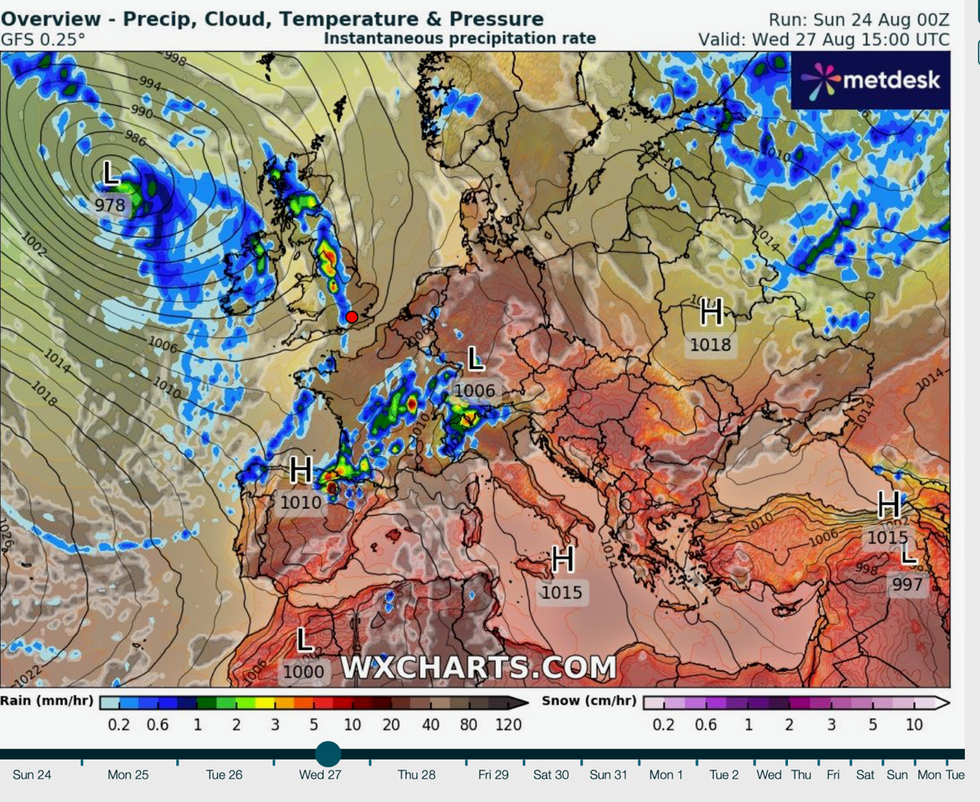
The remains of mega-hurricane Erin will head north of the UK, shunting the jet stream, and building high pressure.
**ARE YOU READING THIS ON OUR APP? DOWNLOAD NOW FOR THE BEST GB NEWS EXPERIENCE**
Temperatures, particularly across the East, will rise through the end of the holiday before a mid-week shake up.
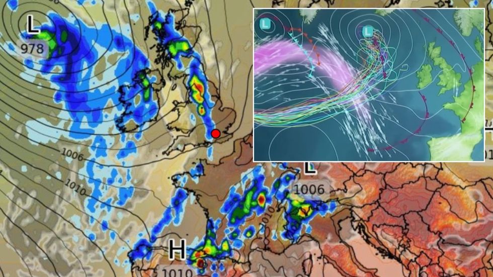
A 30C bank-holiday heat surge will give way to a week of wind and rain as ex-hurricane Erin heads to Iceland to rattle her death throes
|WXCHARTS/ MET OFFICE
Met Office meteorologist Alex Burkill said: “The influence of Erin is going to lead to the high pressure clinging on over the Bank Holiday and some pretty warm air pushing across us.
“It is not going to be super-hot, but temperatures will rise through the long weekend, but we will then feel the influence of Erin towards the middle part of the week, and there is a band of rain coming through on Tuesday and Wednesday, and then more widely a wetter day.
“So, some wetter and windy weather coming through as a result of Erin.”
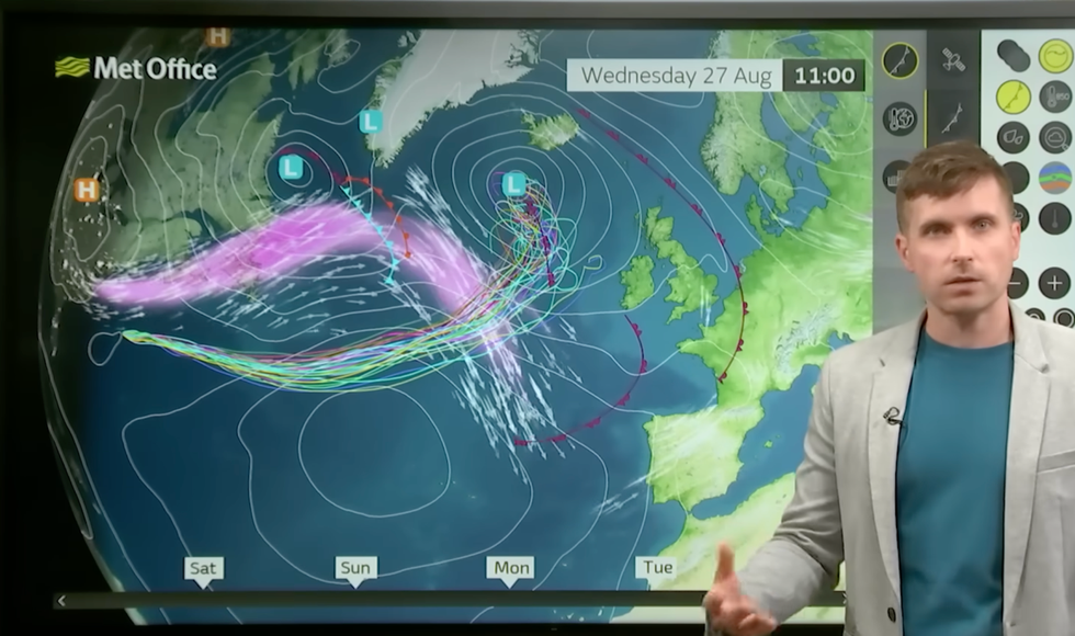
Experts had initially put Erin tracking to the south of the UK triggering stormier weather through the end of August.
But a last-minute swerve means her remains will now head north and anchor off the coast of Iceland.
It will shove the jet stream southwards, helping to stir up unsettled weather for the end of summer, but bringing a calmer start to the week
Burkill said: “There is a reasonable chance that Erin will push the jet stream south because of the momentum from it.
“It is quite likely then to head northwards up towards Iceland, and that means that we are less likely to see the most unsettled weather that we could have had.”
Experts had initially put Erin tracking to the south of the UK triggering stormier weather through the end of August
|WXCHARTS
Temperatures in parts of the country could hit a sweltering 30C before the end of the holiday, according to some experts.
Winds tumbling over the Scottish mountains – the foehn effect – could push northern Britain into a mini heatwave.
Jim Dale, meteorologist for British Weather Services and co-author of ‘Surviving Extreme Weather’, said: “On Monday we could hit the high 20Cs or even 30C in parts of the country.
“This includes Scotland where temperatures will rise with the foehn effect, elsewhere, eastern parts of Britain will see the warmest weather.”
The remains of mega-hurricane Erin will head north of the UK, shunting the jet stream, and building high pressure
|MET OFFICE
The "ashes" of Erin will shift pressure patterns dragging a plume of warmth and humidity in from the south, he said.
Hot weather for most, however, will be on the way out by mid-week as wind and rain arrive, he added.
Mr Dale said: “The highest temperatures will be at the start of the holiday, and some places will hang on to this through Tuesday, but afterwards, the whole country will cool as things turn more unsettled.
“The ashes of Erin will wallow to the north of the country, and this will bring the warmer air up from the south, and some rising humidity.”
Hints of warm weather have prompted bookies to slash the odds on a September scorcher.
Coral spokesman John Hill said: “It has been a summer to remember this year, and the glorious weather may not end there, as we now make it odds-on for next month to be a record-hot September, with high temperatures likely to continue to hang around.”