


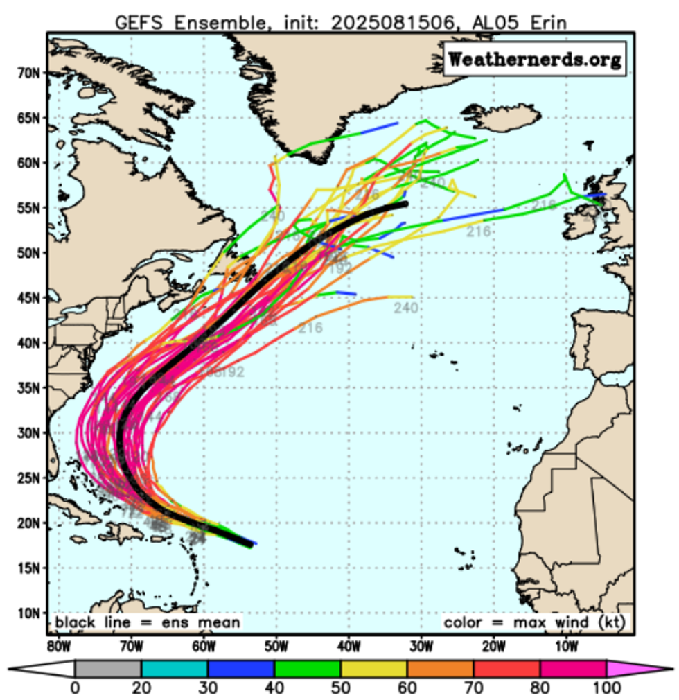
The tail end of Hurricane Erin, currently developing north of the Bahamas, could trigger wind and rain across Britain.
The effects of the storm would be felt in the British Isles before the August Bank Holiday weekend.
After tracking northward and then northeast away from the US East Coast, Hurricane Erin's tropical energy may strengthen the jet stream off eastern Canada, potentially driving strong westerly winds towards western Europe.
**ARE YOU READING THIS ON OUR APP? DOWNLOAD NOW FOR THE BEST GB NEWS EXPERIENCE**
Southern England is set to experience its final day of widespread temperatures reaching 30C or higher today, with the heat becoming increasingly confined to the southwest in the coming days.
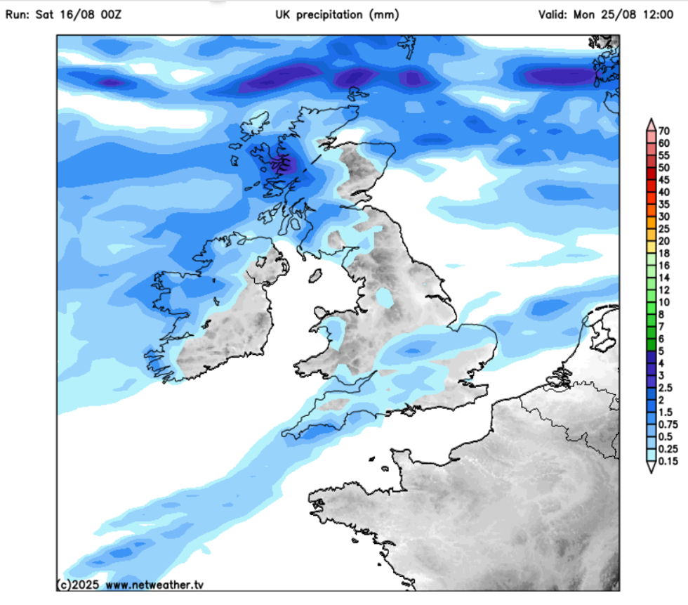
The effects of the storm would be felt in the British Isles in the lead-up to the August Bank Holiday weekend
|NETWEATHER
Very warm conditions will persist across southern regions through the weekend and into next week, though temperatures above 30C will be limited to southwestern England.
The easing of the heatwave comes as high pressure develops over northern Britain, drawing in cooler easterly and northeasterly winds across most areas.
Only the far southwest will maintain a southerly airflow, continuing to pull warm air from France.
Despite the warm temperatures in southern areas, strong easterly winds will develop through the English Channel and across Devon and Cornwall, potentially reaching gusts of 40mph or more.
LATEST DEVELOPMENTS:
The effects of the storm would be felt in the British Isles before the August Bank Holiday weekend
|NETWEATHER
A shift in weather patterns will see high pressure establishing itself to the north and northwest of Britain, whilst low pressure develops to the south and east next week.
This marks a departure from the recent North Atlantic Oscillation pattern that brought periods of intense heat.
The new configuration will maintain predominantly dry and settled conditions across most of the UK throughout the coming week.
However, southwestern areas may experience some shower activity early next week as low-pressure systems track eastward from the Atlantic into France.
Dry conditions are forecast to persist across Britain and Ireland for the next seven days
|GB NEWS
Dry conditions are forecast to persist across Britain and Ireland for the next seven days, with sunshine prevailing for most regions.
Eastern Scotland and Cornwall face a slight possibility of isolated showers over the weekend.
Temperatures will gradually decline across all regions next week as the blocking high pressure to the northwest draws cooler polar air southward from midweek onwards.
This Arctic air mass will bring lower humidity levels across Britain.
According to ECMWF forecasts, temperatures will drop to near or slightly below seasonal averages by Wednesday, with southern areas seeing highs in the low twenties whilst northern regions experience temperatures in the upper teens.
The GFS model suggests warmer conditions may persist in the far south, though this represents the upper range of ensemble predictions.