


Britain is teetering on the edge of a tropical-Arctic switchblade as an ‘amplified’ jet stream see-saws between mild and bitter winds.
Scotland and northern counties face a weekend of sub-zero temperatures and snow, while the mercury may lift further south.
The UK is at the mercy of a wavy ‘amplified’ jet stream, thrusting and diving to bounce Britain between bouts of mild and cold.
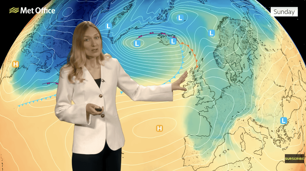
Met Office meteorologist Annie Shuttleworth said: “The jet stream is a key driver in the UK weather, and we have a very amplified pattern in our jet stream.
TRENDING
Stories
Videos
Your Say
“Towards the weekend we continue to see this amplification of the jet towards the north and west of the UK, and that means we will continue to see low-pressure systems driven up to the north and the west of the UK.
“Meanwhile, high pressure is set to dominate to the south and west, and this means drier weather.”
As low-pressure storm systems are hurled at the north, winds will spiral down from the Arctic, stifling temperatures, she said.
Britons will feel the cold through the weekend, with clear overnight skies bringing the risk of frost.
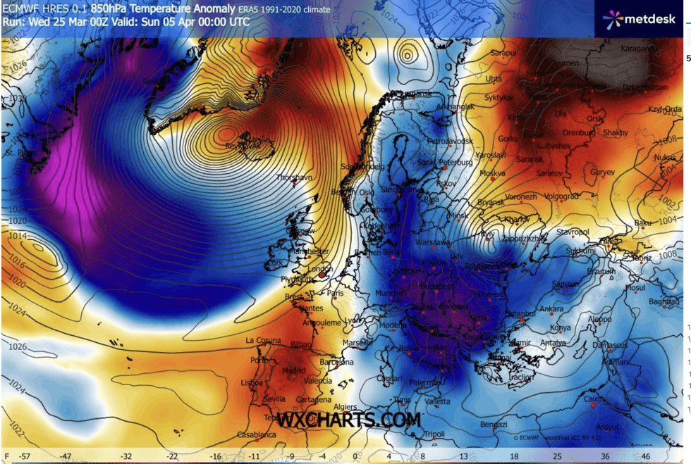
Britain is between cold and mild air flows
|WX CHARTS
But as pressure patterns shift, the gates will open to milder winds from the south, Ms Shuttleworth explained.
She said: “As low pressure pushes in from the north and the west, weather systems will come in from the north and west and that is a cold direction, so for the short term, it is expected to remain a little bit chilly for the time of year.
“So, it is going to be a mix and a bit of a back and forth between the milder and colder air.
“Where skies remain clear on Friday morning, we could see a touch of frost, and Friday brings more in the way of rain to southern areas.
LATEST DEVELOPMENTS
Britons are set to wake up to a cold and wet morning
|MET OFFICE
“Once the rain clears through, we are back into the colder air, so it will start to feel cooler as the day goes on, and there is a risk of snow and sleet mainly to high ground, over the weekend as well.”
Britons could be waking to a cold and wet morning today, with bands of rain to move south during the day.
Met Office meteorologist Alex Burkill said: “A frontal system makes its way southeast, and we are likely to see some fairly wet weather overnight into Friday
“Further north, we see the return of showers and blustery winds, and there is the potential for more persistent wet weather to the south and the southwest and parts of Wales.
“Temperatures will start to creep up, but it will be blustery particularly to the northwest.”
Long-range experts agree on a volatile forecast into mid-spring as models bounce between warm and cold.
Currently, a chilly but dry Easter is most likely with the risk of sleet or snow over high ground in the north.
But a shift in the jet stream could bring a bank-holiday sunshine and warmer temperatures.
Jim Dale, meteorologist for British Weather Services and co-author of ‘Surviving Extreme Weather’, said: “Currently, it is a colder outlook for Easter, although generally dry.
“However, the models are changing, and we could end up seeing something different with milder weather over the bank holiday.
“Next week, there are signs that we will hold on to the northerly, which means colder mornings, although milder to the south especially where there is sunshine.”