


Winter will blast back with freezing minus 12C winds, thunder and snow as an Arctic storm scrapes the tip of Britain.
T-shirts and bikinis are back on their hangers today after last week’s 20C heat blast gives way to an eruptive Polar deluge.
A deep low-pressure storm churning between Greenland and Iceland will drag polar winds into Britain.
Temperatures in Scotland will nosedive to minus 5C or below with bitter winds making it feel close to minus 12C.
TRENDING
Stories
Videos
Your Say
Jim Dale, meteorologist for British Weather Services, said: “Winds will start to turn in from the north mid-week, and then we are back in the territory of snow, frosts and temperatures much lower than normal for the time of year.
“Over the Highlands of Scotland, there is going to be the risk of snow, and there could be wintry showers to lower ground.
“This northerly is going to last a couple of days, through Wednesday and Thursday, and it is going to feel cold at the end of the week.”
Scotland and northern England caught the first lash of the storm last night the region was pelted with heavy rain.
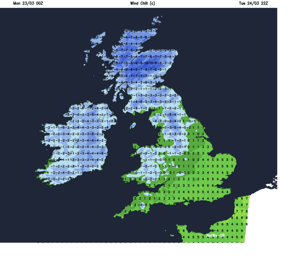
Britons have been told to expect a cold snap
|NETWEATHER
Behind the showers, a cold plume from the North Pole will plummet temperatures with everywhere waking to a bitterly cold morning.
Heavy showers will turn to snow across high ground of the north, with the risk of hail, sleet and thunder.
Met Office meteorologist Alex Burkill said: “Initially it is starting off wet across northern and western parts, but as a weather front pushes southwards there will be rain reaching many parts of the northern two thirds of the UK, but we could see some particularly high totals.
“Overnight into Wednesday, colder air plummets its way across the country, so all of us will feel the chill on Wednesday.
LATEST DEVELOPMENTS
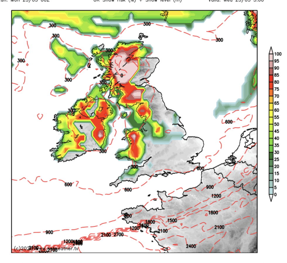
The risk of snow has heightened
|NETWEATHER
“Showers will be heavy and they could be thundery, and there could be some hail and sleet mixed in with them.”
Temperatures in rural spots to the north will drop to minus 5C, he warned, with wind-chill making it feel even colder.
The next couple of mornings could have Britons scraping their cars, he added, with a lingering risk of ice and frost.
He said: “Wednesday is going to be a cold night, and temperatures will drop widely close to or below freezing, we are talking minus 4C or minus 5C in rural spots, so there could be harsh frosts in a few places, and we will have to watch the ice as well.
“And we need to factor in some strong gusty winds, and the strongest gusts will be associated with any showers passing through.
“The feel like temperatures for Wednesday in some places will be sub-zero, so there will be a really raw feeling.”
Met Office deputy chief forecaster Steven Keates added: “After a spell of mild and brighter weather, the UK will turn increasingly unsettled in the coming days.
“A series of weather fronts will bring periods of rain, strong winds and much colder air by midweek.
“Wednesday could be quite a shock to the system.”