


A nationwide split will bring heavy downpours and snow to parts of Britain today, while elsewhere clings to 16C sunshine.
Britons are urged to lap up the last dregs of warmth before bitter polar winds mid-week plummet temperatures everywhere.
Scotland and northern England are today in the crosshairs of a storm front laden with rain, wind and the first outbreaks of snow.
Miserable weather will sweep south through tonight, forecasters predict.
TRENDING
Stories
Videos
Your Say
Met Office meteorologist Greg Dewhurst said: “We will see a north-south divide as an area of low pressure brings wetter and windier weather, particularly across parts of Northern Ireland and Scotland, and some of this rain may be on the heavy side.
“Showers will turn increasingly wintry in northwest Scotland on Tuesday, and a band of rain will push south through Tuesday, with the best of the dry weather in the Midlands, central and southern England, East Anglia, and southeast England.
“This weather system will sink southwards through Tuesday evening, clearing to leave a much colder day on Wednesday for all with showers falling as snow over high ground, particularly in the north.
“With the strength of the north-westerly wind over the next few days, it will feel colder.”
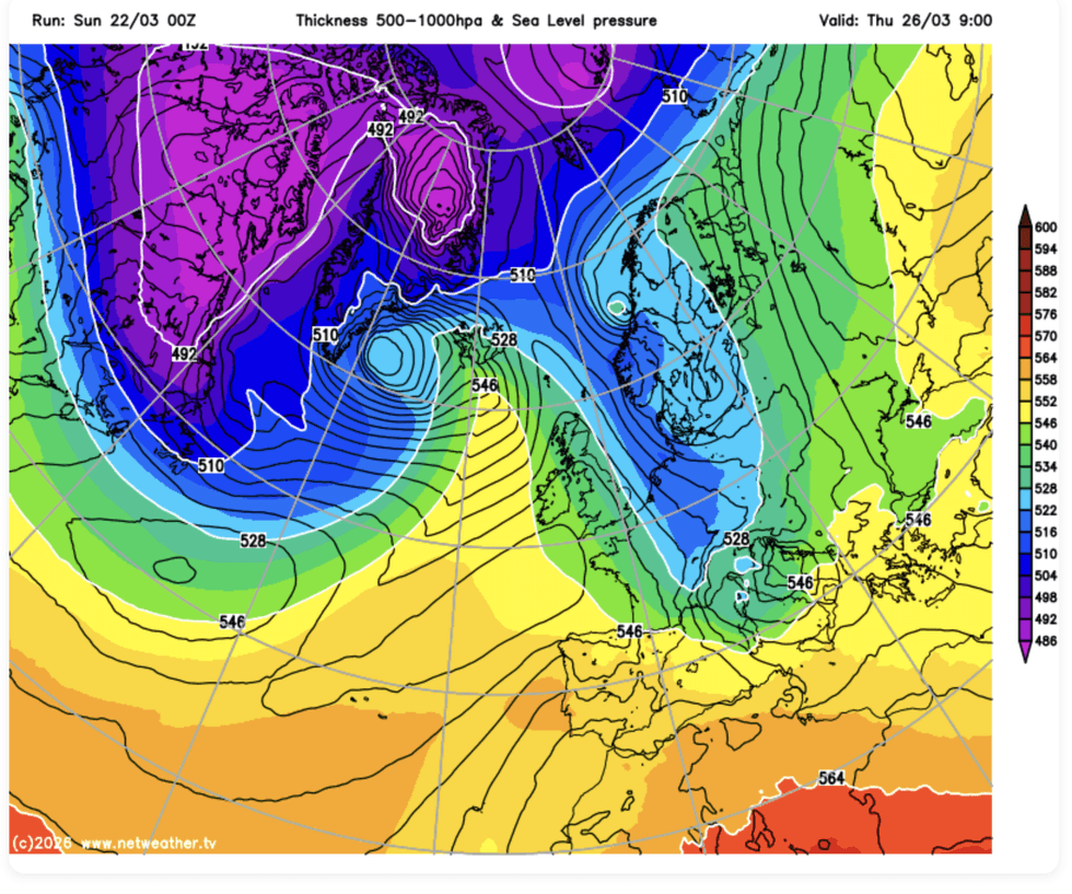
A nationwide split will bring torrential downpours and snow to parts of Britain today, while elsewhere clings to 16C sunshine
|NETWEATHER
Winter will take its last bite first from Scotland and northern England, while southern regions enjoy the balmy remnants of early spring.
Temperatures in the southeast may hit 16C in parts today before plunging more than 6C overnight.
Mr Dewhurst said: “Temperatures may lift to 15C or 16C, but it will feel quite cold under the cloud and rain across northern parts of Wales and northern England, and blustery showers will turn increasingly wintry across parts of Scotland.”
Britain is going to temporarily lose spring over the next 24 hours for something "far more wintry".
LATEST DEVELOPMENTS
- Britain braces for colder and wetter weather as 'big change' this week could bring hail and thunder
- Britain facing bitter ‘shock to the system’ as temperatures in North and Scotland below -5C trigger hail, sleet and snow
- Met Office under fire as 'misleading' weather warnings 'costing businesses £1,000s'
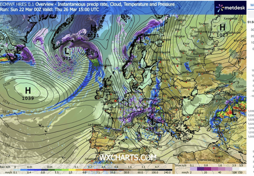
Britons are urged to lap up the last dregs of warmth before bitter polar winds mid-week plummet temperatures everywhere
|WXCHARTS
While a cold snap and snow is not unusual for late March, this one will dip temperatures lower than normal for spring.
Jim Dale, meteorologist for British Weather Services and co-author of Surviving Extreme Weather, said: “It is going to be a change from spring to something more far more wintry this week.
“The week starts off unsettled to the north, and then by mid-week we are all going to be feeling much colder.
“It is going to be windier, wetter, colder and snowier.”
Britain is getting a taste of the cold thanks to shifting pressure patterns from high pressure to a northerly low.
As last week’s high recedes, a cyclonic weather system over Scandinavia will sweep a coil of polar air into Britain.
Mr Dale said: “It is going to feel colder through the week and into the weekend.
“There will be wintry showers, but going further ahead, we are looking at calmer but colder.”
Our Standards: The GB News Editorial Charter