


Britain could be facing a White Easter with the cold snap threatening to hold out into April.
Early signals for the Bank Holiday show temperatures in minus figures and the risk of snow.
While it is early days to give an exact forecast for the four-day break, Britons may be needing jumpers and heavy coats.
As frost, hail, snow and ice return to northern regions this week, experts warn of the northerly chill holding into the end of March.
TRENDING
Stories
Videos
Your Say
Jim Dale, meteorologist for British Weather Services, said: “Next week it looks like we are going back into a northerly, and that means more changeable weather and probably staying cold, but largely dry.
“April is a changeable month, but the cold looks like winning out at the moment for the Easter weekend.
“However, it is early days, and this could change nearer the time with the models producing something warmer.”
Long-range charts, however, paint a chilly picture with temperatures for the Easter weekend widely at freezing or below.
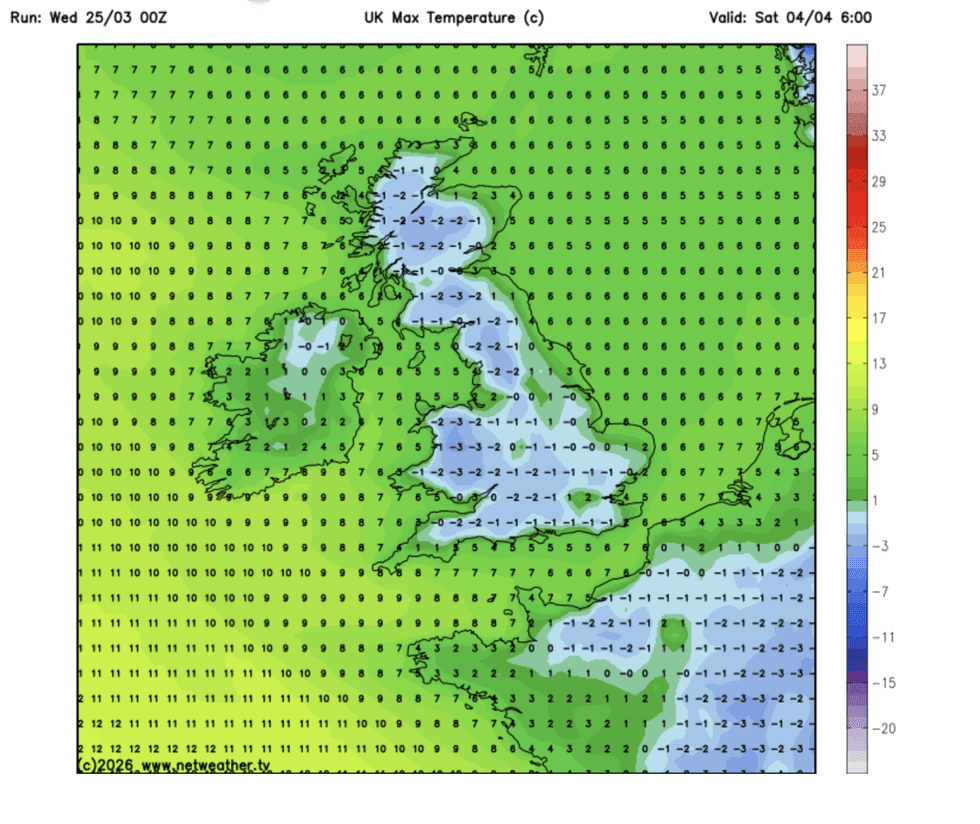
Temperatures will remain low for days to come
|NETWEATHER
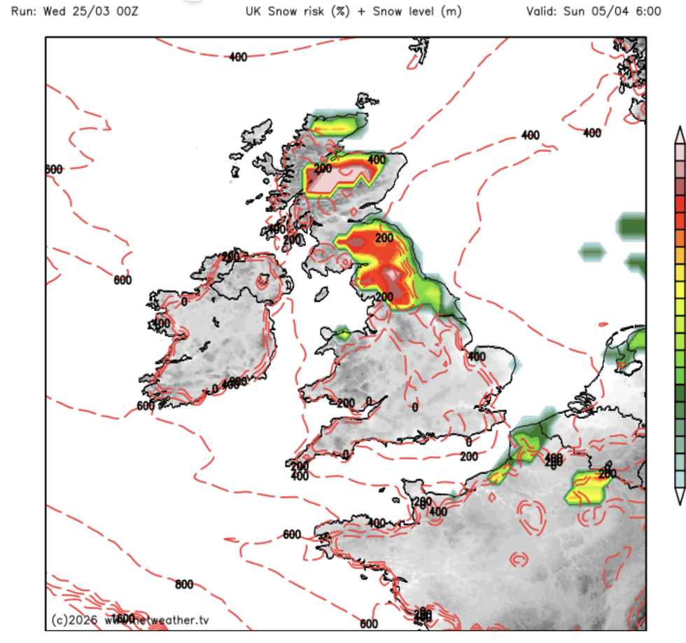
Snow charts show the risk of wintry downpours across Scotland and parts of northern England.
The Met Office’s outlook for Easter favours an unsettled period of strong wind and rain from the Atlantic.
High pressure may build towards the end of the first week of April, helping to recover temperatures, it explains.
A spokesperson said: “A broadly changeable pattern will continue, at least through the first part of this period, as further frontal systems move across parts of the UK, bringing rain and stronger winds at times.
LATEST DEVELOPMENTS
Last week's 20C is now a distant memory
|NETWEATHER
“High pressure is likely to become increasingly dominant with more settled conditions perhaps becoming more prevalent.
“In this setup, temperatures will probably pan out close to average overall, with some overnight frost where skies are clear and winds light.”
Last week’s 20C shivered into a distant memory this week as snow and ice brought a return to winter.
A so-called ‘fools’ spring’ gave way to temperatures widely in low single figures and touching minus 6C in the chilliest parts.
The rest of this week looks drier but cold with temperatures struggling to get out of single figures.
Met Office meteorologist Aidan McGivern said: “It is a frosty start in places on Thursday, but drier for many especially towards the east and the north east before the next weather system brings thicker cloud and outbreaks of on and off rain.
“It is still a chilly day, with temperatures of 8 to 9C in the north and just about double figures in the south, before the very changeable weather continues into Friday and the weekend.”
The Met Office’s Alex Burkill added: “Things are going to turn colder and wetter as we go through the week.
“It is going to be cold, and temperatures are going to be several degrees from what we have seen of late.
“The cold air continues to linger across the UK on Thursday, in fact the air is likely to get colder.”