


Meteorologist John Kettley has warned the UK is set for a sharp shift in weather, with Arctic air bringing plunging temperatures and widespread snow in the days ahead.
Mr Kettley said the country is currently experiencing what he described as “anticyclonic gloom”, with grey conditions dominating most areas and only limited sunshine in the west.
He explained much cleaner Arctic air will move into the north of Scotland on Thursday before spreading south across the entire UK, a change he said is typical between Christmas and New Year.
Snow showers are expected to develop in northern Scotland from Thursday, with temperatures falling rapidly nationwide by the weekend.
Mr Kettley warned of widespread overnight frost from Friday into Saturday, with daytime temperatures over the weekend struggling to rise above zero to three degrees.
He told GB News: "Well, we’re going to see a big change, there’s no doubt about that. At the moment we’ve got what I call anticyclonic gloom: grey conditions across most places, with just a little sunshine in the west over the weekend.
"But that’s about to change. Much cleaner Arctic air will move into the north of Scotland on Thursday, before swinging south across the whole of the UK.
"This is fairly typical for this time of year, we often see a shift between Christmas and New Year and into January.
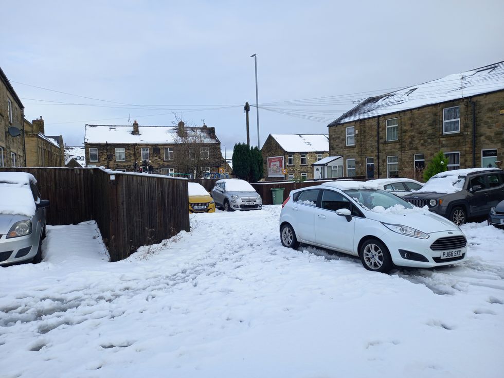 Large swathes of the country were blanketed by snow in January | PA
"In many ways, it’s a repeat of last year. January was cold then, with snow in parts of the country, and we’re looking at a similar pattern again.
"From Thursday, snow showers will begin developing in northern Scotland. By the weekend, temperatures will plunge rapidly across the UK, with widespread frost overnight from Friday into Saturday.
"Over the weekend, more snow showers are expected, with daytime temperatures barely above freezing around zero to three degrees at best.
"Where there’s snow cover, that’s where we’ll see the lowest temperatures. In the Highlands of Scotland, temperatures could fall to minus ten by next weekend.
LATEST DEVELOPMENTS
John Kettley
|GB NEWS
"It’s already been very cold there in recent days, with temperatures struggling to reach freezing.
"While northern Scotland is used to these conditions, much of the rest of the UK is about to get a taste of it too."
He added: "We haven’t seen much snow this December, it’s been relatively mild ,but as we head into the end of the year and through January, much colder air is arriving from the Arctic.
"Not just at ground level but higher up in the atmosphere as well. That makes weather systems more intense.
"White Christmases are actually rare. 2010 was a notable exception, with widespread heavy snow before Christmas.
"There were also harsh winters in 1970 and the early 1980s, but conditions like that are unusual. Things have certainly changed over the past 25 years.
"So I think we should embrace what’s coming, the big kid in all of us should, as long as you’re not travelling.”
The Met Office has put a yellow “be aware” weather warning in place from 6am on Thursday, New Year’s Day, through to midnight on Friday.
Forecasters say snowfall could reach around 5cm at lower levels by Friday, rising to about 10cm in some areas.
Higher ground is expected to see much heavier accumulations, with up to 20cm possible and as much as 30cm across hillier areas.
Strong winds could also lead to significant drifting of snow.
Our Standards: The GB News Editorial Charter