


A Nordic winter storm crippling Scandinavia threatens to swipe Britain’s New Year celebrations with a torrent of snow.
Finland bore the brunt of Storm Hannes at the weekend with sub-zero winds and snow cutting power to thousands of homes and grounding transport networks.
The huge low-pressure cyclone, one of several spiralling Norway, Sweden, Finland and surrounding regions came armed with a cold front laden with snow.
Low pressure sweeping the region through the coming days will drag another swishing front southwards across northern Europe and Britain.
As the nation shivers through a bitterly cold transition from Christmas to New Year, experts warn 2026 could begin under a blanket of snow.
Jim Dale, meteorologist for British Weather Services, said: “What we are expecting over the New Year is really an extension of what has been happening over Scandinavia, with this cold front coming down over the Norwegian Sea with moisture and bringing snow.
“This is low pressure from the north, dragging this Polar airstream into Europe and across the UK.
“We expect to see the first snow from the first day of 2026.”
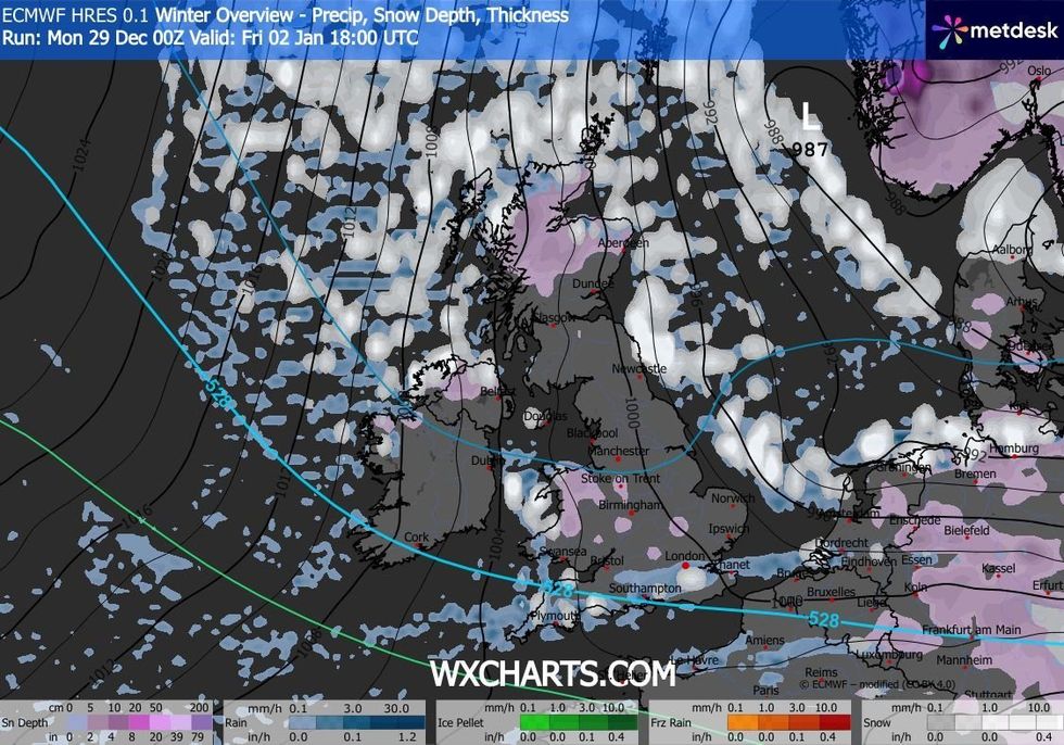
Snow is expected to fall across the country early in January
|WXCHARTS
Weather models are fluctuating as a battle ensues between bitterly cold winds from the north and a milder southerly flow.
High pressure to the north of Britain steering winds in from the Arctic may shift southwards raising thermometers.
Scotland and northern England will hold on to the cold temperatures while southern regions could turn slightly milder.
Yo-yoing winds have weather folk scratching their heads over how long the cold snap will last.
LATEST DEVELOPMENTS
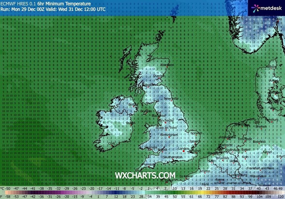
Temperatures look set to plunge across the country
|WXCHARTS
Met Office meteorologist Aidan McGivern said: “High pressure is on the move out towards the west, and this brings some question marks over wind direction.
“It looks like some colder weather coming into the north of Scotland and less cold elsewhere.
“There is a lot of confidence for high pressure to the north into the start of 2026, but then during the first couple of days of January, there could be another weather pattern.”
If the dome of high pressure moves slightly southwards, he explained, this could push temperatures to nudge double figures.
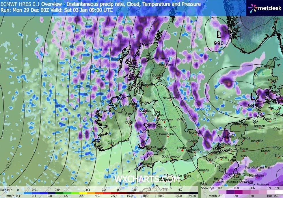
WXCHARTS provides its weather overview for early January
|WXCHARTS
He said: “If high pressure is to the west of the UK, it will allow a northerly to arrive for the start of next week, and that would bring significantly colder weather.
“But the other scenario is for high pressure to sit to the south of the UK, and this will bring winds from the west and the northwest, and this would bring 9C, 10C, 11C.”
Hurricane force gusts unleashed by Storm Hannes across Finland hit 33 metres per second, according to local weather service Foreca.
Heavy snow and sleet hit northern regions on Saturday as thousands of families made their way home after Christmas.
The storm is one of several low-pressure cyclonic features to hit the region, with the next threatening snow at New Year.
While the storms will stay well away from the UK, dangling weather fronts trailing from their centres appear to cross the north sea into Britain.
Snow at the end of the week, according to latest forecasts, will be a risk across Scotland, northern England and northeast coasts.
Dale said: “Snow is going to be an issue across Scotland and northern England and perhaps high ground over Wales, but it is not going to be nationwide.
“Further south, there will be nothing other than perhaps an odd flurry.”