


An Arctic cyclone stretching 1,000 miles to Britain from Scandinavia could deliver a last-minute White Christmas.
As Festive snow rests on a knife edge, a storm brewing over Sweden could sweep a band of snow across parts of Britain in time for the big day.
Scotland and northern England have the highest chance of snow next week, while southern regions are likely to dodge a whiteout.
Weather models reveal a huge low-pressure system swirling across Scandinavia pulling bitter winds in from the Arctic Circle.
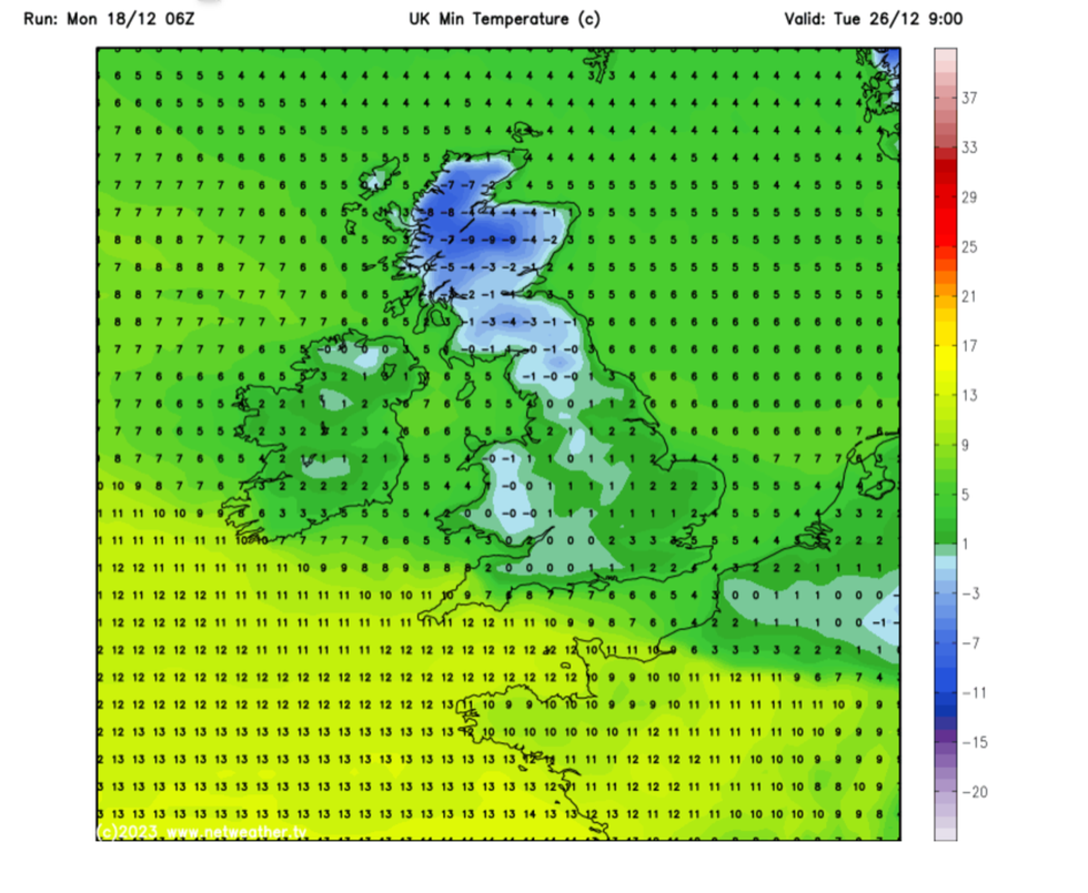
Temperatures are expected to drop to -9C over the Christmas period
Netweather
Snowfall is possible on Christmas Eve from Scotland, through northern England and into parts of Wales and the Midlands.
James Madden, forecaster for Exacta Weather, said: “Later this week we are likely to see a northerly flow with low pressure moving across the UK, and temperatures could drop low enough to see rain turning to snow, which could turn widespread.
“After the milder temperatures, we are expecting winter to return in time for the festive season.
“Initially, snow will be confined to the far north of Scotland, but the northerly influence will increase and with it, so will the risk of snow in the run-up to Christmas.
“Currently, there is still a chance for a notable snowy episode to hit in the run-up to Christmas, and Christmas Day itself.”
Temperatures will fall in the coming days with lows of -9C expected in parts of the country over Christmas.
LATEST DEVELOPMENTS:
Scotland, in the path of a low-pressure ‘cyclone’ pulling cold air across Greenland, will bear the brunt of the cold.
Southern regions, though colder than of late, will hover at freezing or just below from this weekend.
Weather forecasts in the run-up to Christmas have yo-yoed daily, with predictions for snow rapidly melting to promises of rain.
Meteorologists maintain the Christmas forecast still rests on a knife edge, some favouring a wet picture or a ‘pseudo-White Christmas’.
Jim Dale, social commentator and senior meteorologist for British Weather Services, said: “Cold air is going to move in from the end of the week, and temperatures are going to drop.
“However, in terms of a proper White Christmas, I think it is likely that Scotland and the Highlands will be the most likely to see snow on Christmas Day.
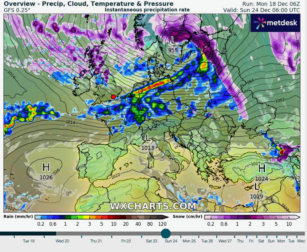
As Festive snow rests on a knife edge, a storm brewing over Sweden could sweep a band of snow across parts of Britain in time for the big day
WXCHARTS
“The cold air is over us during the period, and this could bring a ‘pseudo–White Christmas’, which is frost instead of snow.
“I still expect a highly changeable period, wobbling between mild and cold, with some snow.”
Government forecasters agree it is too early to promise snowmen and sledges on Christmas Day.
The jet stream could take one of three paths this weekend, to bring mild air in from the south or south-west, or a colder flow from the north.
Met Office meteorologist Alex Deakin said: “The most likely scenario for the middle part of the week is for high pressure to edge away to the south and that just opens the door for something of a colder spell with some cooler air coming in from the northwest.
“Temperatures will drop off and we will see something a little bit colder which in December does open the door to something a little bit wintery, with snow most likely over the hills.”