


A ‘long-overdue’ dome of high pressure about to settle over Britain will bring a return to summer-like sunshine and warmth.
An anticyclonic weather system stretching from the tropical Azores islands will build a shield around the UK, fending off storms swarming the Atlantic.
Stormy conditions giving rise to hundreds of flood alerts will this week finally give way to a long spell of dry weather, experts promise.
It spells good news to farmers and those in regions left knee-deep under floodwater after weeks of heavy rain.
Jim Dale, meteorologist for British Weather Services and social commentator, said: “We have not seen high pressure for a long while, so this is long overdue and will bring an end to the persistent rain and risk of flooding that we have seen through the winter and into the start of spring.
“This is a region of high pressure that will build up from the Azores and then form a separate high over the UK, and this will keep the Atlantic at bay, and other low-pressure systems surrounding the country.
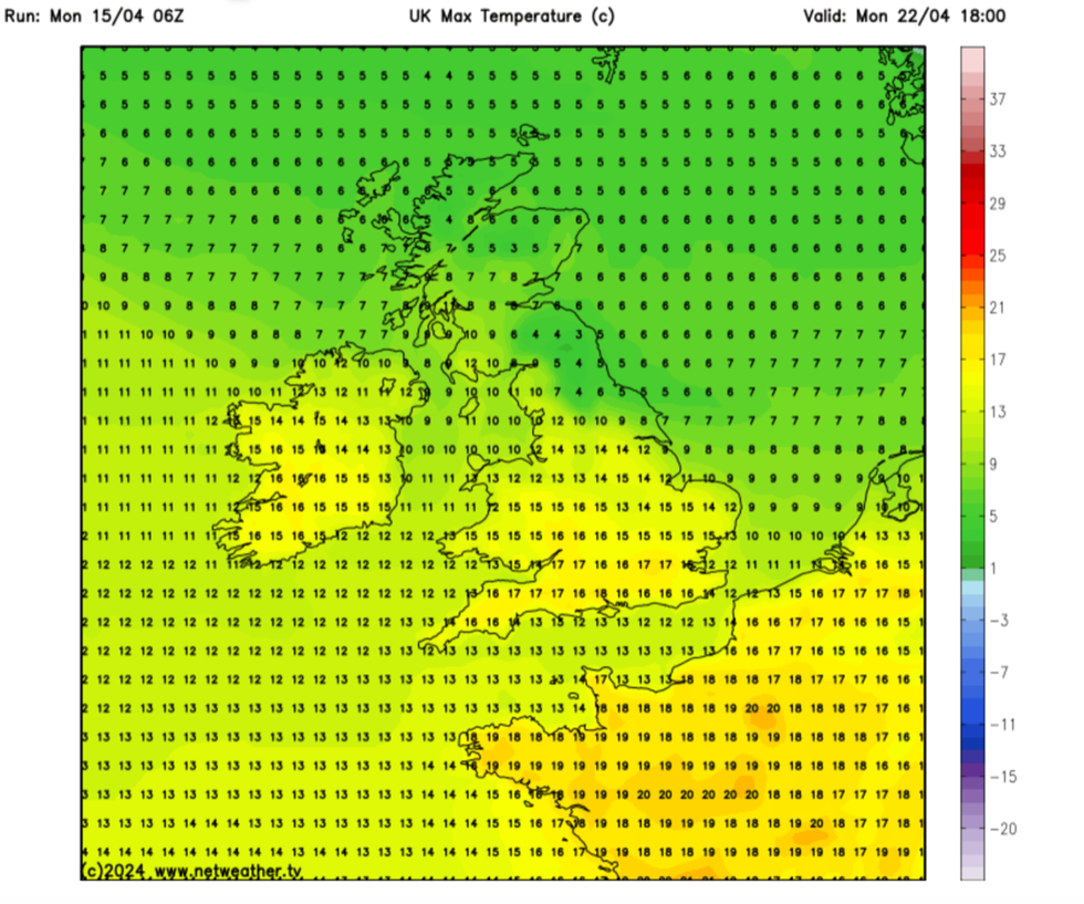
Temperatures start to rise
|NET WEATHER
“The sunshine will be strong at times, with the clarity of the air under high pressure, so people should take the necessary precautions.”
It comes as Britain wraps up for a chilly snap which pushed temperatures at the start of the week back to freezing.
A swath of cold air sweeping into the country triggered torrential downpours in southern Britain, while the north woke to bitter frosts.
Cold weather will hold out for the next day or so before the warmth returns ahead of the weekend.
Dale said: “It is going to be more home-grown warmth that we get over the next fortnight, rather than anything unusually hot pulled in from the Continent.
“And it will take time to get going. We are looking at the end of the week and into the weekend for the temperatures to start picking up.”
Thermometers will dip to -5C in Scotland and northern Britain over the next couple of nights before ramping back into the high teens by the start of next week.
Temperatures will fluctuate through the end of the month, with clear overnight skies triggering colder mornings.
However, with high pressure close and the jet stream to the north, Britain will get a break from the wet and windy weather.
Met Office meteorologist Alex Deakin said: “It has been a lively start to the weather through this working week, but we are going to see things drying up and calming down as we head into the weekend, and this is because an area of high pressure is moving in.
“What we will see this week, is slowly the jet stream moving to the north, and this high-pressure creeps and creeps and by the weekend it is sitting over us.
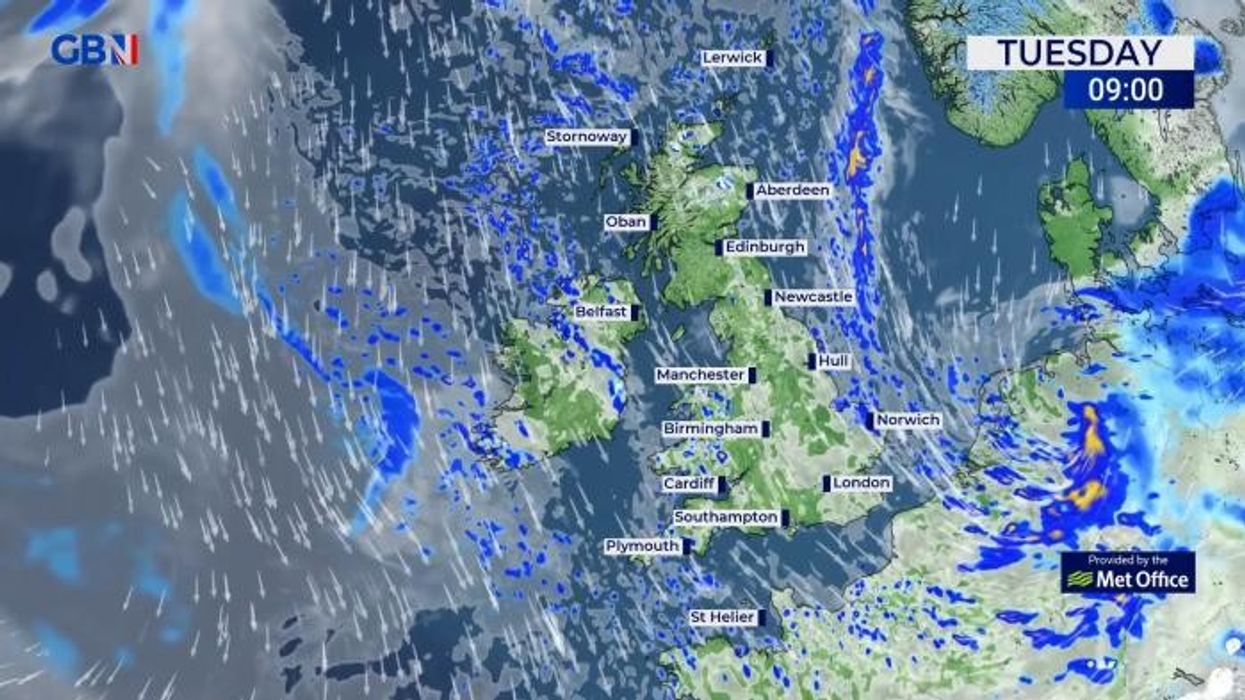
“High pressure means calm and fine weather, and this is coming for the weekend.”Scotland and northern regions will be at risk of further wintry flurries ahead of mid-week, experts warn.
But a slow return to warmer weather will see temperatures rise widely through the second half of the month.
Exacta Weather forecaster James Madden said: “Through Tuesday evening and into Wednesday, it will be cold enough for showers to turn wintry across parts of the far north and Scotland.
“But later in the week, high pressure and more settled weather will finally take hold.
“It is likely to be on the cool side to start with before temperatures start to finally warm up significantly during the final third of April.”