


Violent jet stream winds powered by a ‘dislocated polar vortex’ freezing America will hit Britain tonight with the first storm of winter.
Although not named by the Met Office, the powerful cyclonic system smashing in from the Atlantic could earn the second title of the year ‘Bram’.
Swathes of Britain are on alert tonight for gale-force winds and flooding from torrential rain.
The storm will deepen rapidly through the next 24 hours, hurtled by the jet stream, fuelled by plunging temperatures on the other side of the Atlantic.
Jim Dale, meteorologist for British Weather Services, said: “The issue with this storm is going to be rain, and on that criteria, there is likely to be enough disruption to warrant giving it an official name.
“There will be strong winds, but it is the rain and the potential for flooding that is the real problem.
“Western and northern regions will see a lot of heavy downpours on Monday night and into Tuesday.”
The jet stream on its path to the UK is being supercharged by plunging temperatures to the north of the US, meeting milder air to the south.
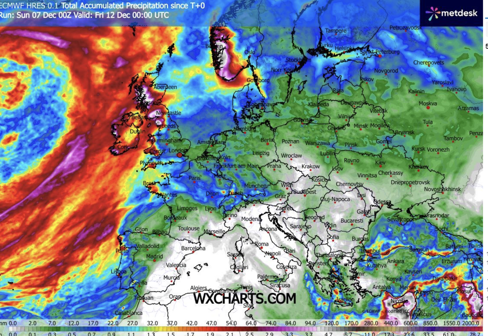
WX Charts map shows rain totals mounting
|WX CHARTS
UK storms at this time of year are fuelled and steered by the jet in this powerful, east-to-west ‘zonal’ position.
Mr Dale said: “There is a dislocated polar vortex over America, and that is bringing very cold air from the Arctic down over the country.
“To the south, there is milder air, and where the two meet is providing a power point for the jet stream as it comes across the Atlantic, bringing with it areas of low pressure.”
While the ferocious jet is the result of freezing temperatures in the US, in Britain thermometers will rise.
LATEST DEVELOPMENTS:
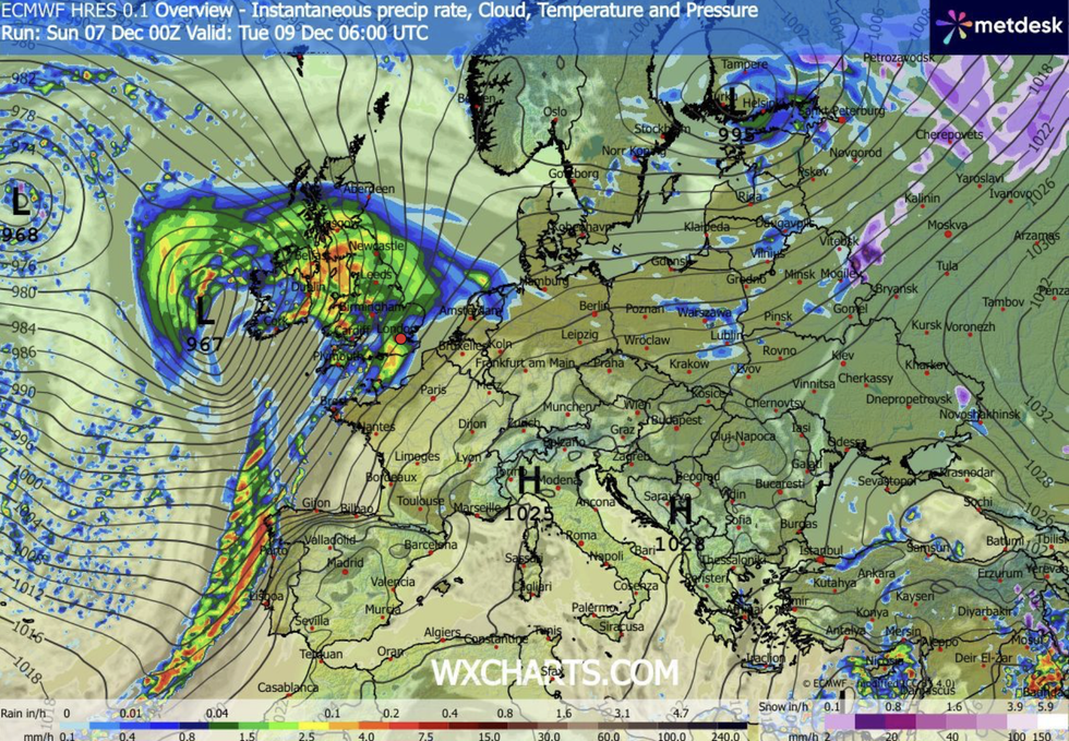
WX Charts map shows a storm hurtling towards Britain
|WX CHARTS
A calm before the storm today will push the mercury in parts into double figures, with nothing in the way of festive snow.
Met Office meteorologist Tom Morgan said: “Temperatures may stay in double figures in some towns, and any ice will be limited to the Scottish glens.
“We could see some longer spells of rain across more central parts of Scotland, and it will be western and northern parts of the UK that will see the most heavy showers.
“Into Tuesday, we are keeping very close eyes on a feature out to the west, a deep area of low pressure could start to move towards the UK, and it will turn increasingly windy.
“There will be potentially in some parts of the UK, some very strong winds, so if you have plans, there could be some severe weather, particularly on Monday night and into Tuesday.”
Met Office meteorologist Alex Burkill added: “As we go into Tuesday, there is an area of low pressure that is coming towards us and it looks like tracking across Ireland and northern Ireland and then Scotland.
“It could be particularly deep, and even some inland parts could see some windy and potentially damaging weather.
“We could also get some heavy rain, and with saturated ground, this could cause some issues.”
Our Standards: The GB News Editorial Charter