


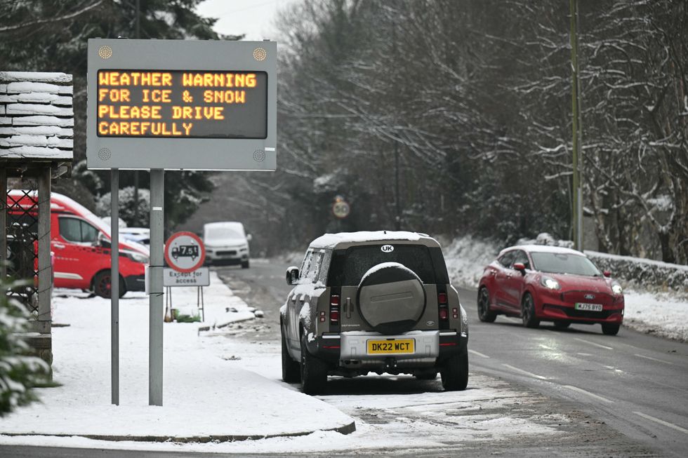
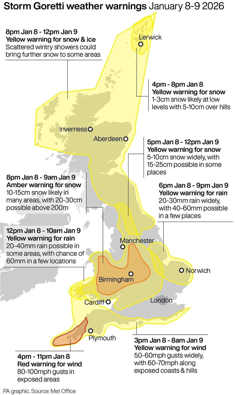
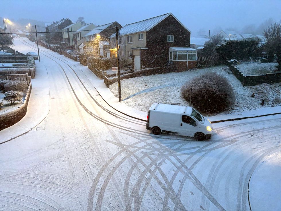
Storm Goretti has landed in Britain, blasting the nation with the “worst snow for a decade” and leaving thousands without power.
The “multi-hazard” event has seen rare severe warnings issued to the public as gale-force winds and heavy rain lash the UK.
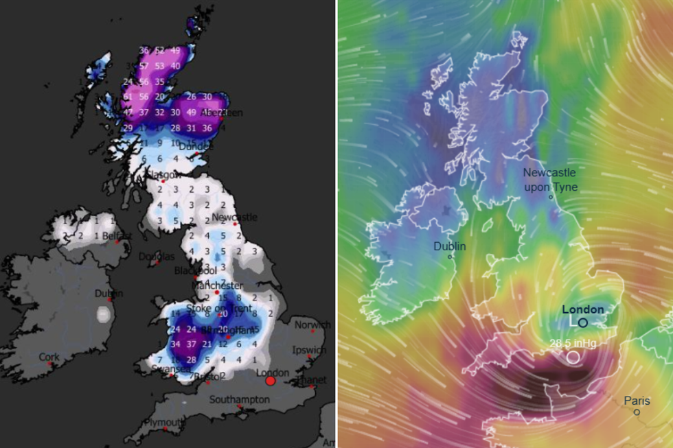
A daunting 30cm of snow was predicted in Wales and the Midlands, with very strong winds in the far South West and heavy rain in some parts of Wales and East Anglia.
More than 65,000 properties were left without power on Thursday evening, with most in southwest England plunged into darkness, according to the National Grid.
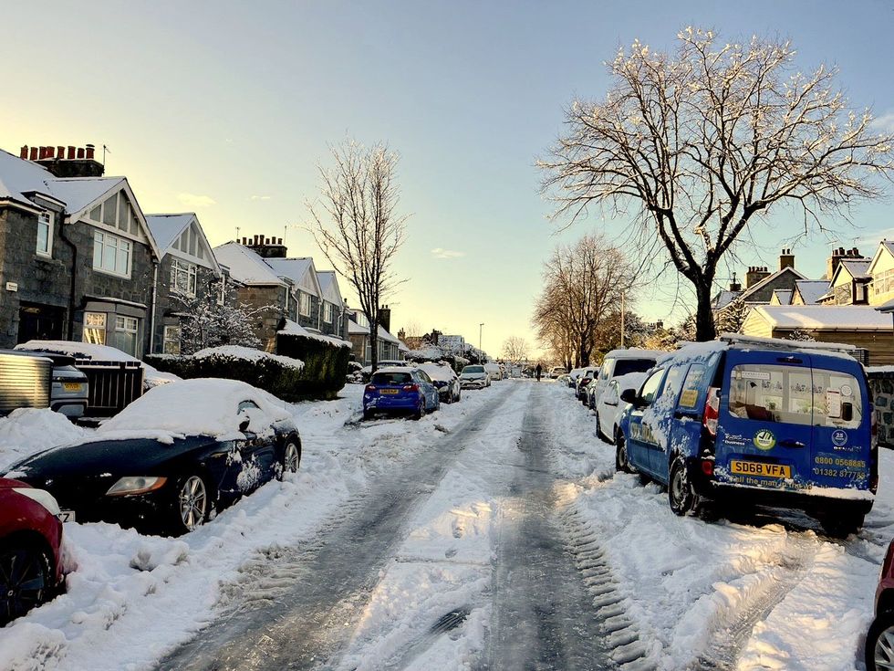
Heavy snow has hit parts of the UK
|PA
The UK was battered by the whiteout and severe winds
|WXCHARTS / VENTUSKY
TRENDING
Stories
Videos
Your Say
In the West Midlands, as many as 11,000 properties were affected, and thousands in Wales were also hit.
As a result, travel chaos has reigned across some of Britain’s vital transport hubs.
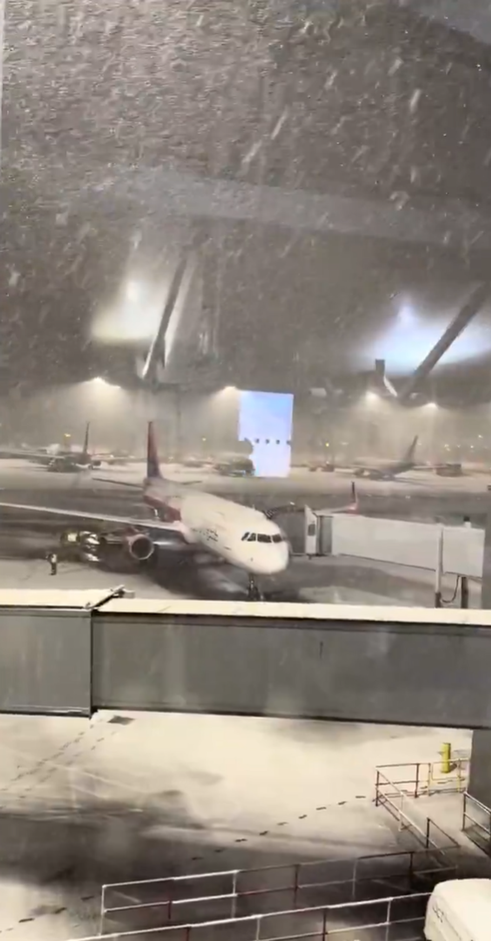
Birmingham Airport was forced to suspend runway operations on Thursday night after “heavy snow” made it unsafe to fly.
Heathrow, Europe’s busiest airport, has seen dozens of flights cancelled due to severe weather.
Thousands of homes were left without power across the UK
|GETTY
Storm Goretti has caused travel chaos across the UK
|GETTY
Prospective passengers were urged to contact their airline about the status of flights, as photos emerged of planes on runways trapped in thick layers of snow and ice.
In Cornwall, Network Rail announced that all trains would be suspended from 6pm yesterday.
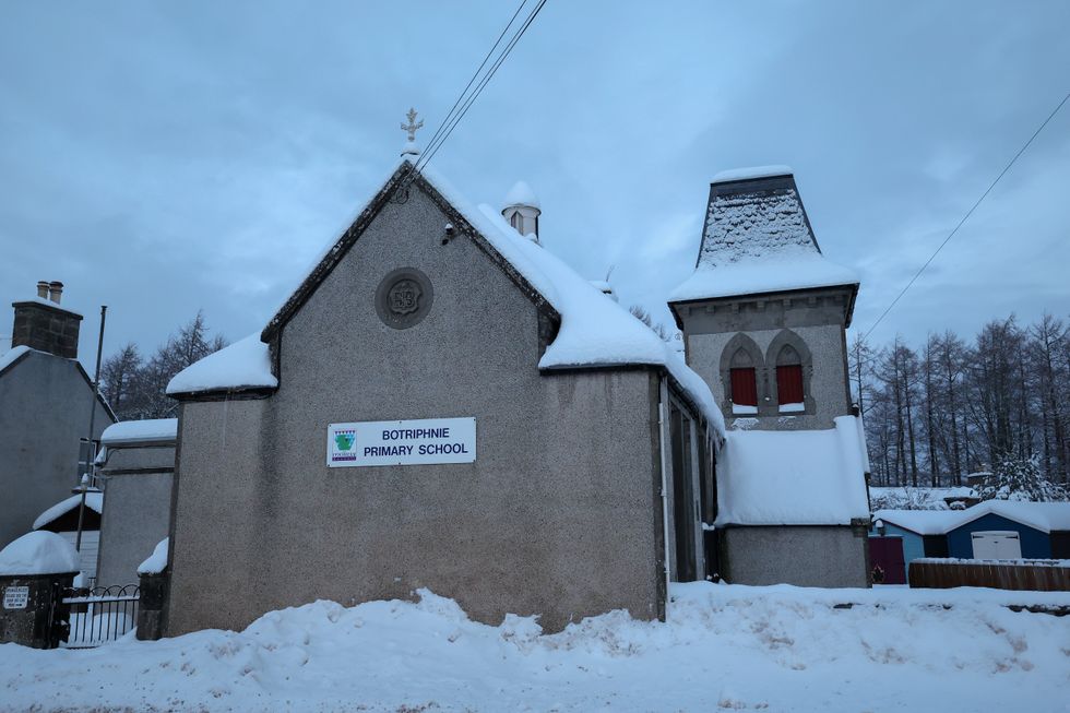
Dozens of schools have also been closed as the weather closed in.
In Devon, trains on the Exeter-Okehampton and Exeter-Barnstaple routes were suspended over the same period because of high-wind speeds.
Flights have been cancelled as Britain's airports, including Heathrow, are hit by snow
|X
The Met Office has issued weather warnings for across the UK
|PA
Yellow weather warnings for snow and ice have been extended into Saturday for large parts of Scotland, England and Northern Ireland, the Met Office said.
A yellow warning for snow and ice comes into force from midday Friday until 3pm on Saturday, with further snowfall possible across parts of northern England and much of Scotland, while a widespread risk of ice is expected to cause disruption.
A separate yellow warning for ice will cover large parts of England and Wales from midday Friday until midday Saturday as partially thawed snow refreezes, accompanied by wintry showers and freezing fog.
In Northern Ireland, a yellow warning for snow and ice will come into force from 5pm on Friday and run until 11am on Saturday, with the Met Office warning of icy patches and some hill snow.
LATEST DEVELOPMENTS
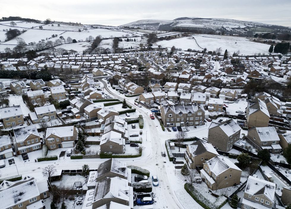
A daunting 30cm of snow was predicted in Wales and the Midlands
|GETTY
Meteorologists predicted Storm Goretti would create a “weather bomb” in the UK.
The phenomenon, also known as explosive cyclogenesis, is caused when the central pressure in an area of low pressure falls rapidly.
Pressure must fall by 24 millibars in 24 hours to qualify as a so-called "bomb".
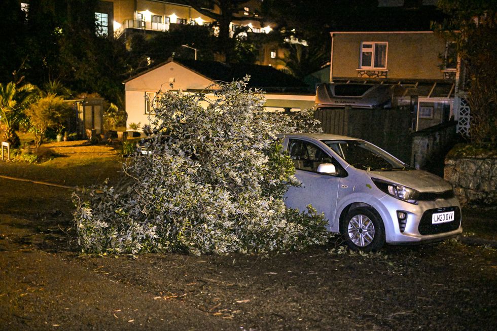
The Met Office said that winds during a weather bomb can be “strong enough to bring down trees and cause structural damage”.
Storm Goretti was said to have created a 'weather bomb'
| PAAhead of the worst setting in, the Met Office issued a rare red weather warning covering Cornwall, in place until 11pm last night.
Meteorologists told those in affected areas to expect damage to homes and flying debris, resulting in danger to life.
Very large waves, power cuts and public transport cancellations were also seen.
Emergency alerts containing guidance on how to stay safe amid the "dangerous" weather were also sent to hundreds of thousands of Britons.
Schools have been forced to shut amid the storm
|GETTY
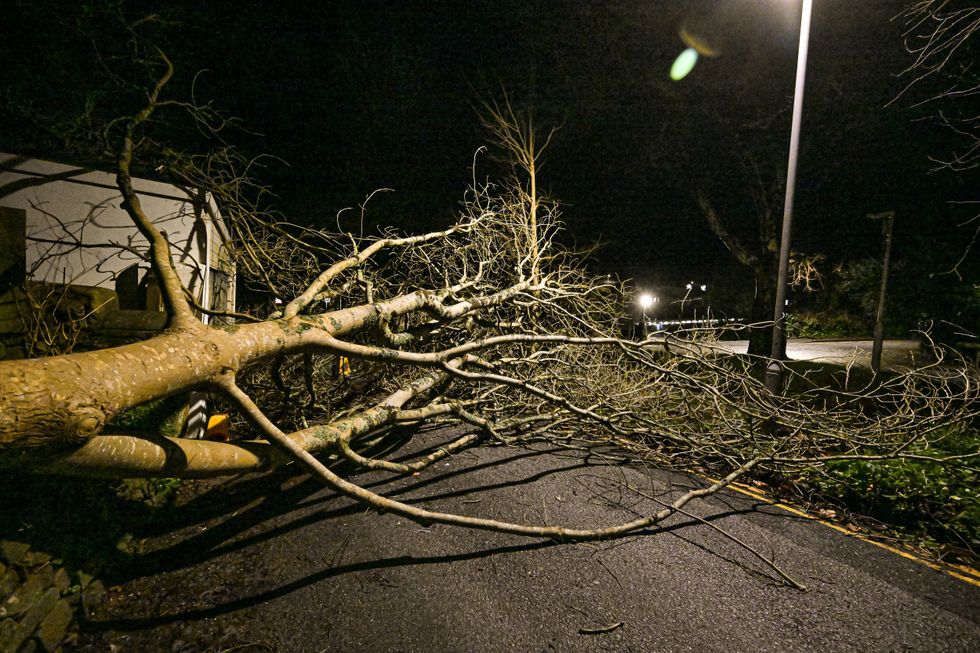
Trees have fallen due to strong winds
|GETTY
“It is very likely that there will be a risk to life, with substantial disruption to travel, energy supplies and possibly widespread damage to property and infrastructure,” the forecaster warned.
“You should avoid travelling, where possible, and follow the advice of the emergency services and local authorities."
Storm Goretti, named by French weather forecaster Meteo France, has been described as a “multi-hazard event” by the Met Office.
The organisation's chief forecaster, Neil Armstrong, said: “Storm Goretti will be a multi-hazard event, with the most significant impacts from snow in parts of Wales and the Midlands and the very strong winds in the far South West, though heavy rain in some parts of Wales and East Anglia also has the potential to bring disruption to many.”

An emergency alert was sent to thousands of Britons
|GETTY
Heavy winds have battered parts of the UK
|GETTY
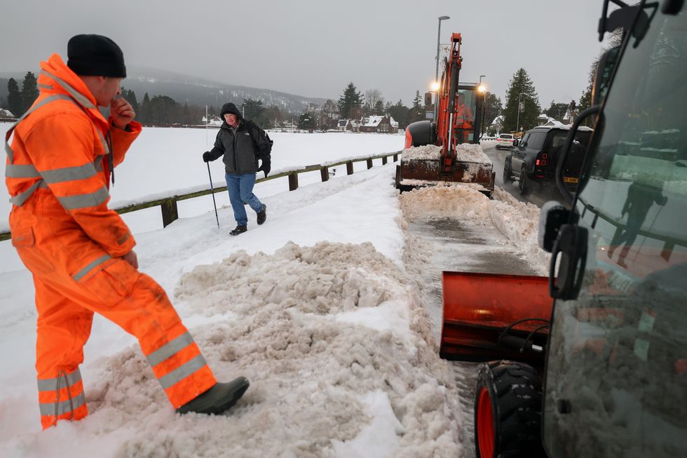
Amber warnings for snow remain in place until 9am this morning, covering parts of Wales, the Midlands and Yorkshire.
About 10 to 15cm of snow is likely across the warning area, with up to 30cm on higher ground in Wales and the Peak District.
Many schools across the Midlands and Wales have said they will remain closed on Friday.
Yellow warnings for snow and ice have also been issued for much of Scotland, which came into force at 8pm on Thursday and runs until midday on Friday.
In the northern parts of Britain, “intense” snowfall, ice and sub-zero temperatures have caused school closures and travel disruption.
Our Standards: The GB News Editorial Charter