


A rare red warning for "dangerous, stormy" winds has been issued by the Met Office for Cornwall and the Isles of Scilly this evening.
Britons are being urged to "take action now to keep yourself and others safe from the impact" amid warnings of "life threatening" hurricane-force winds.
Storm Goretti is set to hit parts of the South West later tonight, with the red alert in place from 4pm to 11pm tonight, stretching from Bude down the coast of Cornwall to Land's End.
The storm, named by French weather forecaster Meteo France, has been described as a “multi-hazard event” by the Met Office, with as much of 30cm of snow possible for parts of the UK and wind gusts of up to 100mph.
TRENDING
Stories
Videos
Your Say
Peak winds of 80-100mph or more in exposed areas are also expected, the forecaster said.
The warning says people should expect damage to buildings and homes, very large waves, flying debris resulting in danger to life, power cuts and public transport cancellations.
The forecaster’s description of the colour red on its website reads: “It is very likely that there will be a risk to life, with substantial disruption to travel, energy supplies and possibly widespread damage to property and infrastructure.
“You should avoid travelling, where possible, and follow the advice of the emergency services and local authorities.”
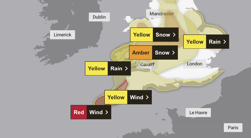
Weather warnings are in place for Wales and much of southern England
|MET OFFICE
Weather warnings have been issued for snow, wind, rain and ice across the country ahead of likely "disruption and dangerous travelling conditions."
Around half a million people in the impact zone are understood to have received an emergency alert on their mobile device, warning them of the impending danger to life.
Met Office Chief Forecaster Neil Armstrong said: "Storm Goretti will be a multi-hazard event, with the most significant impacts from snow in parts of Wales and the Midlands and the very strong winds in the far southwest, though heavy rain in some parts of Wales and East Anglia also has the potential to bring disruption to many.
"Goretti will bring snow on its northern edge, this most likely over Wales and the Midlands.
"Here accumulations of 10-15 cm are likely widely, with 20-30 cm possible in some places, especially higher ground in Wales and the Peak District.
"An amber warning has been issued where the greatest risk of disruption is likely on Thursday night into Friday morning.
"This is a complex spell of severe weather and I’d advise people in the warning areas to keep up to date with the forecast and messages from local authorities."
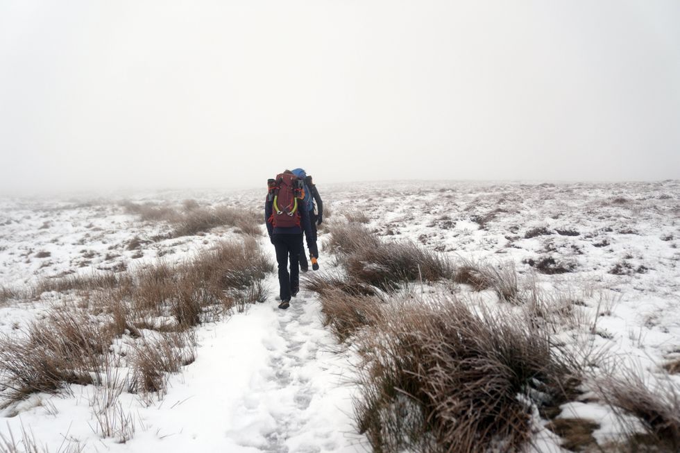
Much of the country has already been hit with widespread snow
|PA
LATEST DEVELOPMENTS
Rail passengers have been advised to check ahead today and tomorrow, with services cancelled across Wales, Cornwall and north-west England.
National Rail has said all train services in parts of south-west England will be cancelled on Thursday evening, and warned that there were likely to be delays and cancellations on Eurostar routes from London.
Network Rail Operations Director Dan Matthews said: "We are doing everything we can to prepare the railway for the impacts from Storm Goretti.
"In more remote parts of our network we’re anticipating the storm impact on roads will mean that our own staff will struggle to reach signal boxes and, potentially, to respond to incidents on the railway as they normally would.
"As a result, we and our colleagues in EMR have taken the difficult decision to remove late evening and early morning services.
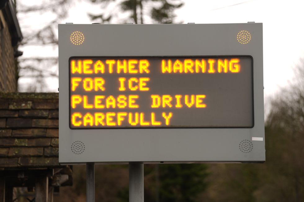
A warning sign in Glossop in the Peak District as the wintry weather continues
|PA
He continued: “We’re really sorry for the impact which this will have on these communities but the safety and wellbeing of passengers and our own teams must come first.
"We’ll make sure websites and social media is kept up to date with the very latest information.
"We intend to run the full timetable on the Midland Main Line between London and Nottingham and Sheffield as this is controlled by central signalling and, generally, more accessible from main roads for our response teams.
"We will have extra teams out working and a snow plough working this route through the night.
"However, there may be delays and disruption caused by the storm here too so please plan ahead if you are travelling and continue to check your journey."