


Tornadoes could strike within a 357-mile zone across southern Britain as a Met Office wind warning comes into force.
The NetWeather forecast, spanning from South Wales to East Anglia, predicts "isolated tornadoes" could form this evening and into tomorrow.
The independent weather forecaster predicts much of the UK and Ireland could see intense thunderstorms.
It warns that Britons should expect lightning, damaging wind gusts and the possibility of flash-flooding.
In a blog update on the weather forecasting website, senior meteorologist Nick Finnis warned "there is potential for organisation of convection, possibly some thunderstorm developing, forming into linear multi-cell convective clusters or even one or two transitory supercell structures capable of producing locally damaging wind gusts and one or two brief isolated tornadoes.
"Intense rainfall leading to flash-flooding will also be a hazard with this activity."
He continued to warn that cold air overnight could lead to "heavy showers and some thunderstorms" affecting Ireland, southwest Scotland, North England, Wales and South West England.
The Met Office's own forecast echoed this by issuing a yellow wind warning for the entirety of England.
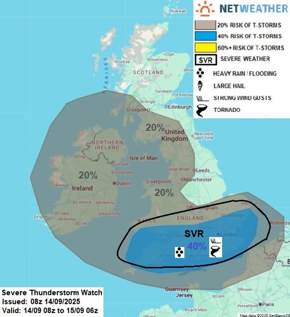
NetWeather map predicts the possibility of isolated tornadoes
|NETWEATHER
Coming into force at 8pm tonight, the yellow weather warning will last until 6am tomorrow.
Forecasters predict powerful westerly and southwesterly winds will initially impact southwestern coastal regions this evening before spreading inland throughout Monday morning.
The warning indicates a medium probability of weather-related disruption with relatively low overall impact levels.
Wind speeds could reach between 45 and 55 miles per hour across inland areas but reach as much as 60-70mph along exposed coasts and hills.
LATEST DEVELOPMENTS:
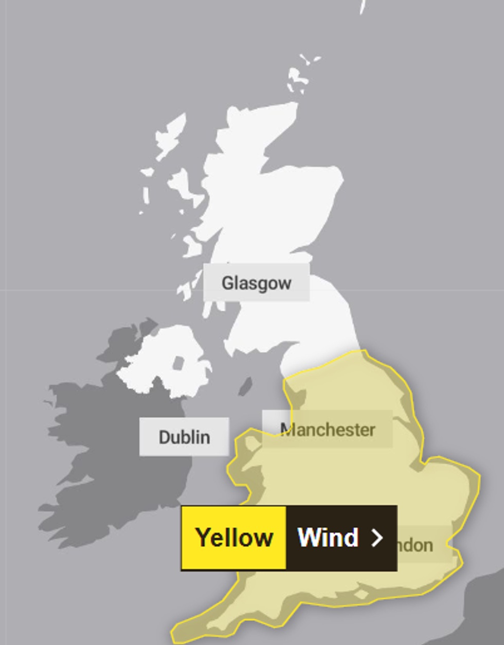
A Met Office wind warning comes into force today
|MET OFFICE
The Met Office anticipates widespread travel delays affecting roads, railways, airports and ferry services, with high-sided vehicles particularly vulnerable on exposed routes and bridges.
The warning read: "Strong and gusty winds are likely to cause some disruption to travel and interruptions to power."
Coastal communities face risks from large waves and sea spray.
The weather service recommends checking transport schedules before travelling and gathering emergency supplies, including torches, batteries and mobile phone power banks.
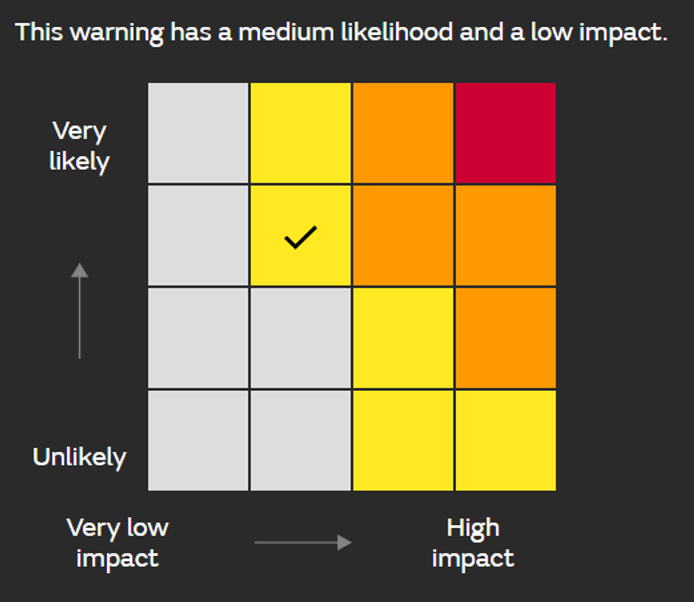
This warning has a medium likelihood and a low impact
|MET OFFICE
Explaining the reasons for the alert in more detail, the Met Office said: "An area of low pressure will bring a prolonged spell of windy weather through Sunday evening and into Monday.
"Check for loose items outside your home and plan how you could secure them. Items include; bins, garden furniture, trampolines, tents, sheds, and fences."
It added: "If you are on the coast, stay safe during stormy weather by being aware of large waves.
"Even from the shore, large breaking waves can sweep you off your feet and out to sea.
"Take care if walking near cliffs; know your route and keep dogs on a lead.
"In an emergency, call 999 and ask for the Coastguard."