


A double-storm whammy powered by the jet stream threatens a week of chilly winds, rain, wind and thunder.
Swaths of Britain today face torrential downpours and gales which across exposed regions could touch hurricane-force.
A cyclonic storm system will barrel through during this morning before another heads in during mid-week.
Met Office warnings are in force across southern Britain today for strong winds which could bring disruption, flying debris and damage to buildings.
Meteorologist Tom Morgan said: “It is a very windy start to the working week especially across England and Wales, and the most frequent showers will be across Northern Ireland, Northern England and the south of Scotland, with heavy outbreaks or rain, the odd rumble of thunder and perhaps hail.
“Gusts into the afternoon will be 40 to 50mph inland and potential 60 to 70mph on some exposed coasts in the west, and it is going to feel cool in the winds.
“The outlook for Tuesday is for something drier and brighter for a time, but there will be another weather system pushing in from the west later in the day that will bring some further rain.”
Energy in the Atlantic, where sea temperatures are still high after summer, will fuel "volatile" weather.
LATEST DEVELOPMENTS:
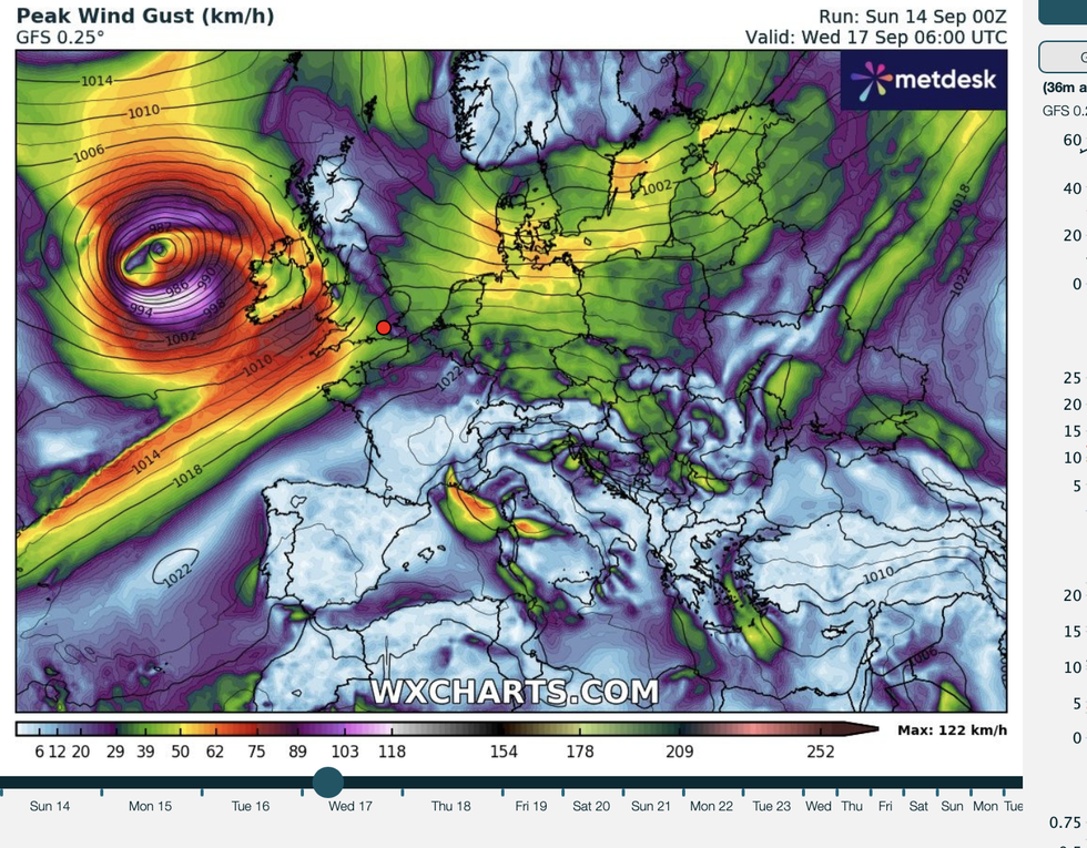
Western regions, including Wales and western Scotland, will bear the brunt of winds rushing off the Atlantic
|WXCHARTS
While Government forecasters have issued no names for this week’s storms, meteorologists say it is not out of the question.
Western regions, including Wales and western Scotland, will bear the brunt of winds rushing off the Atlantic.
Jim Dale, meteorologist for British Weather Services and social commentator, said: “There are two systems coming through this week, the first at the start of the week which hasn’t been named, and although it is unlikely, it is not out of the question.
“Then we have another coming through during the middle of the week, and this will bring more gusty winds and the risk of heavy rain, particularly to western parts of the country.
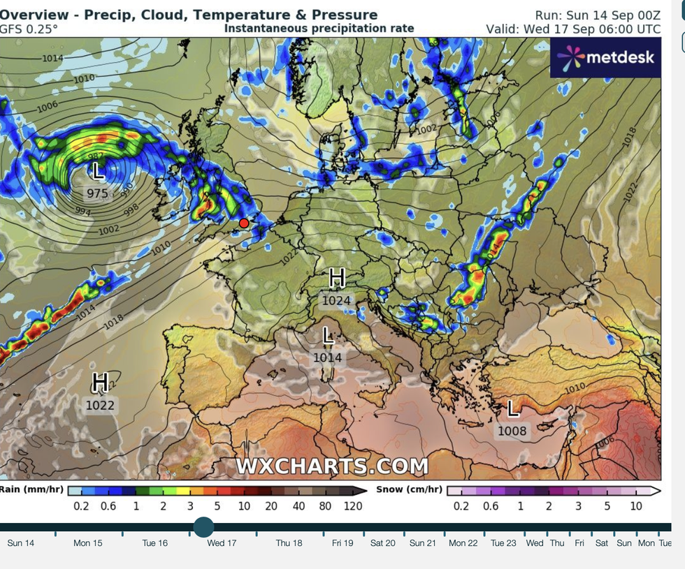
While Government forecasters have issued no names for this week’s storms, meteorologists say it is not out of the question
|WXCHARTS
“These are a couple of volatile systems.”
Unsettled weather will be driven by large ‘flabby’ low-pressure features hovering close to the UK, he said.
Rather than surging at speed across the country, they will hover nearby bringing persistent showers.
Parts of the country could see up to a couple of inches of rain through the coming days.
Dale said: “They are fatter, more flabby features, which sit close to the UK, and where there could be a couple of inches of rain, we could see flooding.
“The strongest winds will be at the start of the week, then we expect a quieter day on Tuesday before another system comes in on Wednesday.”
A wet and windy week could give way to a quieter and drier spell at the end of the month.
Low pressure could give way to high pressure, which drives clear skies and higher temperatures.
Met Office meteorologist Honor Criswick said: “It is looking most likely that it will remain showery all week, and there are some models that indicate another area of low pressure pushing in towards the middle part of the week.
“There is a slight hint of high pressure building back through as we head later into September.
“It is now possible that towards the end of September we will see high pressure building through.”