


A potent mix of rowdy weather systems more typical for autumn than summer is about to put Britain on storm alert.
Shifting jet-stream winds and cyclonic pressure patterns heading in from the Atlantic threaten a weekend of torrential downpours and gales.
As the May heatwave slips from the nation’s memory, experts warn people with outdoor plans to prepare for disruptive weather.
A ‘potent’ storm sweeping in from the west tonight will kick start a week of wind and rain.
Met Office meteorologist Alex Deakin said: “One of the crucial factors for the weekend will be the strength of the wind, and on Saturday morning, the highest chance of strongest winds are across the south of Ireland, south Wales, and southwest England.
“It is quite unusual for this time of year, and with a lot of events on, it could cause some issues, so if you have plans for Saturday, then keep up to date with the forecast.
“There will also be some rain through Saturday, and on Sunday the rainfall totals will build up over the hills, and there could be quite a lot of rain over the weekend.”
The culprit is the jet stream, gushing further south with unusual pep for the time of year, pulling low-pressure storms into Britain.
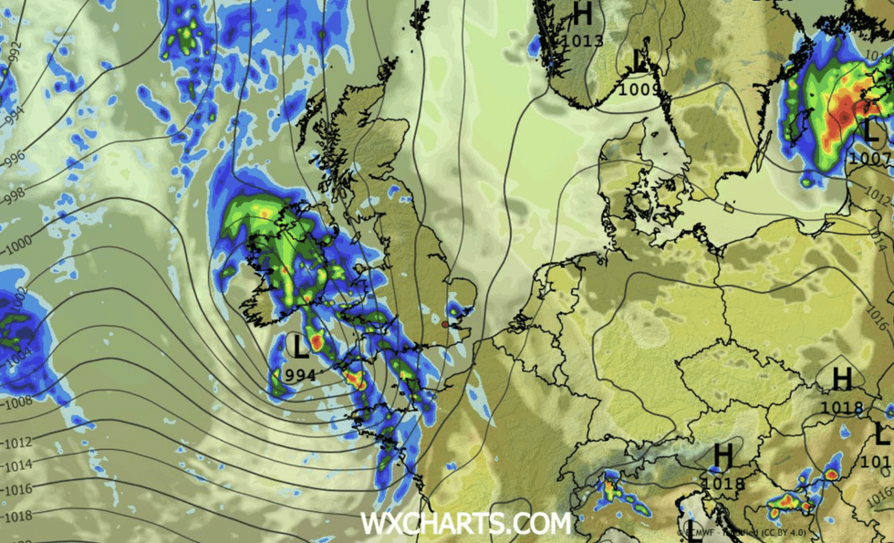
The jet will act as both a steer and a strengthener
|WX CHARTS
The jet will act as both a steer and a strengthener for a barrage of Atlantic cyclones heading towards the UK.
Mr Deakin said: “The jet stream is in a fairly classic position, but not for June, this is a typical position for winter or autumn, and it is fairly active for this time of year.
“A low-pressure system that is going to have most of our attention is forming off the coast of America and intensifying.
“It crosses over the jet stream and interacts with the left exit of the jet streak and intensifies during Thursday and Friday, and on Saturday, it is likely to bring a spell of wet and windy weather.
LATEST DEVELOPMENTS
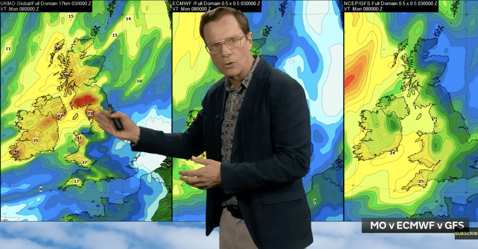
Foul weather is threatening to hold out for another 10 days
|MET OFFICE
“It could be quite a potent low as it comes through on Friday night into Saturday, but not as intense as some of the models were suggesting.”
Foul weather threatens to hold out for another 10 days with the first half of June feeling far from summery.
Heavy rain this weekend threatens floods while volatile atmospheric conditions trigger thunderstorms.
Jim Dale, meteorologist for British Weather Services and co-author of ‘Surviving Extreme Weather’, said: “Unsettled conditions, with the risk of wind and heavy rain, is going to be the picture into the middle of June.
“There will be a risk of severe thunderstorms, and the showers that come with them could have teeth.”
Greg Wolverson, deputy chief forecaster at the Met Office added: “The weekend will remain unsettled as an Atlantic system approaches the UK.
“A developing area of low pressure is forming in the western Atlantic.
“By Friday, the way it interacts with the jet stream will determine how strong it is when it reaches us. It could either stay a well‑developed, windy system, or weaken significantly before arriving in the UK.
“Rainfall totals could also build up through the weekend, with some areas of northwestern UK seeing successive periods of heavy rain.”