


Britain is facing a fortnight of rain, thunder and chilly winds with no sign of summer’s return until mid-month.
After the historic May heatwave pushed the mercury into the mid-30Cs, northerly winds threaten a shivering first weekend of summer.
The high-pressure heat dome behind the heat has retreated to make way for cyclonic low-pressure systems.
It could be mid-June before it returns, with the next two weeks bringing stormy downpours and below-par temperatures.
Met Office meteorologist Annie Shuttleworth said: “We could see temperatures below average at the weekend, with daytime temperatures closer to the mid-teens on some days, but by the time we get to the weekend it could be cooler than average.
“We start to see more of a north-westerly, cooler wind direction, and that could bring the cooler than average weather.
“A south-westerly shift in low pressure could mean it will be drier and potentially warmer across eastern areas, but we get less confident on the position of low pressure, and it does dominate.”
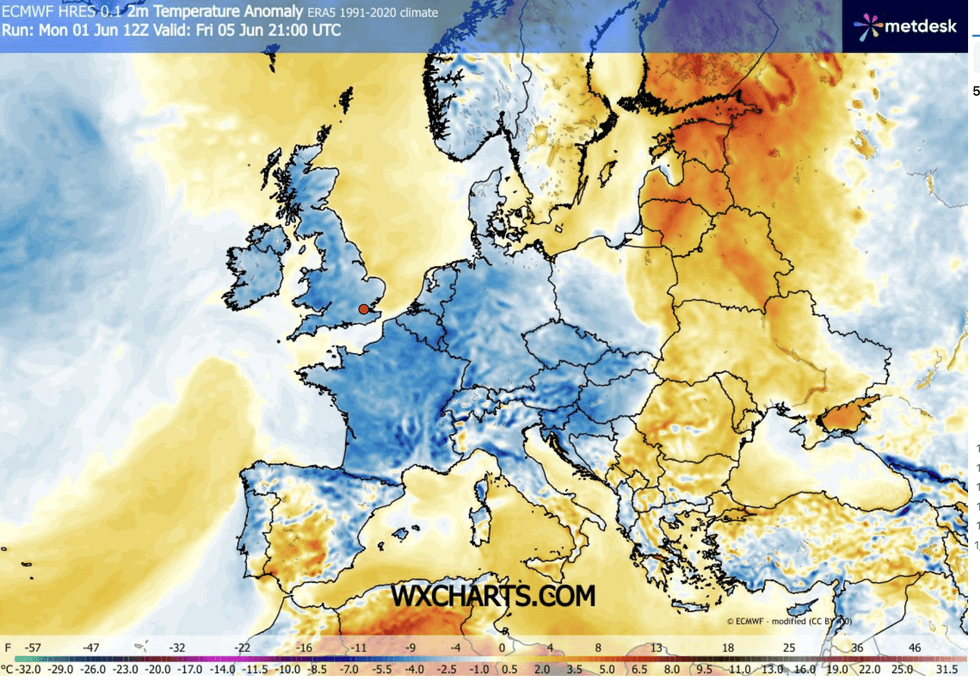
Thermometers will widely struggle to rise above 19C, with overnight lows of around 10C to 15C.
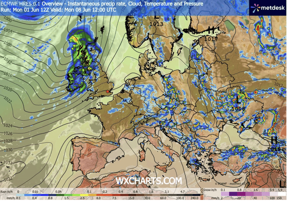
Bands of rain from the Atlantic will bring the risk of flash floods to parts of Britain with heatwave-parched, bone-dry ground.
Ms Shuttleworth said: “Temperatures continue in the high teens, with 15C to 19C likely to be the maximum temperatures.
“And temperatures overnight will come closer to 10C to 15C, and there is a trend to even cooler temperatures that that towards the first weekend in June.
“For the first week of June, we expect something much cooler and much wetter.”
LATEST DEVELOPMENTS
Temperatures will struggle to reach 19C
|WX CHARTS
Long-range experts agree on a ‘mixed’ start to summer, with no immediate sign of a return to the heat.
Tropical winds that last week pushed the mercury to mid-summer peaks will retreat to make way for a northerly chill.
Jim Dale, meteorologist for British Weather Services and co-author of ‘Surviving Extreme Weather’, said: “The outlook for the next two weeks is mixed, with no significant heat, although any warmth will be to the south with the coolest conditions to the north and the northwest.
“There will be a risk of severe thunderstorms through the period, as bands of rain come in from the Atlantic, some of them heavy with the risk of lightning.
“The breeze is likely to pick up through the next week, and it will be windy and cool in parts.”
Signs of a return to summer, however, are tentatively showing up on mid-June weather charts.
Low pressure, wind and rain could once again be given the heave-ho for high pressure.
Ms Shuttleworth said: “There is potential from mid-June that we see high pressure returning to dominate our weather.
“It could push up from the south, the Azores High, or it could be a Scandinavian High, and the position of the high pressure will dictate where we see any warmer and drier weather.”