


The Met Office has issued an urgent thunderstorm warning, with power cuts and lightning strikes expected in parts of Scotland.
In the warning, issued at 2.47pm this afternoon, the National Weather Service predicted "some damage to a few buildings and structures".
It also warns of short-term loss of power, with flooding of a few homes and businesses likely.
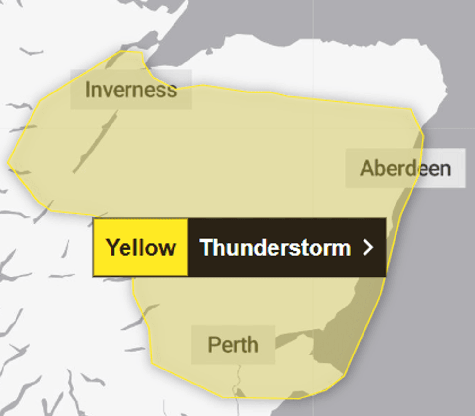
The affected parts of Central, Tayside and Fife include Angus, Clackmannanshire, Dundee, Fife, and Perth and Kinross.
Additionally, the Grampian region is affected across Aberdeen, Aberdeenshire, and Moray, as well as Highland within the Highlands & Eilean Siar area.
Driving conditions will be affected by spray, standing water, leading to longer journey times by car and bus, the service said.
Locals have been told to consider preparing a flood plan and an emergency flood kit.
They advise amending travel plans if necessary.
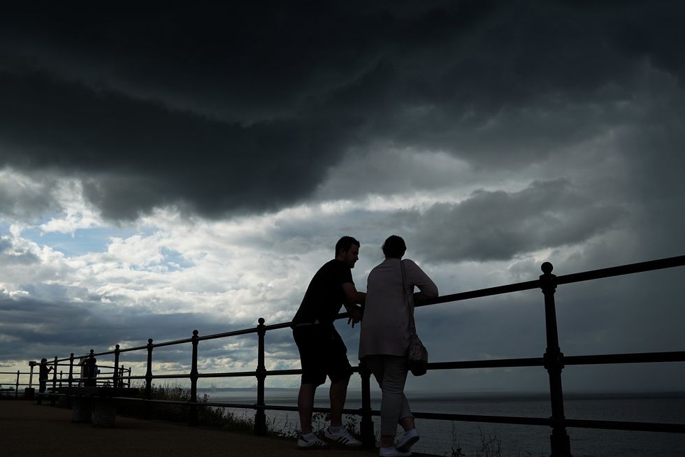
The Met Office has issued an urgent thunderstorm warning, warning of power cuts and lightning strikes
|GETTY
The warning came into affect at 3pm and will remain in place until 10pm this evening.
Showers will become more widespread and heavy into the afternoon, with thunderstorms likely.
Whilst most areas will see much less rainfall, a few spots within the warning area could receive 15 to 25mm of rain in an hour and up to 50mm in several hours.
This could lead to some disruption, with hail and lightning being additional hazards.
LATEST DEVELOPMENTS
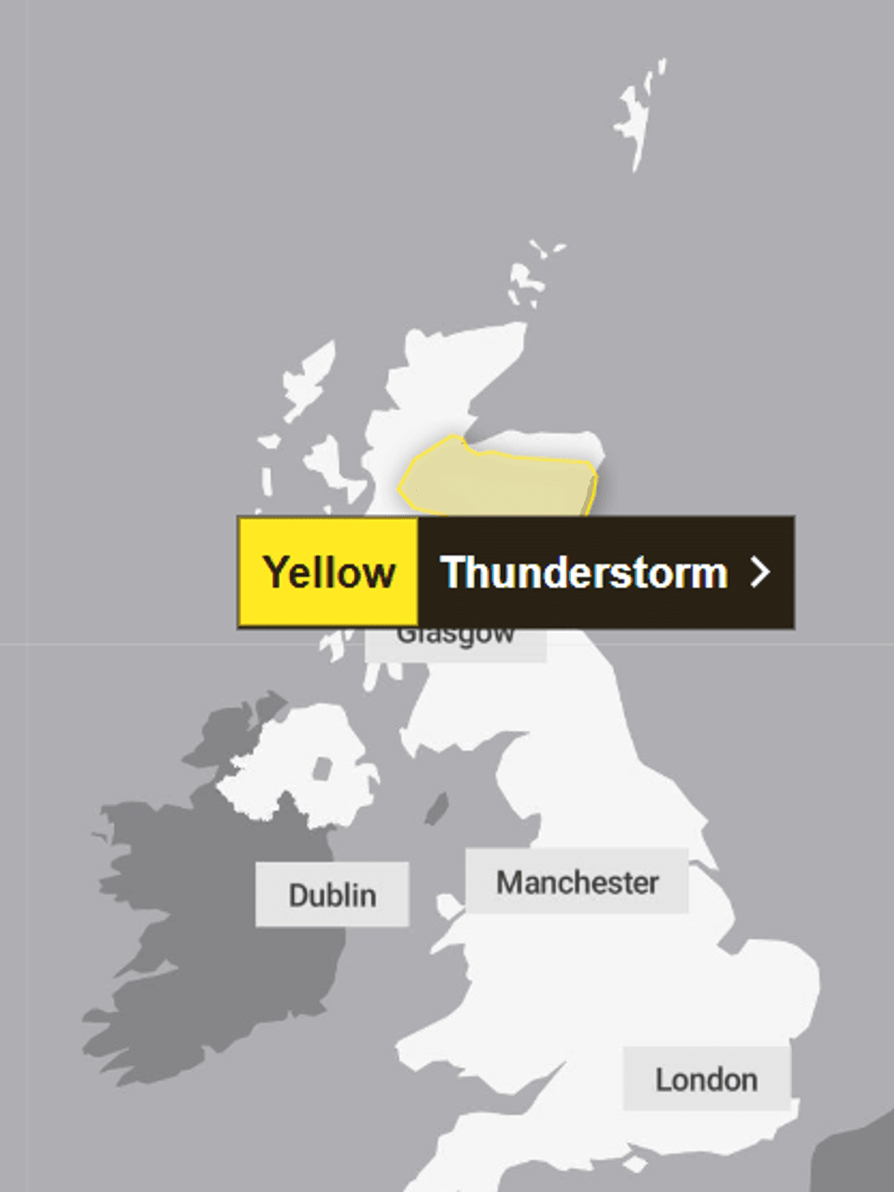
The affected parts of Central, Tayside and Fife include Angus, Clackmannanshire, Dundee, Fife, and Perth and Kinross
|MET OFFICE
Showers and thunderstorms should ease into the evening before largely dying out tonight.
It comes after Scotland recorded its eighth-warmest spring since measurements began in 1884.
England and Wales broke temperature records, with provisional Met Office data confirming the warmest three-month period.
The average temperature across England reached 10.41C during meteorological spring, which spans March through May.
Showers and thunderstorms should ease into the evening before largely dying out tonight
|MET OFFICE
This surpasses the previous high of 10.23C set just 12 months ago by 0.18C.
Northern Ireland experienced conditions ranking as its joint sixth-warmest on record.
Taking the nation as a whole, the UK registered its third-warmest spring since comparable records began more than 140 years ago.
The record-breaking spring means that the three hottest springs ever documented now fall in consecutive years, with 2026 claiming the top position, followed by 2025 and 2024.
Our Standards: The GB News Editorial Charter