


Researchers have uncovered the secret behind Bermuda's remarkable placement above the Atlantic Ocean, despite its volcanoes falling silent more than 30 million years ago.
The scientific team at the Carnegie Institution of Washington and Yale University identified a concealed geological formation beneath the island chain, which developed following the region's last volcanic activity.
The discovery has effectively propped up the territory throughout prehistoric times to the present day.
Located approximately 650 miles off the coast of North Carolina, this Atlantic archipelago is home to around 64,000 residents.
For decades, geologists have puzzled over how the popular holiday destination remained elevated above the deep ocean floor, given similar islands typically require ongoing volcanic activity to remain above water.
This subterranean slab found to be supporting the landmass measures approximately 12 miles in thickness, comparable to the length of Manhattan Island from end to end.
Crucially, this rock mass possesses a lower density than the surrounding material, approximately 1.5 per cent lighter than the adjacent mantle rock.
Scientists believe this buoyant layer came into existence between 30 and 35 million years ago, when molten rock from deep within the Earth ascended and spread beneath the crust, before cooling and solidifying.
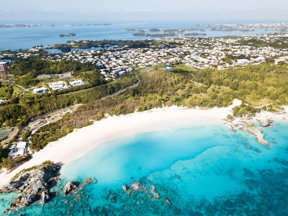
Bermuda is home to around 64,000 residents
| GETTYThe density differential generates sufficient buoyancy to maintain the Bermuda region between 1,300 and 2,000 feet higher than typical deep ocean floor, functioning essentially as an enormous geological flotation device.
To map these underground structures without drilling, researchers William Frazer and Jeffrey Park analysed over two decades of natural earthquake vibrations captured by a single seismic monitoring station on the island.
Their technique involved tracking how fast-moving pressure waves transform into slower shear waves upon encountering boundaries between distinct rock layers.
LATEST SCIENCE BREAKTHROUGHS
Through processing hundreds of seismic signals using specialised equipment and high-frequency filters, the team charted rock layers extending more than 25 miles beneath the surface.
Mr Frazer said: "Bermuda is an exciting place to study because a variety of its geologic features do not fit the model of a mantle plume, the classic way for deep material to be brought to the surface.
"This suggests that there are other convective processes within Earth's mantle that have yet to be well understood."
The findings, published in Geophysical Research Letters, also shed light on the Bermuda Rise, a vast underwater plateau spanning hundreds of miles.
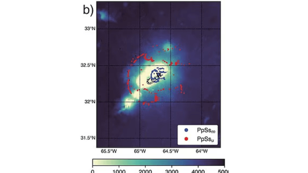
Researchers used decades of earthquake measurements to uncover the massive rock slab
|GEOPHYSICAL RESEARCH LETTERS
This elevated region has persisted for millions of years without any active volcanic or hot spot activity to sustain it.
The area exhibits several peculiar characteristics, including a gravitational anomaly where Earth's pull registers slightly weaker than anticipated due to the lighter rock beneath.
This reduced gravitational force causes the ocean surface to sit marginally higher over the rise, producing what scientists term a geoid anomaly.
Additionally, the region displays pronounced magnetic irregularities that can affect compass readings and navigation instruments, though these disturbances stem entirely from iron and titanium-rich rocks remaining from ancient volcanic activity and pose no danger.