
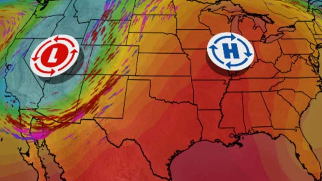


Violent electrical eruptions triggered by blazing heat colliding with an Arctic plunge to create a thunderstorm “factory” threaten to tear through the US.
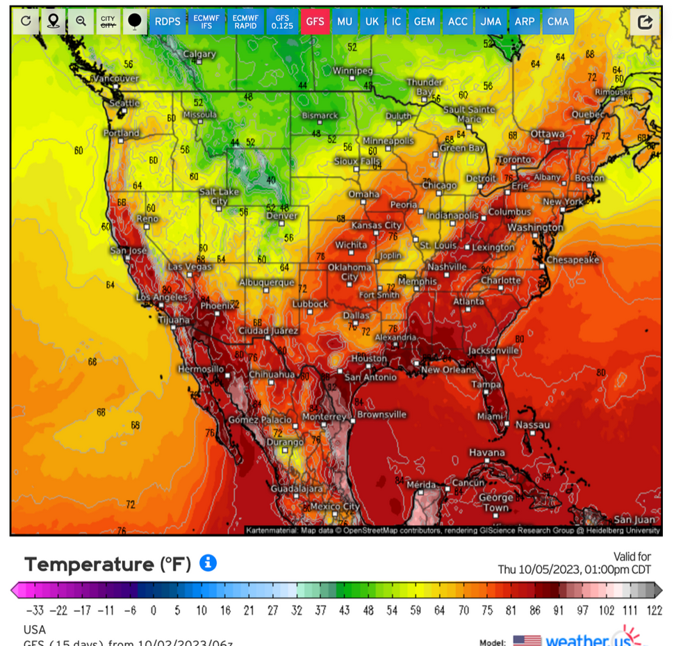
Blistering 100F temperatures will continue to roast mid-western and southern states this week under a “heat dome” of high pressure.
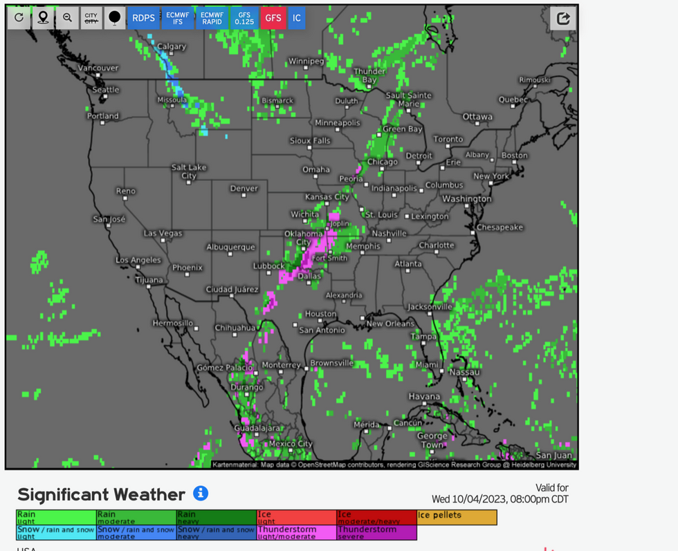
The meeting point will form an alley of thunderstorms which could be vicious enough even to spawn tornadoes.
WATCH NOW: Weather outlook for 03/10/2023
Most at risk later this week will be Oklahoma, Kansas, Illinoi, Wisconsin, Missouri, Utah and Kentucky, experts warn.
Jim Dale, US weather correspondent and senior meteorologist for British Weather Services, said: “At the point of division between the hot air across the south and the mid-west, and the cold air from the north there will be a risk later this week of thunderstorms and potentially tornadoes.
“Where the two air masses meet will create a factory for these storms which could bring further rain and disruption.
“The risk of thunderstorms in this region will be greatest during Tuesday, Wednesday and Thursday.”
US LATEST:
The storm is not expected to make landfall across the US but will instead swerve northwards into the Atlantic.
A spokesman for the National Hurricane Centre (NOAA) said: “Strong westerly vertical wind shear is expected to prevent significant strengthening for about another 12-24 hours.
“After that time, Philippe is expected to encounter a more favourable upper-level wind pattern as it moves northward over the Atlantic.
“This should allow for steady strengthening, and much of the guidance predicts that Philippe will become a hurricane in three to four days.”
Stubborn heat across southern States could push thermometers to 100F this week while chilly gusts to the north bring snow.
Hot weather shows no sign of abating as the US ‘mirrors’ heatwave conditions which gripped Europe earlier this summer.
Mr Dale said: “There is no real sign, at least at the moment, of colder conditions spreading widely across the states.
“It is almost like spring going into summer again, with no real intrusion of Polar air.
“The push of warm air from the south is huge, and this is what is causing this battle between air masses and the very unstable atmospheric conditions.
“We are looking at temperatures of 100F in Arizona and Texas, which isn’t unusual in itself, but is unusual in that it is so unrelenting.”
Weather Channel meteorologist Danielle Banks said: “It’s warmed up in the middle of the country, and warmer than average temperatures will extend into the northeast.”
Weather Channel meteorologist Orelon Sidney added: “This first week in October is going to feel more like the end of August for parts of the Mississippi Valley.
“The east high pressure is going to be in control in the upper atmosphere, so from the Great Lakes down to the Gulf coast through the southern plains and into the east is going to be quite warm.”