US weather: Freak cold plunge to send temperatures plummeting
US weather: Freak cold plunge to send temperatures plummeting
|AccuWeather

The temperature drop comes in the wake of Hurricane Ernesto
Don't Miss
Most Read
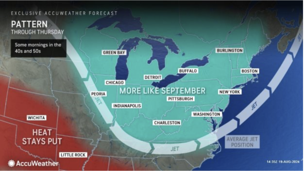
A freak cold plunge will make parts of the US ‘feel like September’ while southern states fry in ‘record-breaking’ heat.
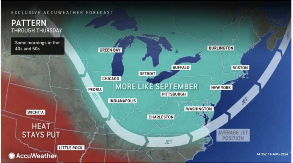
The jet stream will sweep southwards ahead of the weekend, delivering an autumnal chill to the east and northeast.
Temperatures will tumble below average for the time of year, although southern and western regions will continue to bake under an unrelenting heat dome.
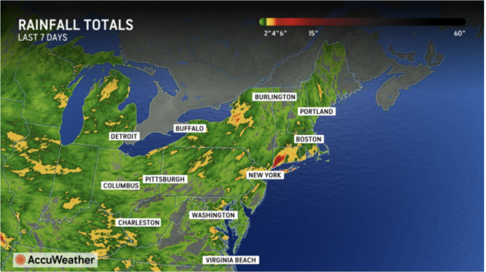
The change in pattern will bring a much-needed dry spell after torrential rain in the wake of Hurricane Ernesto.
 US weather: Freak cold plunge to send temperatures plummeting | AccuWeather
AccuWeather meteorologist Jon Porter said: “The northeast is in for a pattern change this week with a series of cool intrusions through the region.
“Through Thursday, this could bring temperatures that are below the historical average.
“Because temperatures will be lower, many people will be able to enjoy more comfortable and less humid conditions.
“It will also bring some dry weather.”
It will, however, be a different story to the south and across some western states, where thermometers will rocket into the 100Fs.
Map shows cooler conditions in the east
|AccuWeather
A high-pressure heat dome wedged in place since early summer has driven excruciating heat across swaths of America.
With no immediate end in sight to the misery, the National Weather Centre (NOAA) has issued yet more warnings for the region.
A spokesman said: “High pressure will dominate through mid-week from the Mississippi River to the Appalachians.
“A stubborn, slow-moving ridge over the southern High Plains will allow for hot and humid conditions to persist from southern Oklahoma into much of Texas.
“Some daily record high temperatures could be met along with heat index values of 105F to near 115F.
“While record-breaking heat is expected in Texas, locations across the midwest, northeast and northwest see below-average temperatures.”
US WEATHER: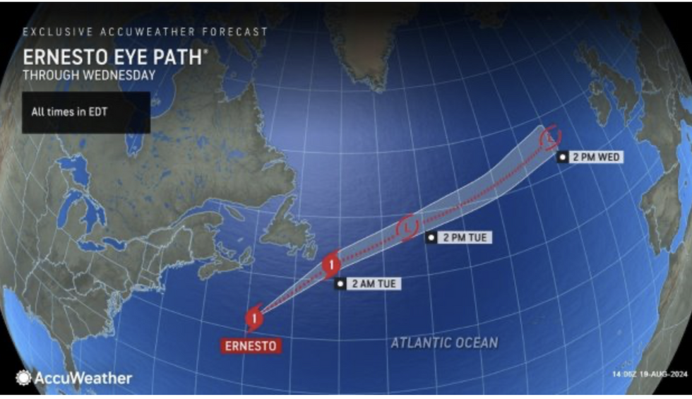
Ernesto storm path
|AccuWeather
Southern states will fare worse with the heat this week, with desert regions also on alert for wildfires.
‘Red-flag’ blaze alerts remain in place across California while ‘excessive heat’ warnings cover Texas.
Further northeast, as the jet stream pulls in cooler air, it will feel more ‘pleasant’, experts say.
Jim Dale, US meteorologist for British Weather Services and co-author of ‘Surviving Extreme Weather’, said: “The thrust of the heat will be in the south of the country this week, especially across Nevada, Arizona, Texas and New Mexico.
“Further north and east, it will be much more pleasant with cooler temperatures.
“Where the heat continues, though, there will be a continued risk of wildfires as parts of the country remain in drought.”
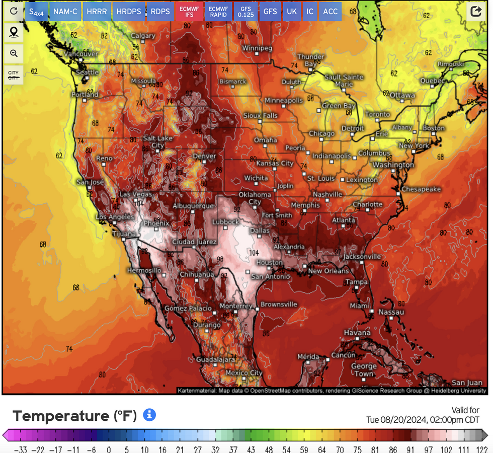
Temperatures surge to the south
|Weather.US
Meanwhile, eastern states are reeling from torrential rain and floods left in the wake of Hurricane Ernesto.
While it veered more than a hundred miles from the coast, heavy downpours were partly fuelled by the storm.
Ernesto had last night re-strengthened into a hurricane after being downgraded from a tropical storm on its path eastwards into the mid-Atlantic.
AccuWeather meteorologist Bernie Rayno said: “Although Ernesto’s moisture did not cause the flooding, Ernesto indirectly contributed to the slow movement of the storms.
“More than 10 inches of rain fell in parts of Connecticut and more than nine inches was reported in parts of New York.”


