


Winter could be about to roar back with a bitter bite back from the Arctic to send temperatures into freefall.
Battle lines are being redrawn between the Atlantic and the east as storm-battered pressure systems realign.
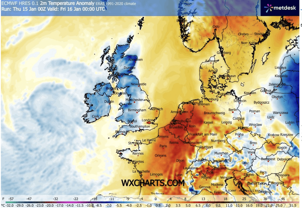
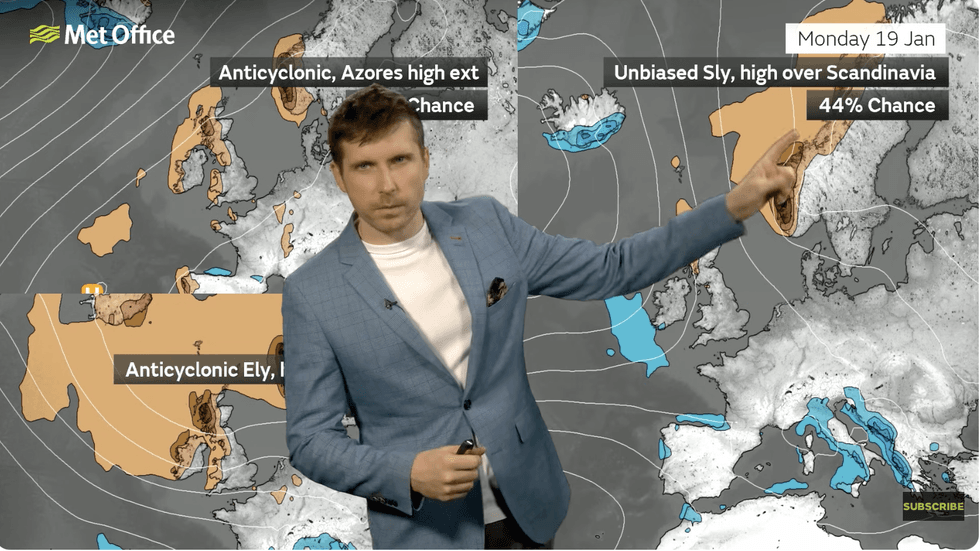
A giant anticyclonic high building over Scandinavia will nudge Britain, drawing in a flicker of cold from the north next week.
Met Office meteorologist Alex Burkill said: “It looks like we are going to get high pressure building across Scandinavia next week, and there is lower pressure to the southwest, and we will end up in a battleground between the two.
TRENDING
Stories
Videos
Your Say
“In this set up, our winds go clockwise around high pressure, and we would be dragging our winds in from a southeasterly direction, so there is the chance that we could drag in some colder air again.
“It looks like temperatures are going to be a little bit below average for the time of year.”
Once again, forecasts are being thrown into turmoil by tussling weather systems forcing models to lock horns over wildly varying outcomes.
The uncertain landing point of high pressure next week means the difference between a bitter cold winter snap, or more rain.
Mr Burkill said: “High pressure could extend a little bit south westwards bringing that colder air, but with the influence of the high it would be largely dry.
“If the low pressure pushes in from the southwest, things could be milder but also quite wet and there could be some spells of rain.
“Or, we could have a combination of the two, and if that comes off, that could bring some particularly hazardous weather, but that is very far ahead.”
The cold will follow another bout of wet and windy weather threatening more than an inch of rain in parts of the country reeling from Storm Goretti.
LATEST DEVELOPMENTS
Cold air will sweep through
|MET OFFICE
Southwestern and western counties are in the firing line as gales blow in from the Atlantic.
Cold air will sweep through on the tail of a low-pressure cyclone due to hit Britain today.
Jim Dale, meteorologist for British Weather Services and co-author of ‘Surviving Extreme Weather’, said: “With the battle between the Atlantic and the Arctic, we expect unsettled weather at the end of the week to be followed by a colder spell as Polar Maritime air comes through behind low pressure.
“This will bring the change from mild and unsettled potentially back to cold.”
As temperatures drop this weekend under lighter winds, Britons face the added hazard of fog.
Burkill said: “There is likely to be quite a lot of low cloud and some murkiness leading to fog and mist on Saturday morning.
“There should be some breaks in the cloud, but a fair few places will stay stuck under that cloud and in some places, fog could linger through the day and if you are stuck under that cloud it is going to feel pretty cold indeed.
“Through Friday into Saturday, the low pressure is going to fill, so the winds will be easing and there will be fewer showers around.”