


Melting snow, rain and mild days after bitter nights threaten to smother Britain in a shroud of murky fog.
As the nation reels from Storm Goretti’s Arctic hammering, a fresh threat looms from swirling banks of chilly mist.
Rising temperatures with heavy rain and snow melt will rocket humidity levels which in overnight lows of below zero will thicken into curtains of fog.
Jim Dale, meteorologist for British Weather Services, said: “There is the potential this week for some major issues with fog, as the rain comes in with the snow melt, and temperatures rise.
TRENDING
Stories
Videos
Your Say
“From Tuesday onwards, there may be some issues with travel as this risk grows, and this is going to be where there is little to no wind.
“As the snow melts with rising temperatures, and we see more rain, this is going to raise humidity levels, and then when temperatures drop overnight, this is when we are going to see the risk of fog.”
Britain’s freakish weather is still under the cosh from warring Arctic and Atlantic pressure patterns.
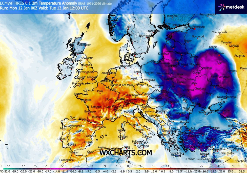
Milder will sweep the UK, WXCHARTS has said
|WXCHARTS
A win by low pressure from the west saw Storm Goretti barge out the cold calm to deliver the worst autumnal hammering for a year.
It followed a period dominated by stubborn high pressure, which drew a freezing airflow from the North Pole.
This week will bring an Atlantic pattern, with wind, rain and milder temperatures from the west.
LATEST DEVELOPMENTS
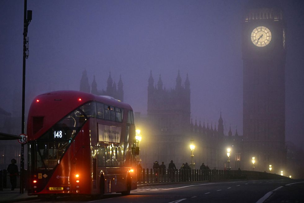
A double-decker bus crosses Westminster Bridge as early morning fog covers the streets of London
|GETTY
However, northwestern Britain will keep the risk of bitterly cold winds and wintry showers, experts warn.
Met Office meteorologist Marco Petagna said: “Towards the northwest where clearer spells develop, we will see some colder spells developing, and with colder air in the north and west of Scotland, we could see a touch of frost on Tuesday morning with temperatures in low single figures.
“The central slice of the UK will see the most unsettled weather for a time, and some of the rain could turn to snow across the southern uplands, and across the northwest highlands, we could also see some wintry showers.
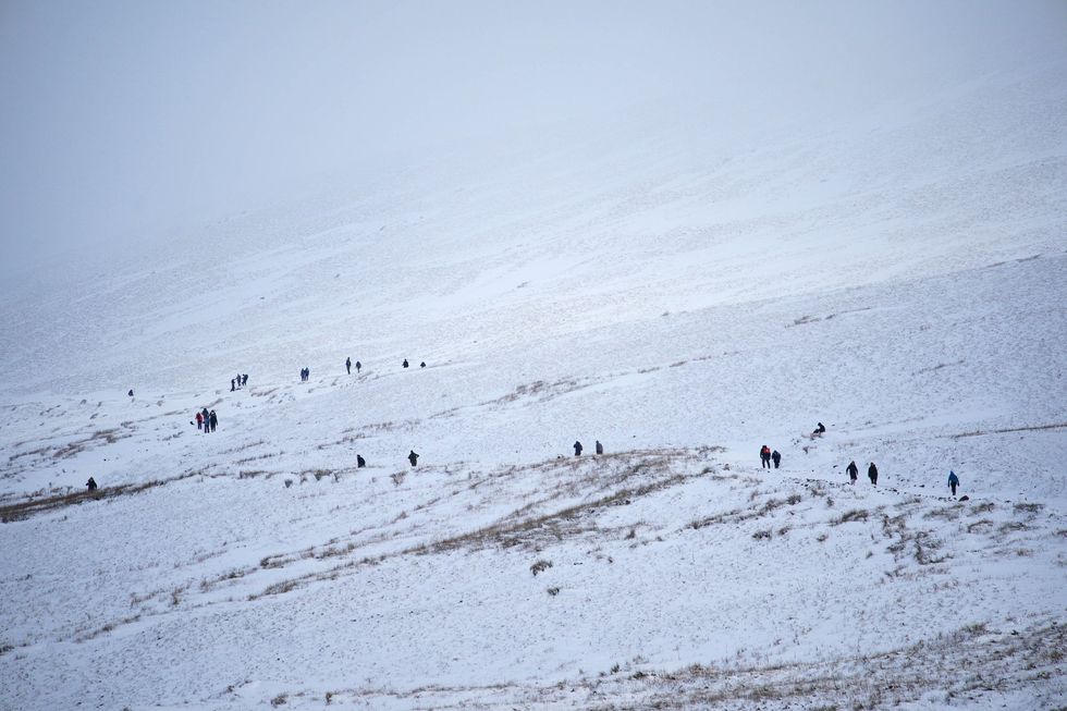 The UK has seen huge snowfall as a result of Storm Goretti | PA
“Further southeast it stays pretty mild, with an afternoon high of 10C or 11C.”
The rest of this week will be mild compared to the start of the month, he added, although northern regions will see overnight frosts.
Southern Britain will enjoy the mildest temperatures this week with highs of 12C possible.
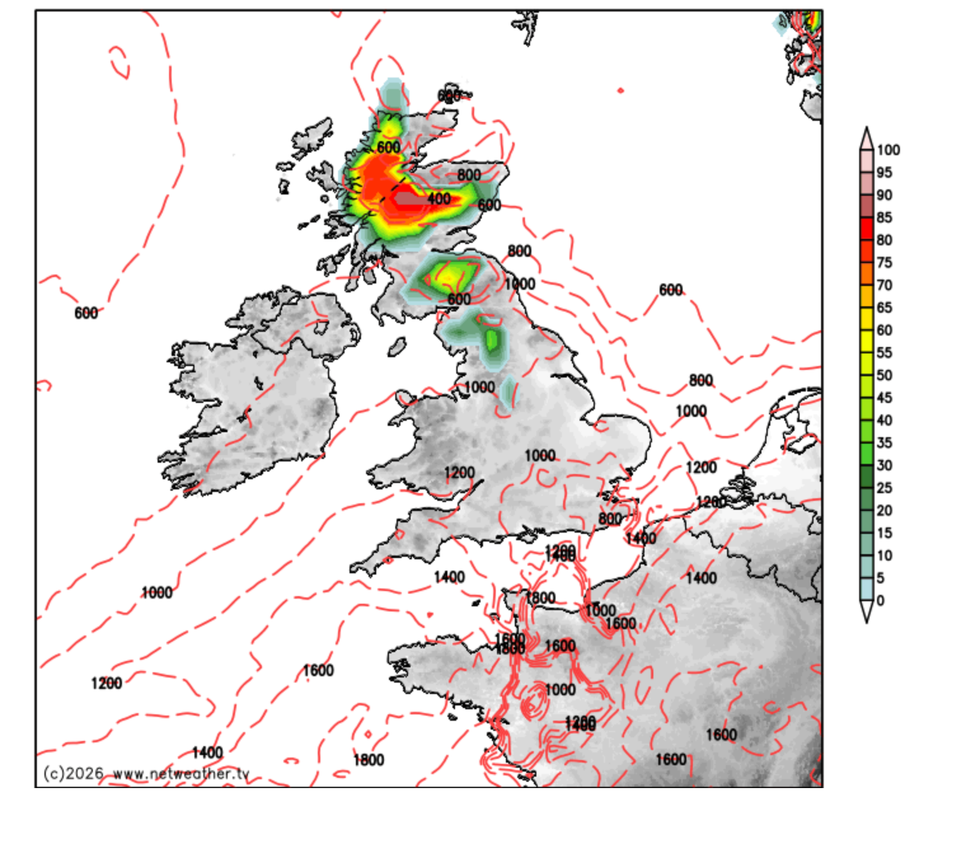
A snow risk stays in place in the north, Netweather has said
|NETWEATHER
Scotland and northern England will stay within biting distance of the Arctic, with a greater risk of snow.
Dale, co-author of ‘Surviving Extreme Weather’, said: “Through the week, the milder air will come in from the west, and this will push temperatures closer to the seasonal norm.
“We still have an ongoing battle between the Arctic and the Atlantic, but any cold weather from the middle of the month is more likely to be ‘home-grown’, the result of clear overnight skies and dropping temperatures, rather that something coming in from the north.”