


Britain’s post-storm calm is under threat from a double-barrelled cyclone poised to unleash a fresh clout of wind and rain.
Coastal counties are on alert for torrential downpours and gales as a deepening low-pressure system rolls through.
Britons heading out and about are urged to make the most of fine weather today, before the pre-weekend shake-up.
While wind and rain are the biggest risk across much of the country, the mountains of Scotland face another coating of snow.
TRENDING
Stories
Videos
Your Say
Met Office meteorologist Annie Shuttleworth said: “To the south, an area of low pressure may bring the potential for some wet and windy weather, but there is some uncertainty over the position and the track of that area of low pressure.
“Around Friday lunchtime, this area pushes up from the south and moves to the north, and it is a pretty deep area of low pressure in some model runs, so it will bring some strong winds to coastal areas.
“There are potentially some brisk gale-force winds around that area of low pressure, and as it meets colder air, it could bring some snow to the highest ground to Scotland and the Pennines.”
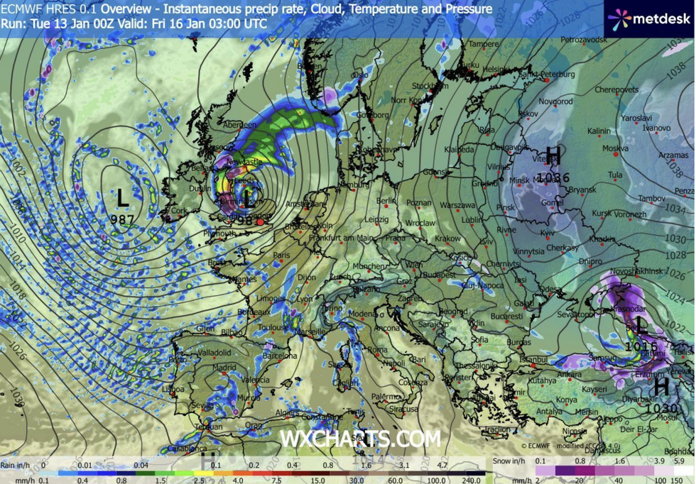
WXCHARTS suggests downpours could rock Britain later this week
|WXCHARTS
A battle between westerly Atlantic winds and the stubborn Arctic chill will keep Britain on a winter knife edge.
Yo-yoing temperatures will sink below freezing in parts mid-week before surging ahead of the weekend.
Shuttleworth said: “It will be a cold start to the day on Wednesday with the risk of frost, and there is a risk of ice.
LATEST DEVELOPMENTS
“The next weather front moves in on Wednesday with winds picking up, and the cloud will thicken ahead of that for many western areas of the UK.
“After the chilly start, temperatures will struggle, so it will be a chilly day with more in the way of sunshine.
“Temperatures for Friday will be about average for the time of year, and the winds will be particularly strong through the middle part of the day around that area of low pressure.”
Britain’s up-and-down weather is the product of tussling low- and high-pressure systems using the nation into a boxing rink.
The cold start to December was dominated by high pressure over Scandinavia pulling Arctic winds south into western Europe.
Last week saw a deep low ride the jet stream to push the battering-ram high leading to Storm Goretti.
A duo of low-pressure systems this weekend threatens to put up the same squabble, as the weather turns back to wet and windy.
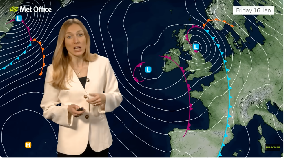
Met Office’s Annie Shuttleworth warns of low pressure coming through
|MET OFFICE
Jim Dale, meteorologist for British Weather Services and co-author of ‘Surviving Extreme Weather’ said: “The battle between the Arctic and the Atlantic has seen the cold weather, for the time being, kicked out by the milder westerlies.
“We are in the Atlantic regime for the next couple of days, but there is cold air coming in behind the next system.
“Rain will be the issue in the west, but there is still going to be a risk of snow to higher ground in northern parts of the country.”