


Britain will shiver into the second half of May as temperatures nosedive in a sinking Polar front.
Bitter winds, frost and hail will hold the mercury in a downward trajectory as the nation wraps up in the coldest spell of spring.
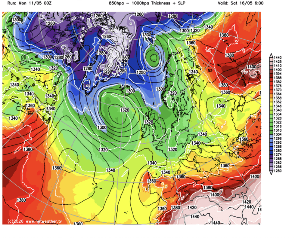
Northerly winds will arrive with the sting of thunderstorms driven by low-pressure swirling over Scandinavia.
Cold weather will hold out into the weekend as the Polar front – the boundary between Europe and the North Pole – scrapes the country.
Jim Dale, meteorologist for British Weather Services, said: “The Polar front is coming south, and it is going to keep us in the cold through the rest of the week and into the start of the weekend.
“The winds are coming from a northerly direction, so it is going to feel cold, with temperatures below average for the time of year.
“We are locked into the colder weather for the time being.”
Northerly winds will keep the wintry feel through the next few days, driven by low pressure to the north.
High pressure is being held out of reach
|WX CHARTS
High pressure, the usual driver of warm spring weather, is being held out of reach by a racing jet stream.
While temperatures may rise slightly on Friday, the risk will remain of chilly downpours, thunder and hail.
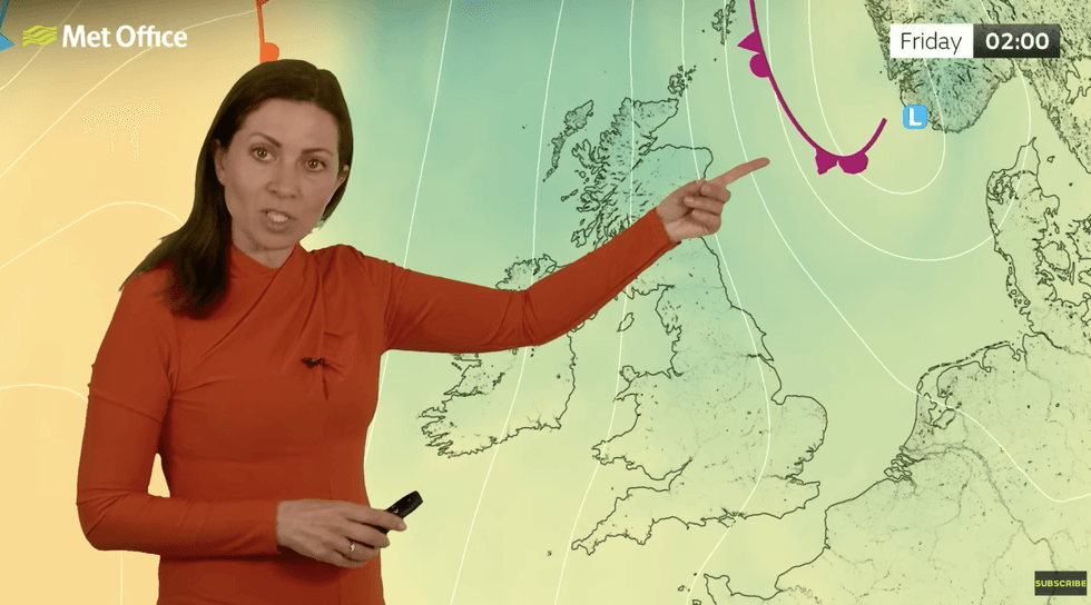
Met Office meteorologist Clare Nasir said: “Through Thursday, we continue with a cold, northerly wind, and this wind will deliver showery downpours, with thunder and hail, and the air is cool, coming in from a chilly direction.
“Into Friday, low pressure towards Scandinavia will be a feature of the weather and showers will become more scattered.
LATEST DEVELOPMENTS
Early signals suggest a warmer end to spring
|MET OFFICE
“Winds will start to pick up some strength, and temperatures will be up a notch, perhaps 12C, 13C or 14C.”
Met Office meteorologist Alex Deakin added: “Temperatures over the next few days are generally at or below average, and with the northerly wind it will be a degree or so lower on Thursday and there is quite a significant wind chill, and still pretty chilly and showery on Friday and Saturday.
“There is still the potential for some frost as we head into the weekend, and even in the south, it wouldn’t take too much in a rural hollow to get some frost.”
Early signals, however, hint at a change to something warmer through the last week of spring.
Below-average temperatures are expected to lift after the weekend as northerly winds give way to southerly gusts.
Mr Deakin said: “There are more cold showers to come for all of us through the next week, but there are signs of something a little warmer as we head into next week.
“As we head towards the weekend, we may see a change as the jet stream starts to shift.
“There are signs of higher pressure trying to topple in, and with winds coming in from the west, it may feel a little warmer, and there are signs that temperatures on the rise as we go through next week.
“There is quite a strong signal for something a bit warmer, probably something closer to or just above average.”