


Freezing winds and snow will erupt into thundery hailstorms as Britain’s missing spring is jolted by a ‘reversing jet stream’.
As temperatures plummet in a blast from the Arctic, the heavens will open in a deluge of downpours.
Today is likely to be the coldest day of the week with icy winds in parts making it feel close to minus 7C.
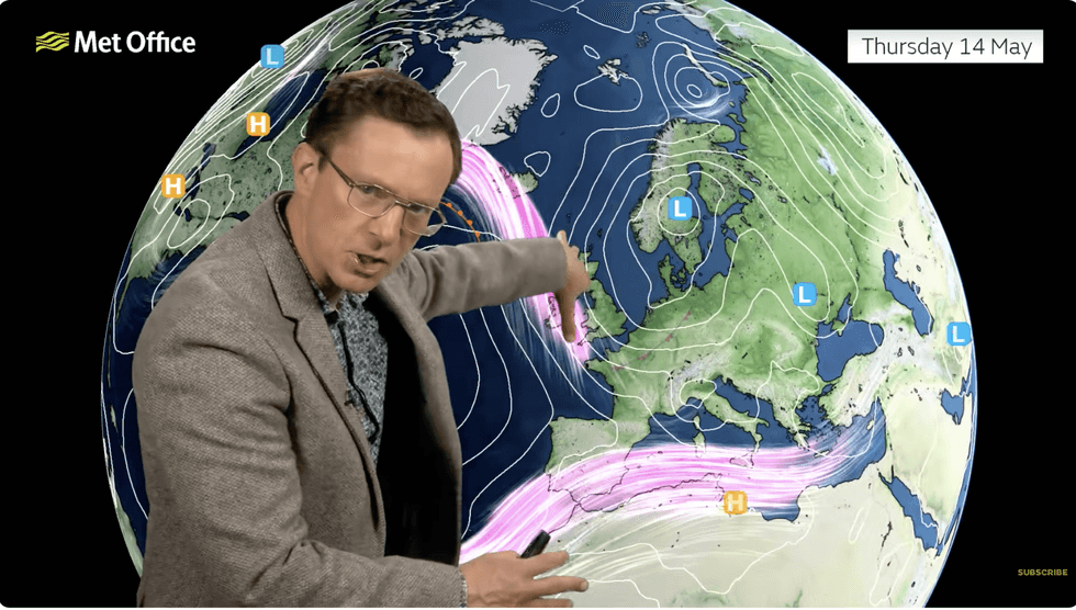
Erratic weather is being driven by a morphing jet stream – the channel of high-altitude winds in the driving seat of the UK’s climate.
TRENDING
Stories
Videos
Your Say
Met Office meteorologist Alex Deakin said: “The jet stream is in a reverse ‘S’ shape, going north south across the UK, allowing low pressure to the east and high pressure to the west,
“We are not really going to see any change through the week, the jet stream shifts further west but allows low pressure to sit around the North Sea, generating northerly winds and keeping things on the chilly side.
“There will be some snow over the hills, and on Thursday, showers could be heavy with some thunderstorms mixed in, and we have a similar set up on Thursday night into Friday, and in a northerly flow we will see more showers, and with the northerly wind it is going to feel pretty cold on the North Sea coast.”
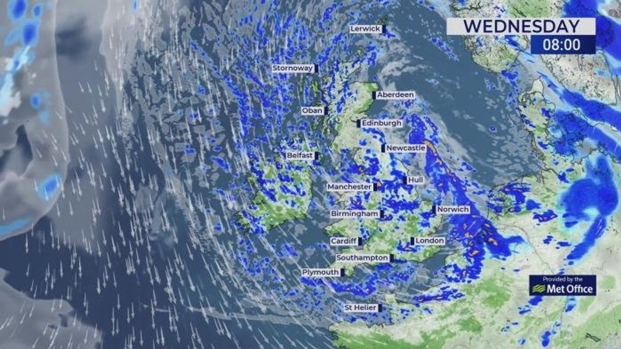
A cyclonic storm swirling to the north of Scotland today will sweep Britain with chilly showers, hail and bursts of lightning.
Today will be the coldest of the week
|NETWEATHER
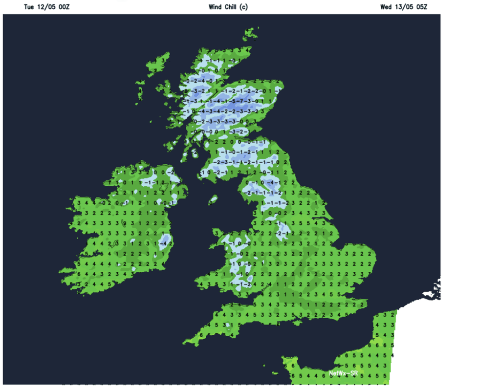
Temperatures in parts will struggle to lift out of single figures with chilly winds making it feel like winter.
Mr Deakin said: “Temperatures are going to be below average for mid-may, there will be some pockets of frost and plenty of showers.
“An area of low pressure pushes its way down, and Wednesday will be a showery day everywhere with thunderstorms likely and hail in some places.
“The brisk wind will bring a cool feel with temperatures struggling to get much above 10c or 11C across the north, and when you add on the wind it will feel like single figures across the board.
LATEST DEVELOPMENTS
Temperatures will struggle to lift out of the single figures
|MET OFFICE
“There is warmer air way out to the east, and cooler air across the UK, and cooler air continues to feed in from the north and there will be plenty of showers.”
Despite the gloomy outlook for the middle of May, another weather U-turn may deliver the sun in time for summer.
Hints of high pressure returning, the driver of fine weather, could signal the mercury bubbling back into the 20Cs or above for the start of June.
Jim Dale, meteorologist for British Weather Services and co-author of ‘Surviving Extreme Weather’, said: “It is going to be cold for the next week, but then we could see a change as we go into the start of summer.
“It is not out of the question that temperatures will quickly rise next month bringing heatwave conditions.”