


Britain will freeze in the coldest week of spring before sub-zero temperatures rocket in time for summer.
Arctic winds will push the mercury to minus 5C in parts over the coming days amid warnings for hard frosts and snow.
Tussling pressure patterns will keep the UK locked in the freezer until the last week of May when early forecasts hint at a return of the sun.
Until then, sun-desperate Britons are warned to have jumpers and coats at the ready as the nation shivers.
Met Office meteorologist Alex Burkill said: “Through the next few days, low pressure is around us, and because of the position of the low pressure, the air that we are dragging in will be from a northerly or westerly direction.
“Weather models go with the idea of cold winds coming towards us, and things are going to stay pretty chilly.
“As we go towards the end of May, there are some signs of higher pressure returning, so we could see things turn a bit more settled and a bit warmer through the latter stages of May and into June.”
The absence of spring warmth is the work of a stormy weather cell stuck over Scandinavia, sweeping cold winds southwards.
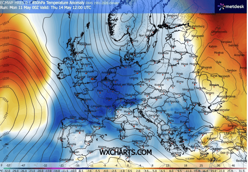
High pressure is being held at bay, delaying warmer conditions as a result
|WX CHARTS
High pressure, the usual driver of warm weather during spring and summer, is being held at bay over the Atlantic.
Scotland and northern Britain will feel the first bite of the chill before most of the country is wrapped up by the weekend.
Mr Burkill said: “Cold air is affecting northern parts of the country, even though it is milder to the south, and we have a cold front across us.
“All the time our winds are coming in from the north and the northwest as we go through the week.
LATEST DEVELOPMENTS
Britons can expect a chilly end to the month
|NETWEATHER
“We see that colder air making its way further southwards, and that colder air will become more widespread.”
The chilly snap threatens to buck the balmy spring trend with overall temperatures likely to come in below average.
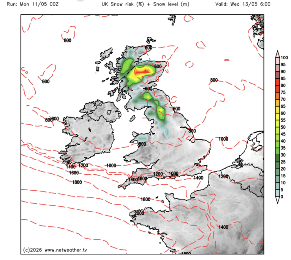
After a record-challenging warm start to spring, snow and the risk of frost will turn the tables on the last month of the season.
Jim Dale, meteorologist for British Weather Services and co-author of ‘Surviving Extreme Weather’, said: “May is probably going to turn out to be below-average in terms of temperatures, and also rainfall, with the cold spell also looking dry.
“There are going to be some ground frosts around this week, and over the mountains to the north, the risk of wintry showers.
“People are going to need their jackets and their coats because it is going to be cold.”
But hope is on the horizon with hints that the start of summer will make up the shortfall, he added.
He said: “As we go into June, there is a chance that we will see a vast difference with much warmer weather on the way.”