


Winter will snarl back with bitter North Sea winds driving the first flurries of fresh snow before the next big freeze.
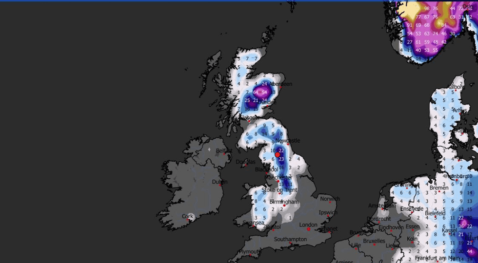
Northern Britain faces the first bite of the cold as wintry downpours over high ground blanket parts of the region.
Weather models agree on easterly winds arriving ahead of the weekend with an "angry" jet stream triggering a widespread cold snap next week.
Met Office meteorologist Alex Deakin said: “Increasingly we are going to see a bit more snow over the hills across eastern Scotland through Thursday and Friday, and the winds will continue to feed in, picking up the moisture in the North Sea.
TRENDING
Stories
Videos
Your Say
“As the colder air comes in, we are likely to see rain more and more mixed with snow, and some snow settling in parts of the Grampians at about 400m and above on Friday, and that could be quite a bit of snow.
“Winds are picking up over the next several days, with between 50mph and 70mph out at sea, coming in from the southeast, and that is a factor that could play into causing some disruption.”
The cold snap will be driven in part by a big freeze hitting northern America, firing the jet stream on its path across the Atlantic.
As the jet sinks southwards, it will help high pressure build over Europe drawing in winds from the east.
The cold snap will be driven in part by a big freeze hitting northern America
|WXCHARTS
Temperatures widely this weekend will plunge below average as Britons wrap up for a freezing end to January.
Deakin said: “We have another cold plunge over northern parts of north America, so the jet stream is pretty angry, and some of the strongest winds in the jet are dictating what is going on for us.
“By the time we get to the weekend, temperatures are down below average and so we are seeing more of an easterly wind coming in.”
Cold-triggering high pressure to the east, which has so far been held at bay by Atlantic lows, will finally show its clout, he explained.
LATEST DEVELOPMENTS
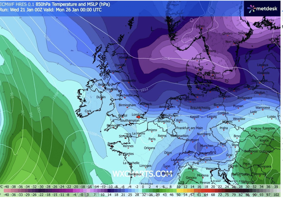
Britons wrap up for a freezing end to January
|WXCHARTS
He said: “Out across northern Europe, we have a big blocking area of high pressure and a lot of cold air building up under this high, and over the next couple of days, slowly but surely, the high extends closer to the UK.
“The colder air is also seeping away through the northern parts of the north sea, and so it is getting wetter, windier and colder in the northwest corner of the UK.
“Higher pressure is building further north, and that is allowing the winds to switch to an easterly to allow things to turn a bit colder over the UK.”
In the meantime, Britain will feel the last throes of the Atlantic assault with wind and rain on the way.
Torrential downpours to the northeast of Scotland and across southwestern Britain threaten mid-winter flood misery.
Jim Dale, meteorologist for British Weather Services and co-author of ‘Surviving Extreme Weather’, said: “There are signs that things are going to turn colder from the weekend as we get our weather coming in from the east.
“But before then, the main risk is going to be from rain, and in parts of the country that have already seen heavy rain this month, there will be a risk of flooding.”