


Wide-spread snow sparked by "a scoop of very cold air" could hit Britain again in just days.
Forecasters are predicting a chance of a return to sheets of white across parts of the UK by the end of the month.
Britain's fate relies on the outcome of a "battle between Atlantic weather systems", but meteorologists appear increasingly in agreement the country will face a fresh barrage of snow and freezing temperatures.
The next week is expected to see average temperatures for this time of year, but freezing conditions and snow could begin to kick in from next Thursday, January 22.
TRENDING
Stories
Videos
Your Say
"There is growing agreement among the medium-range forecast models that there will be a substantial push of cold air from the east in around a week's time," NetWeather's Ian Simpson said.
"A fair number of runs are bringing that cold air all the way across to the British Isles.
"If it does get this far, it is likely to produce snowfalls, via snow showers over the North Sea, particularly into eastern counties, and/or frontal systems pushing into the cold air from the west.
"Thus, there is a significant possibility of a notable wintry spell in the last week of January, but not a certainty as things currently stand."
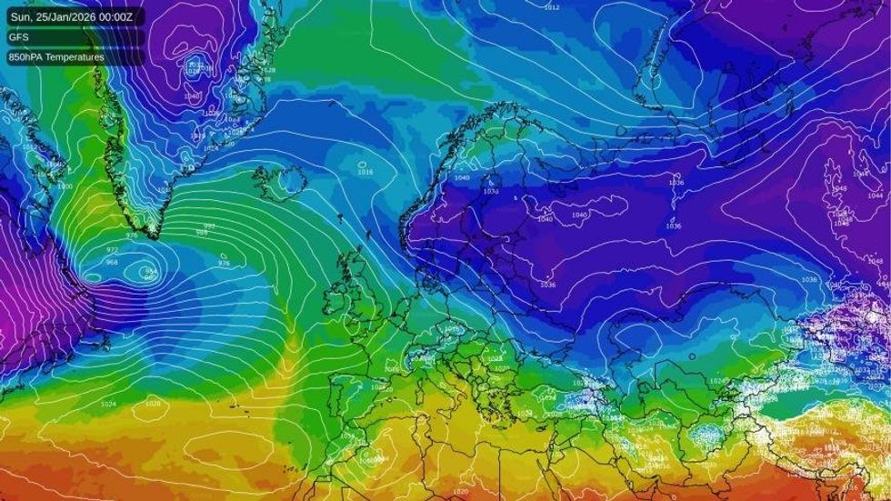
Milder temperatures will initially hit the UK, before dropping nearer the end of the month
|NETWEATHER
Outlining what it would take for such a cold spell to hit, he continued: "For us to get a notable easterly spell, we will need the lows coming in off the North Atlantic to start undercutting a developing blocking high over Scandinavia, heading into the southern half of Europe and propping up the easterly flow over Britain and sending a scoop of very cold air our way.
"It will also rely on the Scandinavian high throwing up a ridge to the north of Britain, towards Greenland and Iceland.
"If this does not happen, and the lows predominantly stay to the west of Britain, the Scandinavian blocking high is likely to end up ridging south into central and southern parts of Europe instead, leaving Britain in a southerly flow and keeping the pool of very cold air away to the east."
The Met Office remained cautious in giving its verdict on the potential of snow.
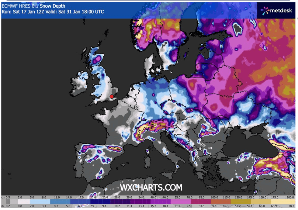
Weather maps show that by the end of the month, most of the UK is set for snow
|WX CHARTS
It said: "The UK will see a battle between Atlantic weather systems attempting to arrive from the west while high pressure and colder conditions attempt to exert some influence from the east.
"Initially, milder Atlantic air is expected to dominate for the majority of the country.
"This should maintain often cloudy, changeable conditions with showers or longer spells of rain for most, with the wettest weather in western parts of the country.
"Temperatures overall likely to be around average, though likely quickly becoming colder in the north east, after which there is an increased chance that conditions will turn more generally colder.
"This aspect of the forecast is still somewhat uncertain but the potential transition to colder weather also increases the chance of snow across parts of the country."
The return of the chances of snow comes less than two weeks after Storm Goretti battered parts of the UK with wind, snow and heavy rain.
Storm Goretti, described as a “multi-hazard event” by the Met Office, brought gusts of almost 100mph and a rare red warning for “dangerous, stormy” winds in the south-west of England earlier this month.
Police said a man in his 50s was found dead in a caravan after a tree fell on to the vehicle in Helston, Cornwall.
Flights were cancelled, trains disrupted and hundreds of schools closed by the wintry weather.