


Summer threatens a damp-squib arrival after the record-smashing spring heatwave fizzles in wind, rain and below-average temperatures.
Britons will be reaching for their jumpers again this week as northerly winds in parts push the mercury into single figures.
Yo-yoing weather patterns will unleash relentless showers across western Britain as eastern counties cling onto the last dregs of warmth.
The change will be driven by a shift in position of the jet steam, pulling cyclonic low-pressure systems in from the Atlantic.
Met Office meteorologist Aidan McGivern said: “We end spring with an area of low pressure arriving just in time for climatological summer.
“Monday is likely to bring a spell of wet weather into the north and west before making its way east across the UK, and with the jet stream south shifted, there is another low queueing to come in.
“I suspect the theme of the week will be areas of low pressure coming in from the west, and these will bring spells of rain, followed by a gap of drier and sunnier weather, before the next low comes in.”
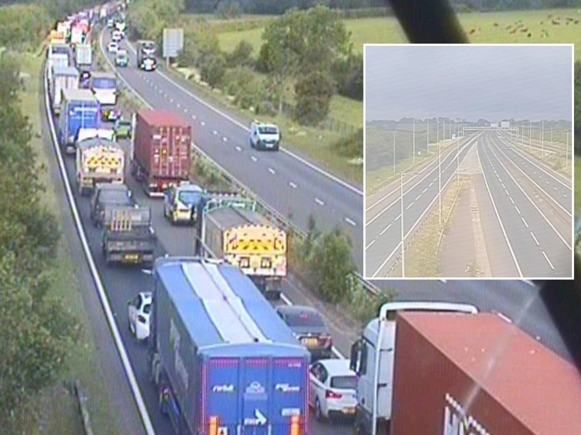
Western regions will take the hit of the U-turn before bands of rain sweep eastwards though the week.
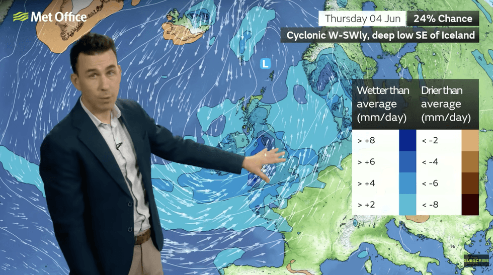
Western regions will take the hit of the U-turn
|MET OFFICE
After spring closed with record-breaking heat and little rain, parts of the country are braced for unusually high rainfall.
Mr McGivern said: “Western parts of the UK will become progressively wetter through next week, and eastern parts will see some much-needed rain.
“It will be wettest towards the west, with winds coming from the west and the southwest, and there will be a cooling trend.
“The weather will be westerly dominated with westerly winds and low pressure to the northwest of the UK, and wetter than average weather for the time of year.”
LATEST DEVELOPMENTS
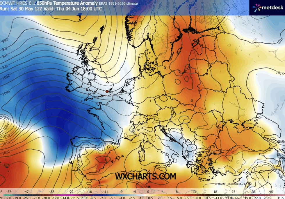
Scotland and northern Britain will feel the chill
|WX CHARTS
Scotland and northern Britain will feel the chill as winds pick up, he added, while the southeast holds on to the warmth.
He said: “Temperatures for the first weekend of June in Glasgow are more likely to be below average as we get north westerlies
“The warmest weather will be towards the east and southeast, and it will be cooler towards the west and the southwest.”
Unsettled conditions will set in today as sub-tropical winds retreat to open the doors to the Atlantic.
Bands of rain could turn thundery mid-week, with a ‘mixed bag’ on the cards for the start of summer.
Jim Dale, meteorologist for British Weather Services and co-author of ‘Surviving Extreme Weather’, said: “Once the bands of rain move through, some of these showers could have teeth.
“We are swapping sub-tropical conditions back to temperate conditions, so it is a mixed picture for the start of June.
“We are going to see more of an influence of the Atlantic, and high pressure will give way to low pressure.”