


A freakishly powerful high-pressure dome hovering between Britain and the Arctic is about to trigger a potentially major New Year freeze.
Plunging temperatures over the coming days threaten to give way to heavy snow for the start of 2026.
Meteorologists are eyeing an unusually mighty high-pressure system building off the Scottish coast, which they say could smash records.
Depending on its position over the coming days, it will conduct a battle between mild air to the south and bitterly cold winds from the North Pole.
Met Office meteorologist Aidan McGivern said: “For the next couple of weeks, the models are confident for high pressure to the north right the way through to 2026.
“If the high pressure moves to the west and sits to the west of the UK, it will allow a northerly to arrive, and that would bring significantly colder weather with Arctic winds and sleet and snow showers to the north and the northeast.
“But another scenario is for high pressure to sit to the south of the UK, and in this scenario, winds from the west are much less cold, and we could get 9C, 10C or 11C.”
As the high circles the UK, Scotland and the far north of England will shiver in the coldest temperatures.
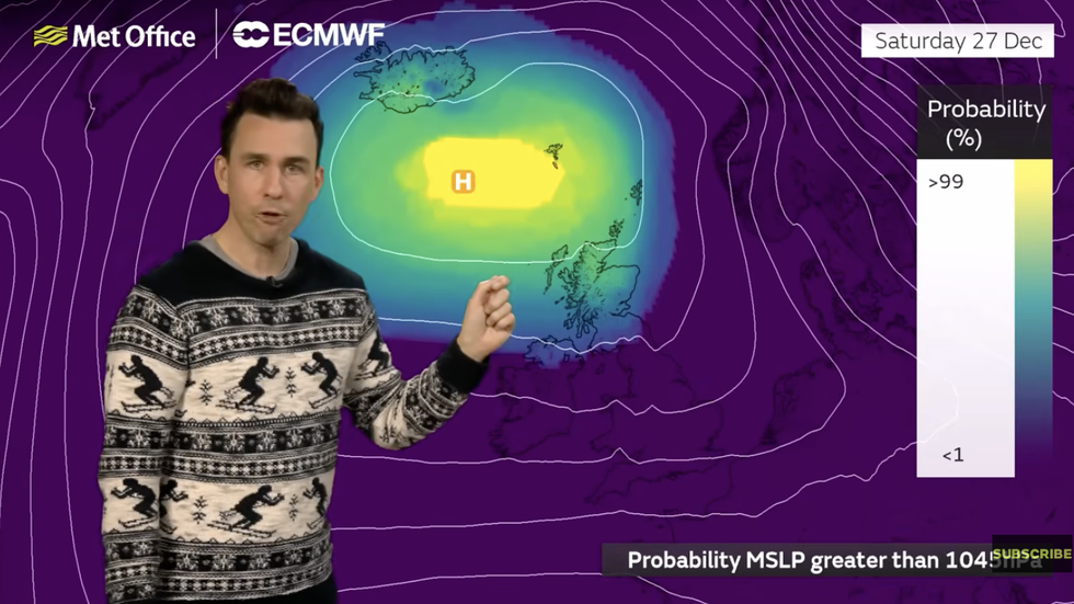
Aidan McGivern describes the mega high sitting over the UK
|MET OFFICE
Unusual is its strength, which could push pressure ‘millibar’ readings to their highest in this part of the world for more than 40 years.
McGivern said: “There is a chance of pressure being between 1045 and 1050 millibars, which is unusually high pressure for this time of year, and some station records could be broken with some spots likely to break their December high pressure record.
“Temperatures on Saturday will be a little bit higher, though turning colder in Scotland and less cold in the south, and with lighter winds, frosts will form and some spots are likely to stay below freezing during the day.
“By Monday, there looks like some colder weather coming into the north and less cold elsewhere.”
LATEST DEVELOPMENTS:
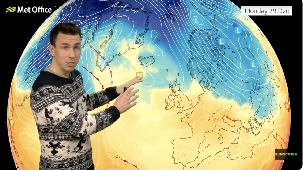
Aidan McGivern describes what the high pressure zone sitting over the UK means for us
|MET OFFICE
Britain felt the first lick of the Arctic chill yesterday as winds swept in from Russia and Eastern Europe.
As the mercury nosedives in the run-up to New Year, bitter gusts in parts will make it feel close to minus 10C.
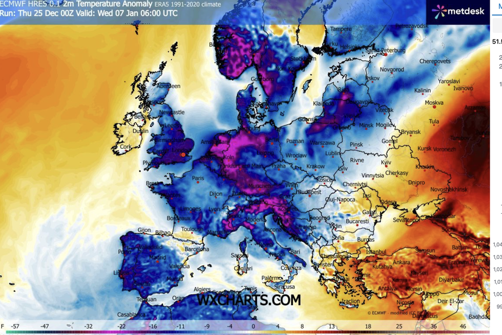
After weeks of mild, wet and windy weather, Britain could be about to hurtle into the first major cold spell of the season.
Jim Dale, meteorologist for British Weather Services and co-author of ‘Surviving Extreme Weather’, said: “As we go through the end of the year and the start of January, there is a growing risk of a significant cold snap.
Cold moves in through the start of January
|WX CHARTS
“This is overdue, with December so far being milder than usual and with a more Atlantic, mobile weather pattern.
“With cold air now in place, this is unlikely to shift over the next couple of weeks, and all it would take is moisture from the west to arrive into that cold air for snow.”
Our Standards: The GB News Editorial Charter