


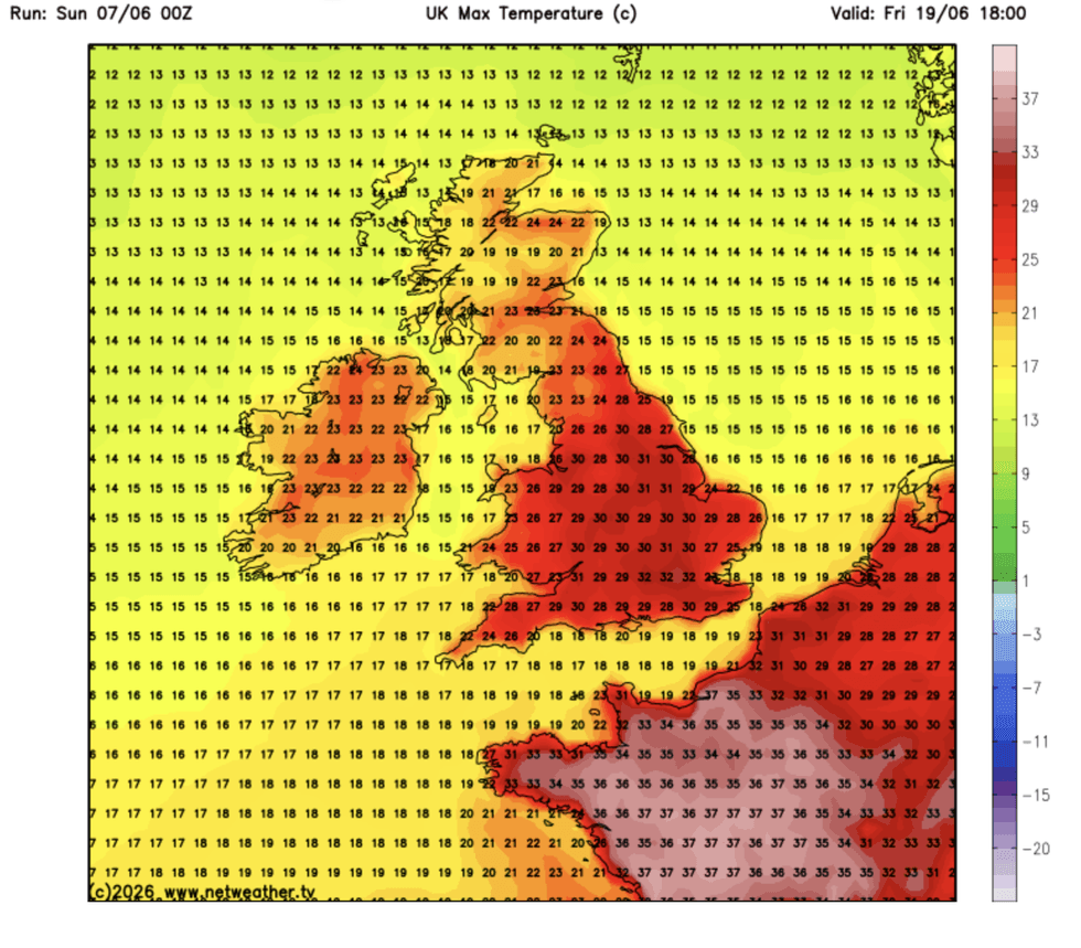
Britain could be days away from its next official heatwave, with temperatures this month threatening to hit 35C.
The chilly, gloomy start to summer is about to make a U-turn this weekend as the mercury heads past the monthly average.
But it is later in the month long-range experts think sun-seekers might be in for a repeat of the May blast.
Highs are possible in the low to mid-30s through the next fortnight as high pressure and continental winds converge to turn up the thermostat.
Jim Dale, meteorologist for British Weather Services, said: “It is going to turn warmer this weekend, but in the longer term, we are watching temperatures with 32C possible in the next fortnight, or even 34C, 35C.
“This is expected during the second half of the month as high pressure starts to become more dominant.
“The change will be gradual with the next few days turning warm before it potentially turns very warm and hot later in the month.”
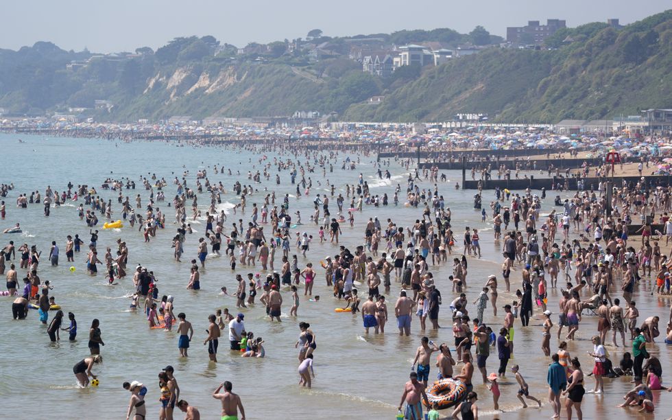
This weekend is likely to be the warmest of summer so far as stormy weather patterns finally recede for sunshine.
Experts think sun-seekers might be in for a repeat of the May blast
|NET WEATHER
Southern counties can expect highs in the mid-20s, although cooler conditions will persist further north.
High pressure, welcomed during spring and summer for driving clear skies and sunshine, will start to build from the south.
With it will come a plume of continental winds, pushing below-average temperatures back where they should be for June.
Met Office meteorologist Annie Shuttleworth said: “Warmth and sunshine return for many of us this weekend.
LATEST DEVELOPMENTS
High pressure is likely to hold out into next week
| PA“The jet stream starts to amplify and buckle north of the UK, allowing high pressure to the south to push further north through the latter part of the weekend, warmth from the near continent will build, and temperatures will rise above average.
“The highest temperatures will be in the southeast with 25C most likely for Saturday, and central and southern areas will be in the low-20s.
“More eastern areas hold on to winds from a more northerly direction, but Sunday is looking like a widely dry day, but there will be a bit of a chill along coastal areas.”
High pressure is likely to hold out into next week before weakening to allow back rainy Atlantic lows, she said.
However, another change ahead of the weekend promises to pendulum swing the weather back to summer sunshine, she added.
She said: “High pressure will stick around into the start of next week, but it does slip away slowly to the east, and in its place an area of low pressure builds in from the Atlantic, and this will dominate our weather.
“It sits out to the west of the UK, driving in southerly winds and we are going to see more in the way of rain.
“By the end of next week, the most likely scenario is for low pressure out to the west, but there is a chance we could see high pressure building to the south, and potentially this could push further north.”
Our Standards: The GB News Editorial Charter