


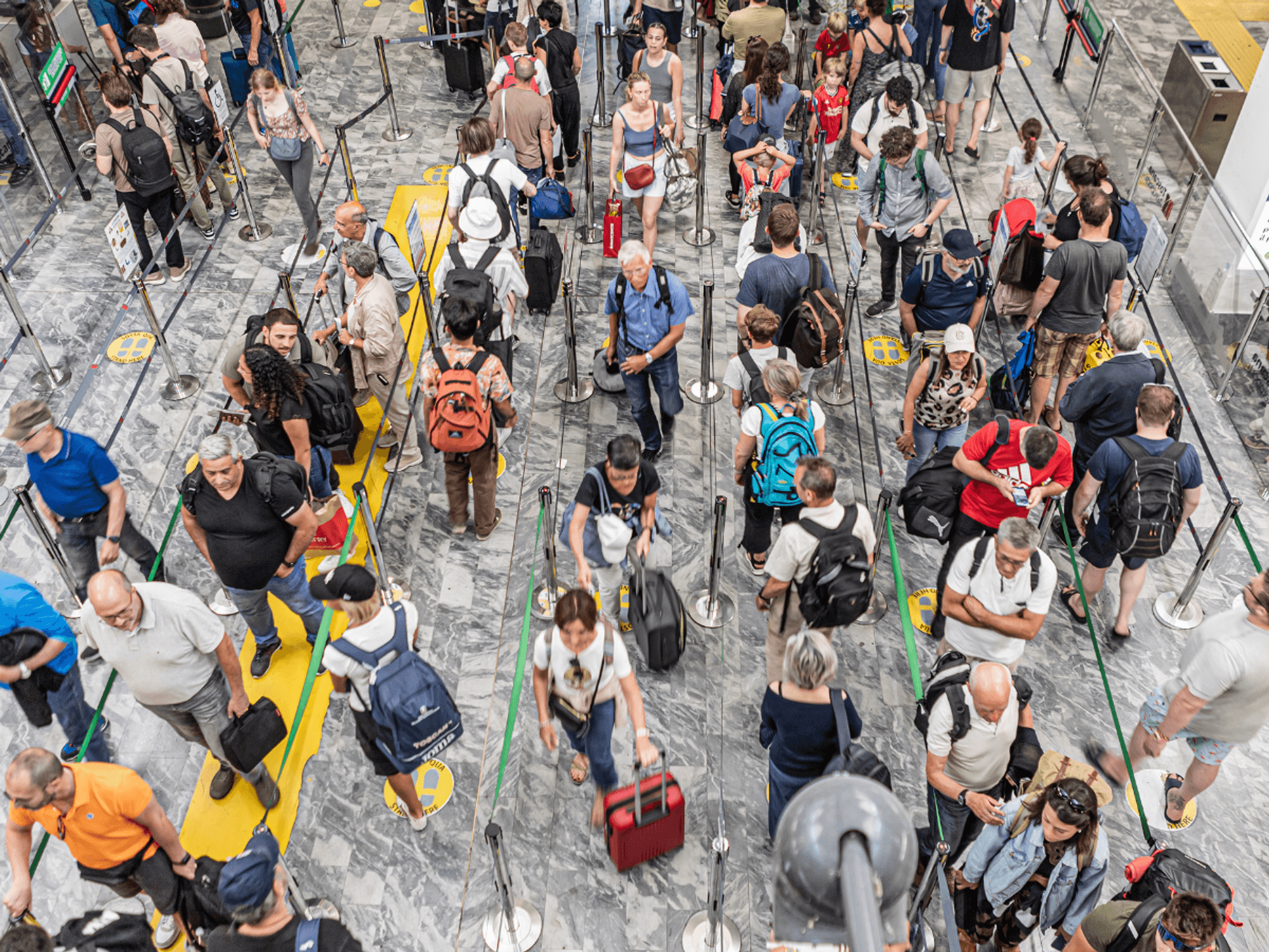
Sun-desperate Britons will brave rain and chilly temperatures until the end of the week when signs emerge of a sizzling return to summer.
As the historic May heatwave fizzles into a distant memory, a U-turn in weather patterns could be about to ramp up the thermostat.
A high-pressure heat dome like the one which roasted late spring in 35C sunshine is on course to slide back.
Temperatures are expected to rise on Thursday, hitting the high-20s or low-30s by next week.
Jim Dale, meteorologist for British Weather Services, said: “By the middle of the month we could be back to 30C or higher.
“Temperatures are on the way up by the end of this week as pressure starts to rise and we lose the influence of low pressure.
“In the meantime, it will be cooler with the risk of rain from the west and the Atlantic.”
While signs are emerging of the heat returning, it will be a slow climb back to the tropical temperatures, Mr Dale said.
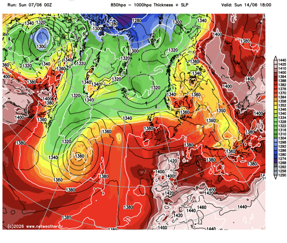
A high-pressure heat dome like the one which roasted late spring in 35C sunshine is on course to slide back
|NETWEATHER
Rather than northerly winds, currently pushing the mercury below average, giving way to balmy southerlies, high pressure will build slowly, Mr Dale added.
He said: “This is going to be the effect of our own home-grown high pressure, which is different from when we get a plume from the south.
“So, it is going to be a slow climb in temperatures through the weekend and next week.
“But from then onwards, we could be looking at returning to something warm or very warm during the start of summer.”
LATEST DEVELOPMENTS
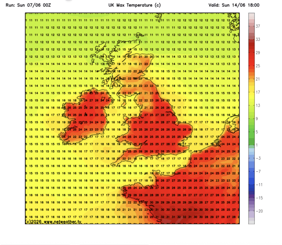
Temperatures are expected to rise on Thursday, hitting the high-20s or low-30s by next week
|NETWEATHER
Weather models from mid-month are still flip-flopping between low pressure and high pressure.
If high pressure dominates, depending on where it settles, the UK could be in for another blast of heat.
If low pressure, the driver of the cool, wet and windy weather, wins the battle, the rest of the month could end up with a soggy gloom.
Met Office meteorologist Alex Burkill said: “There are signs of higher pressure building towards the middle of the month, so things are likely to settle down after a wet start to summer.
“The trend for June is that it is more likely to be hotter than average rather than cooler than average, and while it feels a bit fresh at the moment, temperatures are about normal for the time of year.
“They are dropping down a little bit this week, but the trend is for it to warm up again as we go deeper into June, and the second half of the month is likely to be warm.”
The outlook, however, could change, Mr Burkill warned, based on global trends and a "most likely" outcome.
He added: “There is around a 40-per-cent chance of it being hotter than average into August, but near normal looks most likely.
“There are lots of things that we look at to make the three-month outlook, and the influence of teleconnections (global climate patterns with a knock-on effect on the UK weather) is less during the summer.
“So, the confidence with this outlook is a little bit less.”
Our Standards: The GB News Editorial Charter