


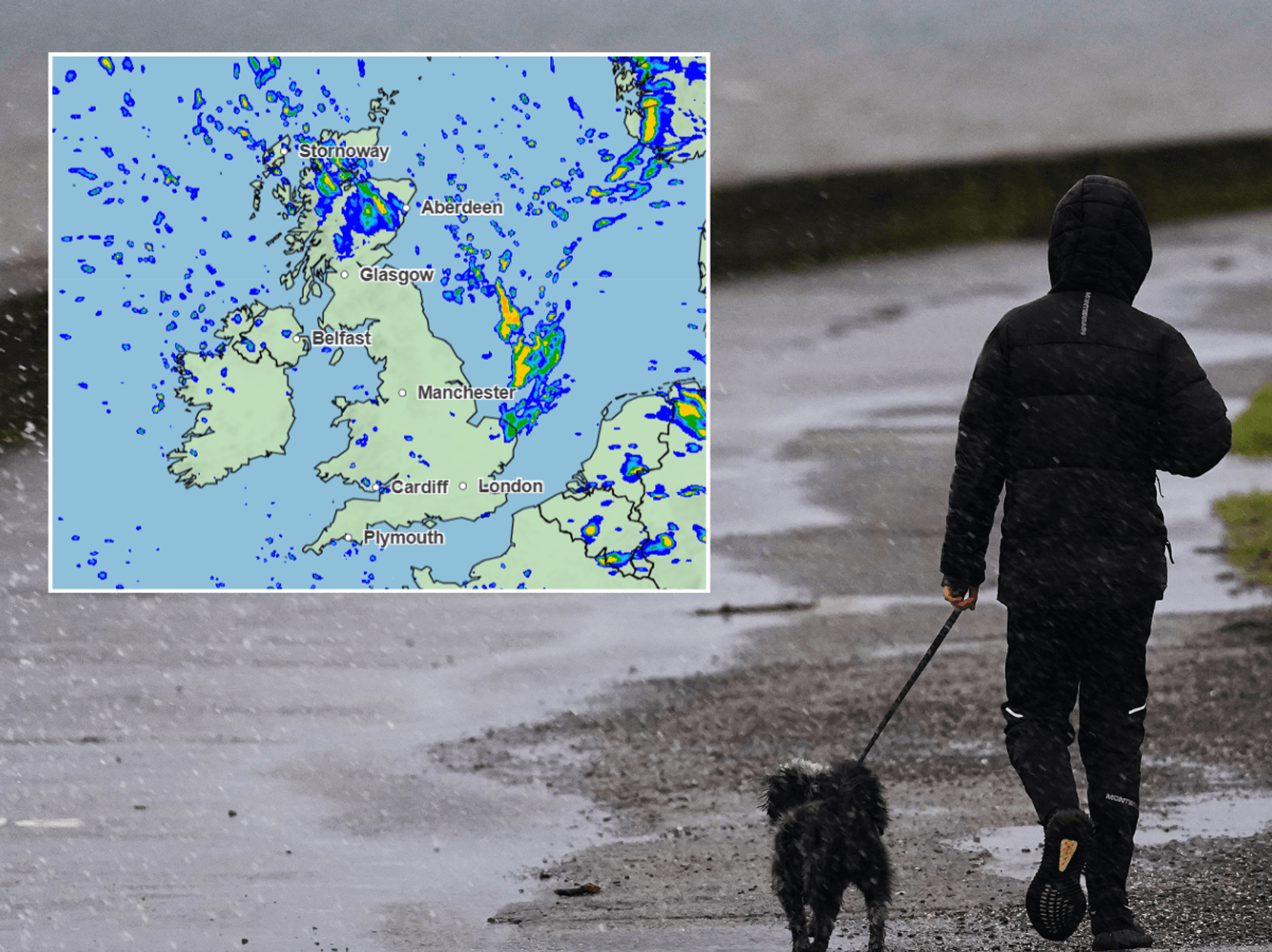
Summer will be kept on hold as battling "cyclonic" weather systems unleash heavy rain and chilly winds.
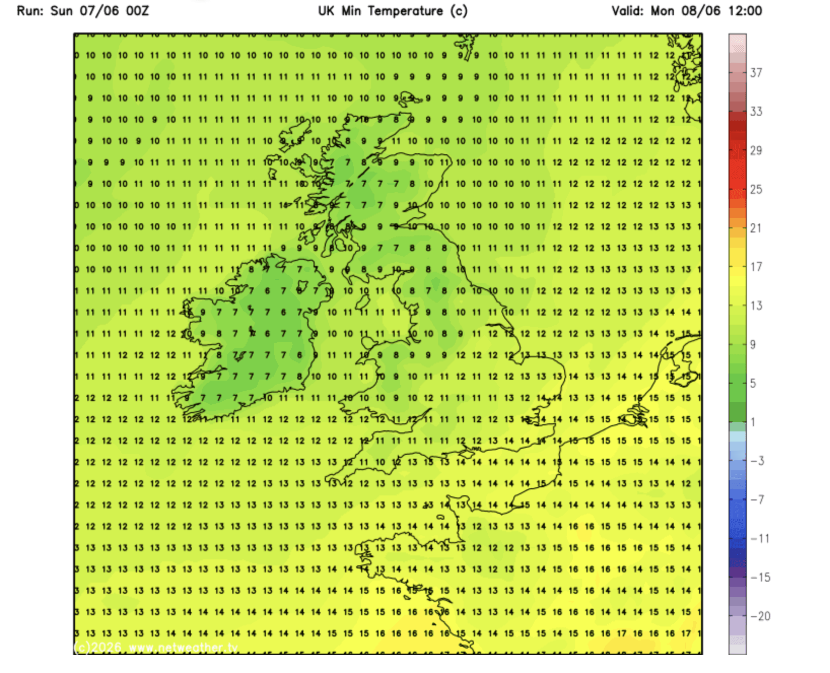
Northerly gusts through the start of this week will make it widely feel more like autumn as Scotland and northern England face single-digit temperatures.
The late-spring heatwave continues to stay a distant memory as heat-bringing high pressure retreats in favour of stormy "cyclonic" lows.
Met Office meteorologist Alex Deakin said: “Low pressure is still on the scene, and we are likely to see more wet and windy weather.
“Low pressure is coming from further north and forming in the cooler air, so it is a cooler-air feature and is likely to bring some wet and windy conditions across Scotland and Northern Ireland.
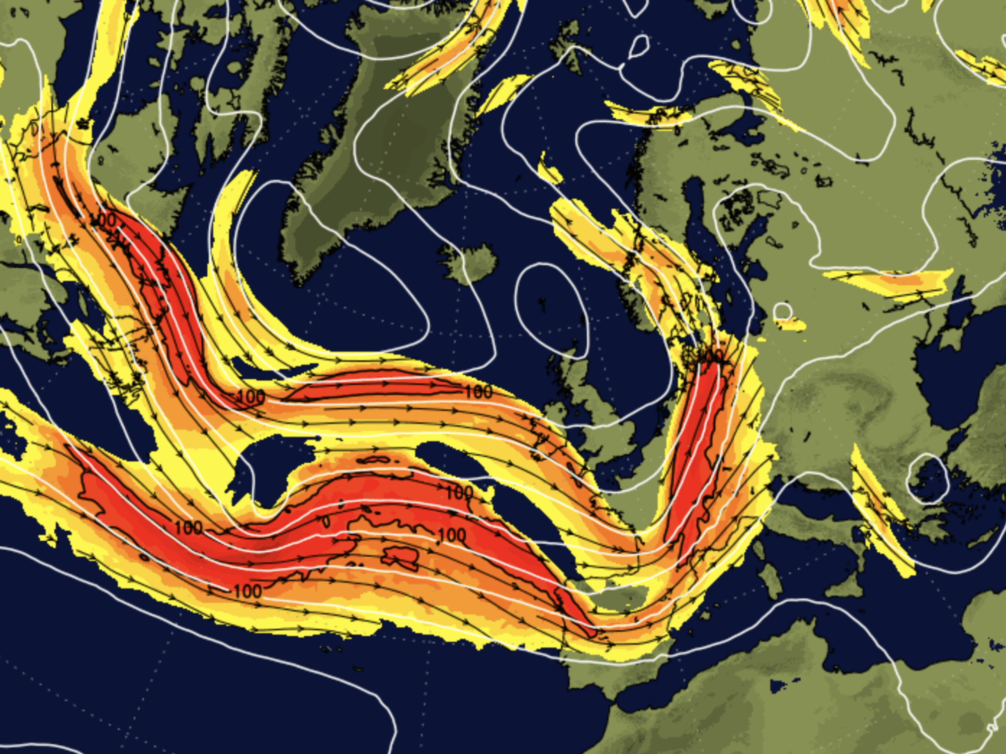
“A low-pressure system is controlling our weather into the early part of next week, and its interaction with the jet stream will determine how deep that area of low pressure is.”
Western and northern regions in the firing line of the Atlantic this week will face the worst of the rain.
Gloomy weather will hold out through much of this week before shifting weather patterns hint at a return of the warmth.
Gloomy weather will hold out through much of this week before shifting weather patterns hint at a return of the warmth
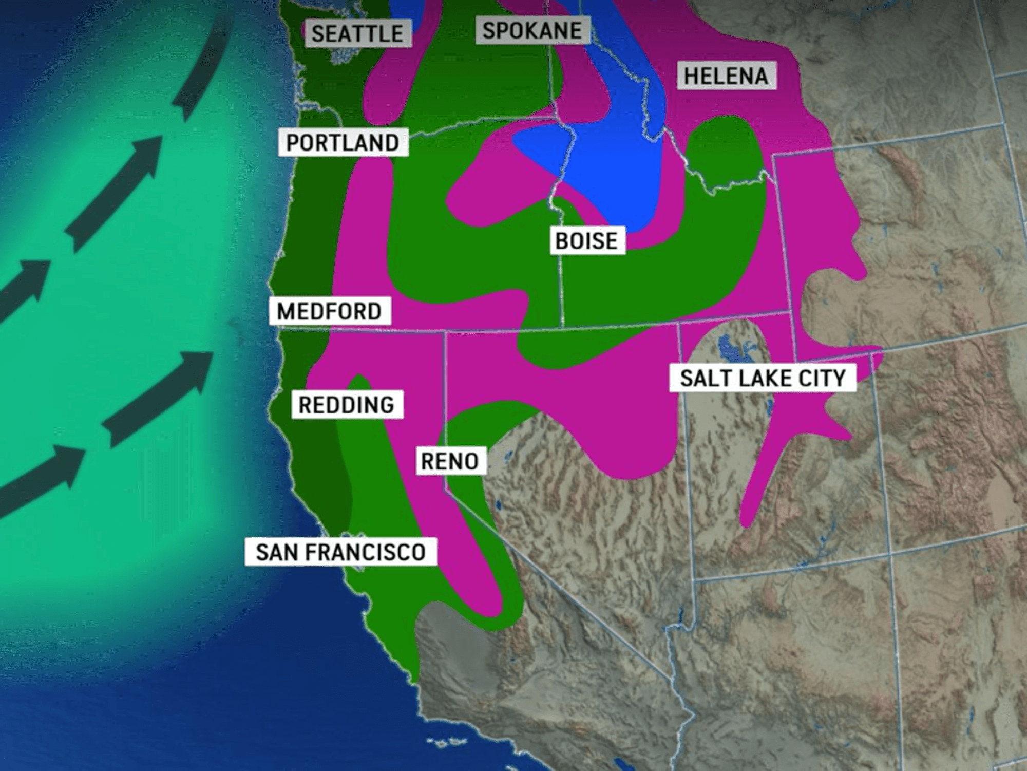
|NETWEATHER
In the meantime, the cyclonic-anticyclonic battle between low and high pressure will keep hopes of summer’s return hanging in the balance.
Mr Deakin said: “As we go towards the end of the week, high pressure might be close, but the most likely pattern is south-westerly winds and cyclonic weather patterns.
“The jet stream has dipped south, and while it is not as strong, there is the potential for interaction with another low which is likely to move across the country as we go through the middle of the week.
“At the end of the week, there are signs that higher pressure might influence things, and if that high is located to the east, it may waft up some warmer air.”
LATEST DEVELOPMENTS
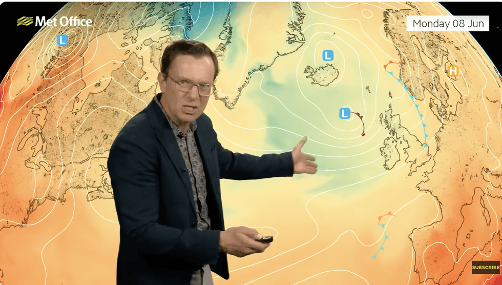
Met Office meteorologist Alex Deakin said: “Low pressure is still on the scene, and we are likely to see more wet and windy weather'
|MET OFFICE
While meteorologists agree on a gloomy start to the week, some are more optimistic about the sun’s return.
Temperatures in the 20s could be on the cards by the weekend, with the rest of the country catching up during the run-up to mid-month.
Jim Dale, meteorologist for the British Weather Services and co-author of "Surviving Extreme Weather", said: “By the end of the week, there are signs that we could see the return of high pressure, and with that, temperatures will slowly start to climb.
“We are not talking the same heat that we saw at the end of May, but something a bit more seasonal compared to the weekend.
“We are talking about temperatures back into the 20Cs across the south of the country.”
In the meantime, swathes of the country will be taking cover for rain and the risk of heavy, thundery downpours, he warned.
He said: “The next three days will bring more unsettled weather, and there will be a risk of heavy showers, some of which will be thundery.
“Temperatures will then start to rise in the south, and it may start to feel warmer by Thursday or Friday.”
Our Standards: The GB News Editorial Charter