


An Atlantic deluge dumping inches of rain in hours threatens a monsoon entry to the hottest blast of spring so far.
Western regions face a torrential onslaught dumping more than a month’s rainfall in the run-up to mid-week.
Stormy weather systems spinning of the UK coast will keep the arrival of summer at bay for another 48 hours before the tables turn.
Met Office meteorologist Craig Snell said: “It is an unsettled start to the week, but changes are in store as an area of high pressure begins to build in from the Continent.
“Tuesday will be a bit of a miserable day as a band of rain continues to move eastwards, and the rain will be replaced by frequent blustery showers into the afternoon and some of the shower could be on the heavy side.
“It will start to turn drier, and although it will be a bit of a slow process, it will turn increasingly sunny.
“That will start to lift the temperatures, and we could be in the mid-20Cs on Friday across parts of England and Wales.”
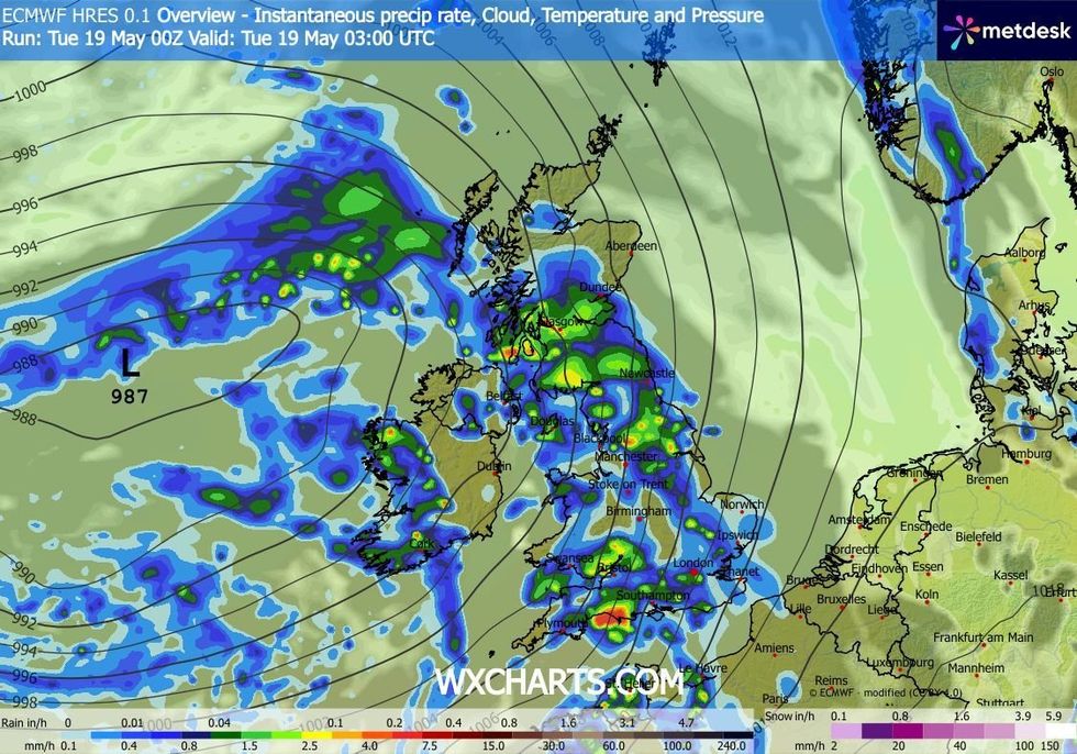
WXCHARTS is warning of a washout today
|WXCHARTS
After a chilly start to the week, northerly winds will eventually make way for tropical southerlies.
Britons desperate for summer warmth are on notice to be patient with this week to bring a slow climb in the mercury.
Temperatures will simmer from below average to above average in time for the long weekend.
LATEST DEVELOPMENTS
Met Office meteorologist Annie Shuttleworth said: “Northerly winds have been with us for quite a while, but the signs of change begin to show as Atlantic air starts to move in.
By the end of the week, there are signs of high pressure and drier weather to come.
“Temperatures are still going to be below average, but that trend is set to rise.”
Heavy showers driven by stormy weather systems will drench western regions with up to four inches of rain, she warned.
She said: “By Tuesday, the most likely pattern is for low pressure still with us with wet weather pushing in from the west.
“We could see a lot of rainfall, and the Met Office weather model shows there could be more than 100mm over the 48-hour period, so that is something to keep an eye on.
“With milder air coming in, in southeastern England, there is more warmth, and sunshine and dry weather around.”
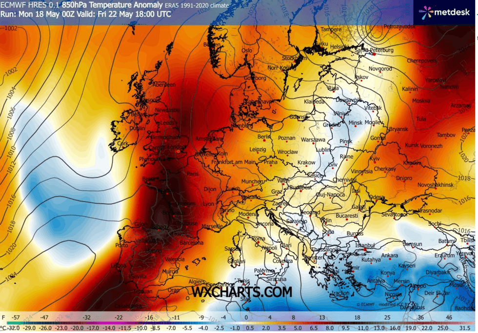
A heatwave is still expected to arrive in the coming days
|WXCHARTS
Sun-seekers in southern and eastern regions are on notice to get shades and t-shirts ready this bank holiday.
Temperatures in London, the southeast and the east could nudge the record for the end of spring.
Jim Dale, meteorologist for British Weather Services and co-author of ‘Surviving Extreme Weather’, said: “Saturday is likely to be the hottest day of the weekend, and we could see highs of 30C in some parts.
“This is going to be a sea change from the cooler conditions we have seen through the month, and we could approach the record for May.”