


A blowtorch African surge nudging temperatures towards 30C promises a near-record-smashing bank holiday scorcher.
Britons will say goodbye to the dreary spring cold as temperatures rocket through this week.
Shifting weather patterns will swap chilly northerly winds for tropical gusts from the south in time for the long weekend.
Met Office meteorologist Alex Burkill said: “For the bank holiday, high pressure is set to become more dominant across the country, so it should settle things down.
“There are signs that we will see things warming up as we go through next week, and 25C, 26C or 27C is not out of the question for the bank holiday.
“It is going to take us a little while to get there with some wetter weather through the start of next week, but temperatures are going from below average to higher, and we could be looking at the mid to high-20Cs.”
The heat will take a couple of days to get going before peaking at the weekend, possibly hitting 30C.
Although the 32.8C May record set in London in 1944 is likely to hold steady, it could be a close call.
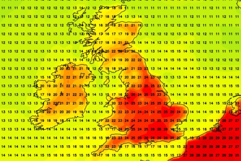
The heat will take a couple of days to get going before peaking at the weekend, possibly hitting 30C
|NETWEATHER
Jim Dale, meteorologist for British Weather Services and co-author of ‘Surviving Extreme Weather’, said: “There is a change on the way this week, and that is to something much warmer than we have seen over the past weeks.
“The hottest day of the weekend is probably going to be Saturday, and we could see temperatures touching 30C in parts of the south and the southeast.
“It is probably not going to be enough to topple the record for the month, but we are certainly going to approach it.”
In the firing line for the hot weather will be London and the Home Counties, eastern Britain and the south.
LATEST DEVELOPMENTS
Sub-tropical air coming out of Africa will be swept into Britain by high pressure building through the week.
Mr Dale said: “Temperatures are going to rise through the week as high pressure builds, and it will start to feel warm in the sunshine, although cooler under cloud cover.
“This is coming out of Africa, across Spain and France and into the UK, which means that it is going to be very warm and possibly uncomfortable at times.
“We are going to get a few days of hot weather, before it turns a bit more comfortable.”
The glorious end to spring will follow a soggy start to the week with western Britain braced for heavy downpours.
Monday morning will bring the last bite of the cold snap with parts of the country still at risk of a late frost.
Met Office meteorologist Annie Shuttleworth said: “On Monday, there is a change, and as a weather front clears to the east, we could see it linger a bit which means we could see cloud in the east and the far northwest we could see a frost.
“South-westerly winds move in, and we could see rain come in early on Monday.
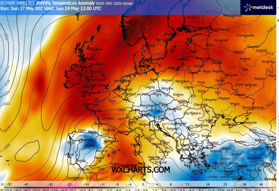
WXCHARTS's temperature anomaly graph suggests a surge in temperatures
|WXCHARTS
“With south-westerly winds, temperatures will rise much closer to average, but there will be some rain around, particularly around western areas where it is looking like a wetter than average couple of days.”
Mr Burkill added: “Things are going to change, and when we get to Monday a weather system arrives with more rain and we are dragging in air from the southwest and we are going to see temperatures rising,
“Temperatures are going to continue rising through the week, but it is not going to be particularly dry.”