


A deluge of wind, rain, thunder and hail threatens Halloween hell before Britain braces for the corpse of Hurricane Melissa.
Trick or treaters will be wrapping up tonight for hair-raising storm fronts to smash in from the Atlantic.
Torrential thunderstorms will last into the weekend before the weather is given another shake by the remains of Hurricane Melissa.
The deadly vortex, which hit the Caribbean with some of the strongest hurricane winds on record, will rinse Britain in her final death throes.
TRENDING
Stories
Videos
Your Say
Met Office meteorologist Aidan McGivern said: “It stays unsettled on Friday, with low pressure to the northwest of the UK, and that will stay there for a couple of days, swinging weather fronts and features in from the west.
“Friday could be a very unsettled day with some particularly lively showers, particularly gusty winds, and some really quite lively thunder storms.
“On Sunday the next system brings a band of rain, and the winds will start strengthening towards the west, and this band of rain may be associated with the remains of ex-Hurricane Melissa.”
By the time ex-Melissa reaches the UK, the deadly hurricane will have weakened into a standard low-pressure feature.
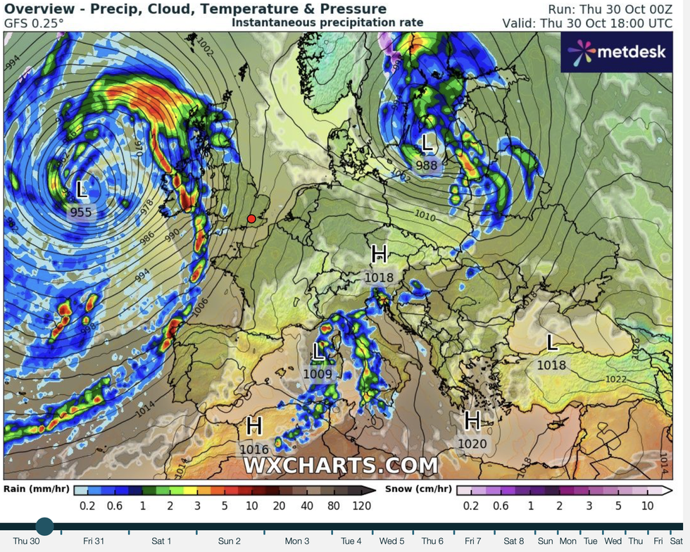
By the time ex-Melissa reaches the UK, the deadly hurricane will have weakened into a standard low-pressure feature
|WXCHARTS
Hurricanes cannot survive the cool waters of the North Atlantic, meaning they never reach the UK intact.
Their remains do, however, interact with the jet stream and our home-grown weather systems to bring unsettled conditions.
Melissa’s remains will, later this weekend, join forces with another cyclonic low in the Atlantic to tell a ‘complicated’ weather story.
McGivern said: “Melissa will end up as a typical mid-Atlantic low and most probably pass to the north of the UK as just another low-pressure system.
LATEST DEVELOPMENTS
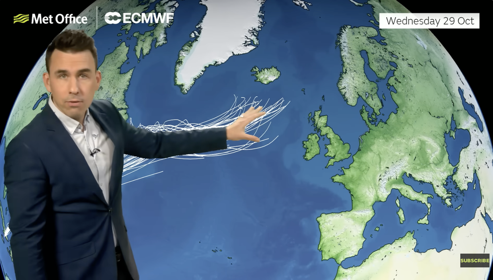
Aidan McGivern points out the possible path of ex-Melissa
|MET OFFICE
“On Friday, it is likely to be picked up by the jet stream, but there is another low coming out of north America, and the interaction between these two lows, Melissa and the new low, and the interaction of the jet stream make for a very complicated forecast.”
While the next couple of days look wet and windy, gusts from the south will bring balmy temperatures.
Highs will touch the upper teens in the south, while the rest of the country hovers between 14C and 15C.
Clear overnight skies, however, will bring a morning chill to parts and the risk of isolated frosts.
But it is a queue of Atlantic storms that will have the biggest impact on the weather into the last month of autumn.
Jim Dale, meteorologist for British Weather Services and co-author of ‘Surviving Extreme Weather’, said: “It is going to stay unsettled into the weekend as a line of lows bring weather fronts in from the Atlantic.
“This means the risk of strong winds and heavy rain, with western regions most likely to see the worst of the weather.
“It is turning increasingly unsettled through the end of the week and into the start of November.”
The miserable outlook could be a sign of things to come, he warned, after the unusually quiet October.
He said: “It would be expected that after such a long period where the weather has been dominated by high pressure, that when the change eventually comes, there will be a swing to something more unsettled.
“This is what is happening now, and in a balancing effect, we could be in for a longer period of unsettled weather through the end of autumn and into winter.”