


An amber health alert has been issued across England as "intense heat" threatens to plunge Britain into a fresh heatwave.
The UK Health Security Agency (UKHSA) has put out two alerts - amber and yellow - which start from 12pm today and end at 9am on Monday, July 14.
Regions including the East and West Midlands, South East, South West, East of England and London are affected by the amber alert.
These areas are under a "medium" risk of seeing significant impacts across health and social care services due to high temperatures, according to the UKHSA.
This includes a possible rise in deaths, particularly among people aged 65 and over or with health conditions.
There could also be travel delays and issues managing medicines.
The yellow heat health alert meanwhile affects the North East, North West and Yorkshire and the Humber.
There is a "low" risk of these parts of the country seeing significant impacts to health and social care services, the UKHSA said.
It comes as weather experts are expecting to see a battle between colliding weather systems which will end Britain’s latest heatwave in an eruption of spectacular thunderstorms.
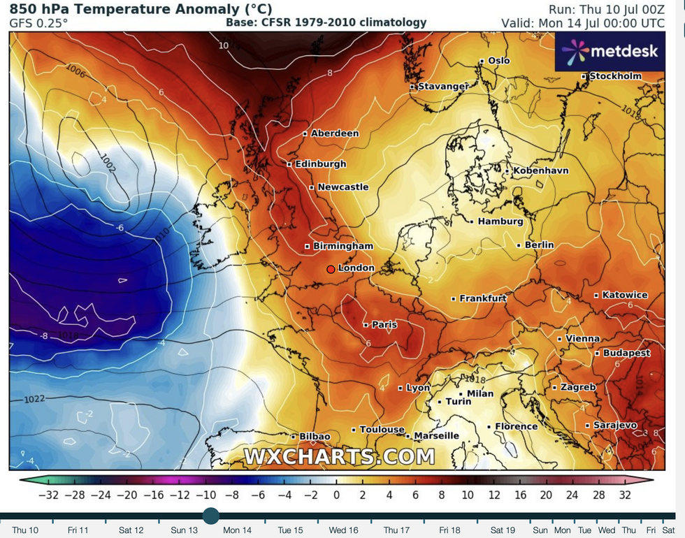
A battle between colliding weather systems is expected to end Britain's latest heatwave
|WXCHARTS
A ‘messy breakdown’ after the weekend will trigger torrential downpours and lightning strikes.
But after a brief respite from 30C-plus temperatures, the mercury is set to rocket through the rest of a roasting July.
High pressure driving weekend heat will lock horns with cyclonic lows from Monday for a volatile fireworks display.
Met Office meteorologist Honor Criswick said: “As we head further towards the middle and end of June, there is a battleground between high pressure and low pressure, and it is likely that we will see a classic split in the weather.
LATEST DEVELOPMENTS:
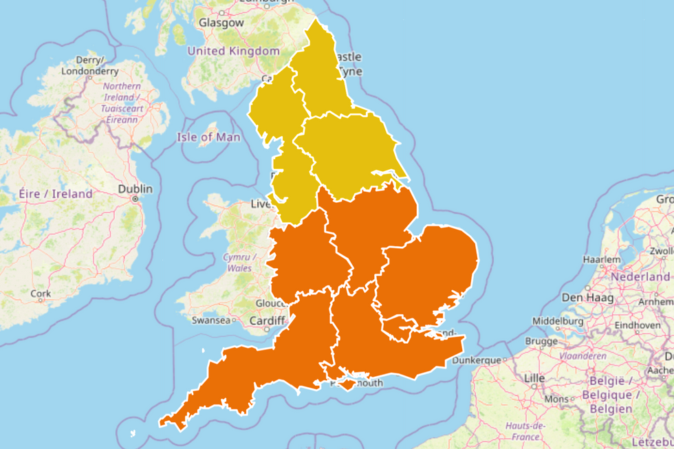
A map by the UKHSA shows where the heat health alerts have been put in place
|UKHSA
“Next week we are going to see a bit of a change, but it is a messy change, still with some uncertainty, but it is likely to turn a bit cooler, with some rain, particularly in the west and possibly even a thundery breakdown into next week.
“It looks like there will only be a slight blip before those temperatures start to increase again, so even if things do turn a little bit cooler and fresher, there is a good chance things will start to warm up again.”
“Intense heat” will build through the next 48 hours with widespread highs expected of 30Cs.
Western regions are in the firing line for the highest temperatures, with warm weather in parts expected into next week, Criswick warned.
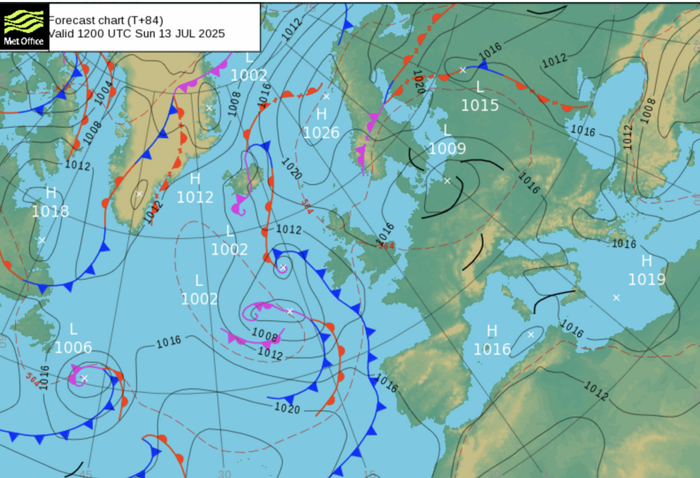
Chart showing the surface pressure pattern. High pressure (H) is usually associated with settled weather while low pressure (L) with unsettled, according to the Met Office
|Met Office
She said: “As we head into Friday, that intense heat will become more widespread, and on Saturday, the chance of 30C becomes more widespread.
“Further into the weekend, we can really see that intense heat becoming widespread across the country.
“Many areas are going to see temperatures above average as we go into next week, and there is still a chance that some localised areas could see 30C.”
Tussling pressure systems will spark ‘big thunderstorms’ and flash floods from torrential downpours.
Meteorologists are closely watching a weather front moving through after the weekend when the skies threaten to go bang.
Jim Dale, meteorologist for British Weather Services and co-author of ‘Surviving Extreme Weather’, said: “There is going to be a threat of thunderstorms when the next round of heat breaks down, and there could be some big ones after the weekend.
“This will depend on how quickly a weather front comes through, so this is something we are going to be keeping eyes on.
“With thunder and lightning is the threat of heavy rain, and because the ground is dry and hard, this will run off bringing the risk of flooding to parts.”
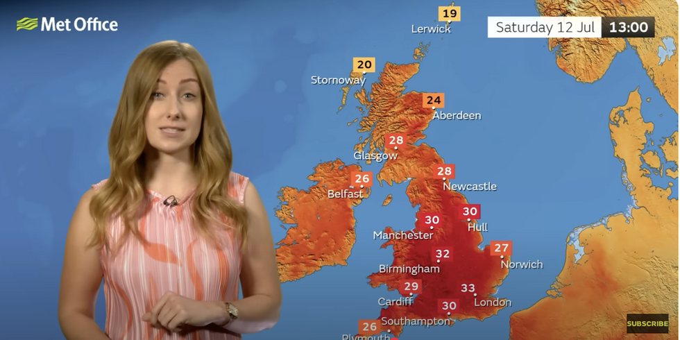
The forecast shows high temperatures are still on the cards across the country this weekend
|Met Office
A stalled cold front hovering close to the UK is likely to trigger a brief drop in temperatures after the weekend.
It will be held at bay by a high-pressure heat dome under which temperatures will skyrocket.
Tyler Roys, international meteorologist for AccuWeather, said: “A cold front that was forecast to come into Scotland later this week is being delayed by high pressure over southern England.
“This will lead to maximum temperatures through the next three days in the mid-30Cs.
“This front will bring cooler conditions when it moves through.”
Following warm and dry conditions this Spring, hosepipe bans have been introduced by water companies in some part of the country.
This includes Yorkshire Water and South East Water, who have introduced restrictions from today.
The ban means residents in these areas can't use hosepipes to water their gardens, wash cars, or fill swimming and paddling pools.