


Britain looks set for a much warmer end to August as a plume of scorching heat approaches.
After an extended period of overcast conditions and drizzle, England is set to be rewarded with some late summer sun.
This is predicted to arrive as a plume of warm weather sweeps up from North Africa, Spain and France, towards the UK.
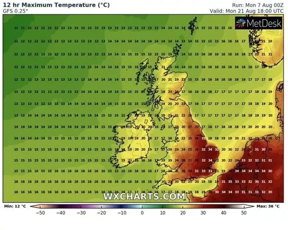
According to new weather maps, pockets of fair weather will break out over the UK on Wednesday 16 August, with highs of 26C expected in some southern areas.
From these glimmers of heat, momentum gathers into the weekend when 28C are expected across the south of England, with London, Kent, Sussex and Hampshire experiencing 30C heat.
A meteorologist has pinpointed the exact dates Britain is expected to bake.
Jim Dale, senior meteorologist for British Weather Services, told the Express that a late summer heatwave is entirely plausible because the globe now exists in a "new abnormal".
He said: "We’re in the world of the ‘new abnormal’ now and we are still in August so anything is possible. The charts are indeed onside.
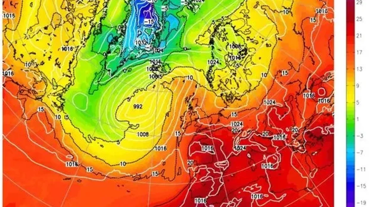
A tale of two climates, the south is set for vastly hotter weather.
|WXCHARTS
"There are long ways to go to August 20, but hot plumes coming over from North Africa, Spain and France are more likely than not now given what July delivered. Pencil it in as a distinct possibility."
Early forecasts indicate the temperature will drop off by August 22 by around 5 degrees.
The Met Office's long-range forecast hints towards a warmer period, but it does not categorically predict such highs.
Delivering predictions for the period between August 11 and August 20, the Met Office said: "High pressure will sit to the east of the UK bringing dry and fine conditions to the southeast and allow low pressure systems bringing cloud and rain into the northwest.
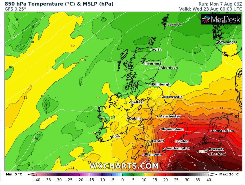
Temperatures in the south east are set to soar.
|WXCHARTS
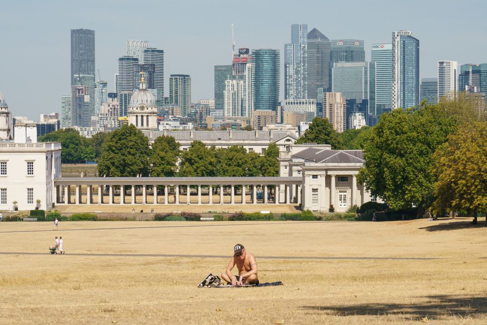
A man sunbathes in a nearly empty Greenwich Park, London, as a drought has been declared for parts of England following the driest summer for 50 years, taken on August 14, 2022.
|PA
"Some low cloud and coastal mist are also possible in the south at times. Winds are likely to be light for most, though stronger in the north. Temperatures will near to or slightly above average."
But from August 21 to September 4, the concept of the heat continuing into the steady decline of autumn, is mixed. It adds: "A changeable pattern is most probable through the latter part of August and into early September.
"This is likely to bring a mixture of some dry, settled weather but also some spells of wetter, more unsettled conditions.
"There is a risk of some heavy rain or thunderstorms at times. Temperatures are expected to be close to average for the time of the year, but some warmer spells are also possible."