


A foggy gloom will slam the brakes on the spring sunshine before temperatures rocket.
Thermometers will nosedive today in a sweeping cold front with even the risk of snow on the Scottish hilltops.
A warmer weekend awaits, but those hoping for sun may be disappointed as a shroud of misty fog descends.
Met Office meteorologist Alex Deakin said: “Cooler air will become more widespread by the time we get to Friday, and temperatures will be significantly below average, but we are still hanging on to some milder air towards the southeast.
TRENDING
Stories
Videos
Your Say
“The weekend is dominated by high pressure, generating a lot of dry weather, and there will be some sunshine, but there is also going to be a lot of mist and low cloud.
“On Sunday, there is an increasing chance of seeing mist and low cloud, and it could be quite cloudy in some places over the weekend, and it could take a while to clear.”
The up-and-down start to spring is due in part to shifting weather patterns steered by a swerving jet stream.
The jet has been the driver of heavy winter rain that has left swathes of the West Country knee-deep in floodwater.
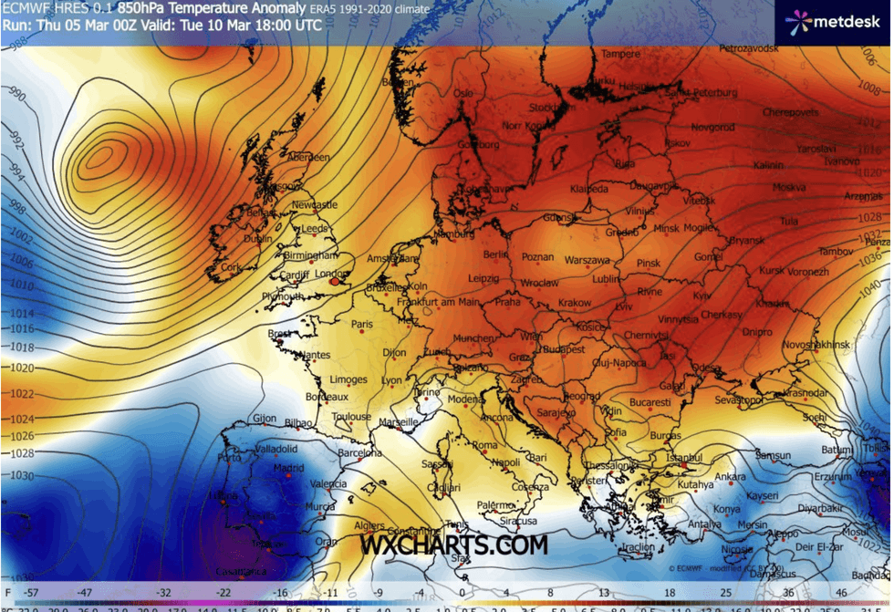
Warmer weekend awaits the UK
|WXCHARTS
Guided by the jet, low- and high-pressure systems will realign this weekend to steer southerly winds as the mercury resumes its upward climb.
Mr Deakin said: “The jet is now in a more traditional position taking low-pressure systems up towards Iceland, and we have high pressure blocking things but unlike earlier this year where it has been over Scandinavia, it is a little bit further south.
“Weather patterns look fairly in agreement next week, with high pressure sitting to the south and east, and low pressure to the north and the west.
“For the start of next week, the flow from the southwest suggest that temperatures will be above average for the time of year.”
LATEST DEVELOPMENTS
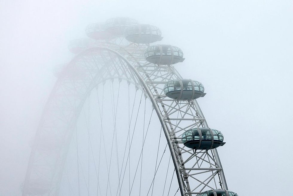
A shroud of misty fog descends
|GETTY
Parts of the country could today be doused in showers of "blood rain", leaving cars and windows smeared in an auburn grime.
A plume of winds from the south will sweep a cloud of Saharan dust into the UK, tinting the skies in a crimson glow.
A Met Office spokesman said: “This week, Saharan dust is once again being transported northwards across parts of Europe and towards the UK.
“Current assessments suggest that concentrations will pass close to or just south of the UK, but a brush of dust‑influenced air is likely, particularly affecting southern parts of the country.”
Long-range experts agree the outlook into mid-spring should bring a cheer to the hearts of rain-sodden Britons.
A pattern of high pressure bringing sunshine and rising temperatures is the general consensus.
Jim Dale, meteorologist for British Weather Services and co-author of ‘Surviving Extreme Weather’, said: “Going into April, it looks like we will see temperatures rise further, with all three months of spring likely to be warmer than average.
“High pressure is starting to become more dominant after the lows during winter brought rain and flooding to western parts of the country.”
Our Standards: The GB News Editorial Charter