


Britain will simmer under a blood-red glow as tropical winds sweep in a cloud of dust from Africa.
Rocketing temperatures this week will be boosted by a sultry glare in the sky as westerly gusts give way to a flow from the Sahara.
Britons are most likely to notice the eerie shimmer during the mornings and evenings through the end of the week.
And it will feel much warmer and drier compared to the past few months as the first week of spring delivers 20C sunshine.
TRENDING
Stories
Videos
Your Say
Met Office meteorologist Alex Burkill said: “ We are going to get a southerly flow as we go into Wednesday, and that is going to drag in some Saharan dust, and so the sky may have a bit of an orangey tint to it, particularly at sunrise and sunset, as we go through from the middle of the week onwards.
“High pressure to the southwest is going to build and push its way across the UK, and that is going to help push our weather to the quiet side.
“It is starting to feel pretty mild indeed, especially where we get the sunshine.”
A major shift in the weather will be driven by a cyclonic-anticyclonic U-turn, switching off the rain-laden Atlantic taps.
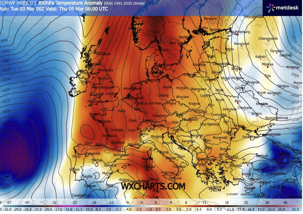
Britain will simmer under a blood-red glow
|WXCHARTS
Anticyclonic high pressure, the deliverer of fine weather during spring and summer, will sweep in from the south, ending the cyclonic deluge.
The almost summer-like weather set up will hold out through the rest of the week and into the weekend.
Mr Burkill said: “The weather is going to feel pretty spring-like, because there is going to be lots of dry, lots of sunny and relatively warm weather around for most of us.
“Across much of England and Wales, Wednesday is going to be a largely fine dry, and with that southerly wind, it is going to be bringing in some warmer air.
LATEST DEVELOPMENTS
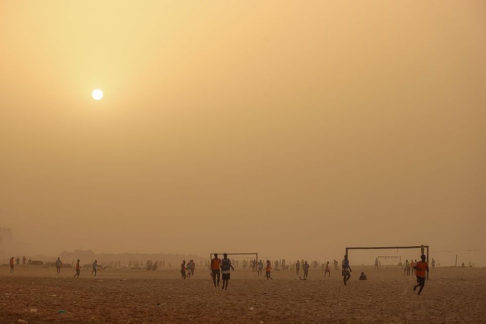
Tropical winds will sweep in a cloud of dust from the Sahara
|GETTY
“Temperatures are going to be even higher than Tuesday, with highs around 15C or 16C, or even a little bit milder than that.”
While much of the country will enjoy a sunny and mild first week of spring, Scotland and the northwest will catch the last dregs of the winter deluge, he warned.
He said: “Rain will feed its way across much of Scotland, and it is only just going to push into some western parts of England and perhaps Wales.
“Towards the east on Thursday, there is lots of sunshine still and it is going to be even warmer, and temperatures are likely to peak around 17C, 18C, 19C, or possibly a little bit warmer than that.
“It is going to feel pretty warm in the sunshine.”
This week could bring some of the warmest temperatures of the year so far, with a slim chance of seeing 21C.
Warm southerly winds and breaks in the cloud would put southern regions in the best spot to catch the summery burst.
Jim Dale, meteorologist for the British Weather Services and co-author of Surviving Extreme Weather, said: “It is not out of the question that we would see 21C in parts of the country before the end of the week.
“We would need the sunshine with the warmer air, and this could happen in parts of the south or the southeast.
“I would not be surprised to see this week bring the warmest temperature of the year so far.”
Met Office winter data show the season has been one of the wettest on record in parts of the UK.
Southern Britain has seen almost 60 per cent more rain than usual, while northern England has seen 17 per cent more.
Met Office science manager Dr Amy Doherty said: “Some southern and central areas of the UK experienced persistent rainfall, leading to saturated ground and several areas recording one of their wettest winters on record.
“In contrast, parts of northern and western Scotland were markedly drier, which is notable given these areas are typically among the wettest in the UK.”
Our Standards: The GB News Editorial Charter