


A first mini-bite of winter will send temperatures plummeting below freezing in an early Polar plunge.
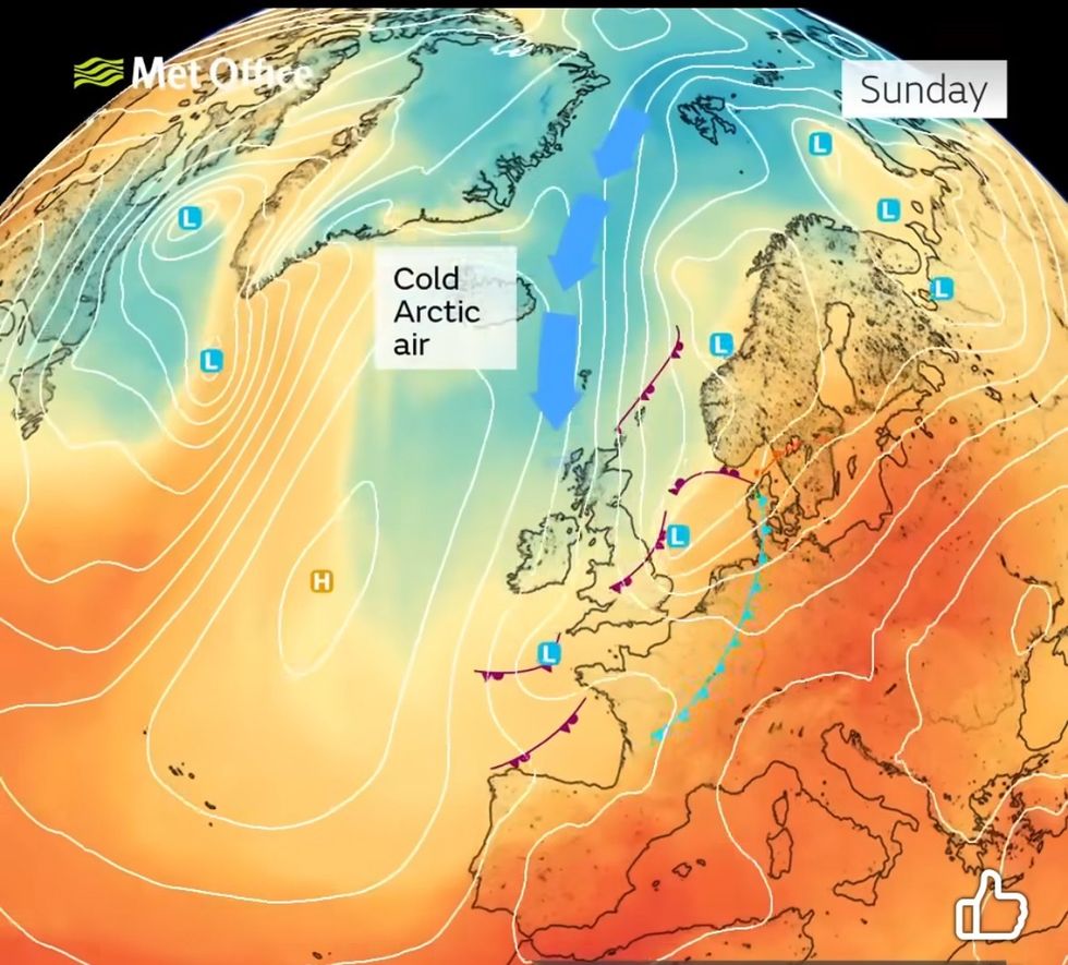
Bitter winds from the Arctic will descend over the country this week, steered by a high-pressure anticyclone over Scandinavia.
Temperatures across Scotland and northern Britain will dip below zero triggering hard frosts, fog and a dusting of snow.
The cold snap will follow a soggy start to the week before the rainy Atlantic gives way to the bitter north.
TRENDING
Stories
Videos
Your Say
Met Office meteorologist Aidan McGivern said: “It is going to be showery early in the week, and then it is turning drier and probably rather cool compared to what we have seen recently.
“There will be several days where high pressure slowly crosses the country, and by the middle of the week we will be talking about chilly nights and some fog patches developing rather than heavy rain.”
The dramatic change in weather will be driven by a major shift in the jet stream as it bends and swerves building ‘troughs’ and ‘ridges’.
As a ridge crosses the country, drier colder weather will dominate, before a passing trough unleashes the rain.
LATEST DEVELOPMENTS:
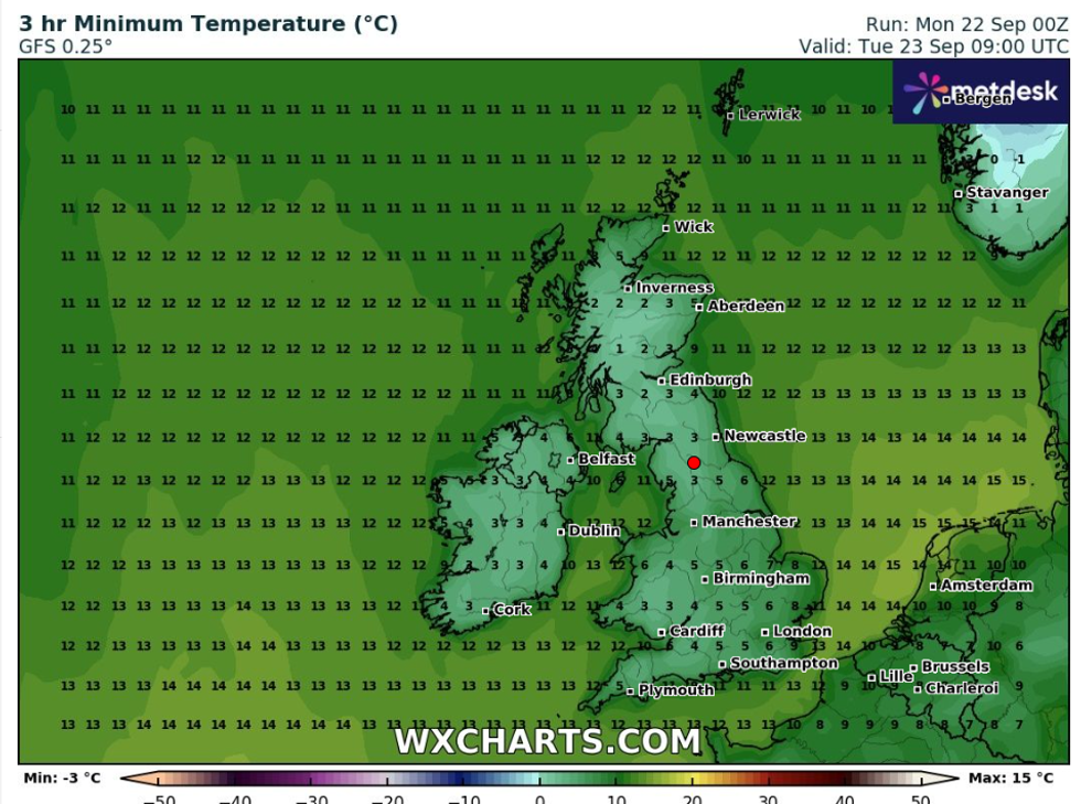
Temperatures will plunge in just days
|WXCHARTS
As the jet stream curls and unfolds over Britain, temperatures will fluctuate with the cold by the second half of the week to ease into rising temperatures.
McGivern said: “On Tuesday, we have a big upper ridge, which takes three or four days to cross the UK, leading to two or three days of drier weather.
“We are going to see a spell of drier weather as high pressure arrives, but before that, there will be three or four days of wet weather.
“Cold air is coming in on Tuesday, and on Wednesday temperatures are rising.”
As the jet stream curls and unfolds over Britain, temperatures will fluctuate with the cold by the second half of the week to ease into rising temperatures
|MET OFFICE
Huge shifts in ‘diurnal’ temperatures – the rapid change from daytime warmth to freezing nights – will plumet the mercury by almost 20C in parts.
Daytime highs in the sunshine could hit 16C this week before nosediving to minus 2C overnight.
Jim Dale, meteorologist for British Weather Services and co-author of ‘Surviving Extreme Weather’, said: “We are looking at a strong diurnal pattern at this time of year with temperatures during the day hitting 17C in parts before dropping to between -1C or -2C in the glens and highlands.
“Through coming days, there may be some warmer days, although it is a cold start start to the week.
“We have a cold air coming down from the Arctic, and although we are not looking at a major cold spell, this is the first proper cold snap of the autumn, with ground and air frosts in exposed regions.”
Cold weather will also be steered by a high-pressure anticyclone building over Scandinavia.
Clear skies and falling temperatures will bring the risk of early morning mist and fog, experts warn.
Met Office meteorologist Alex Deakin said: “During the middle of the week, high pressure is going to dominate, and that is an anticyclone sitting to the north west of the UK.
“Through Wednesday and Thursday, the most likely scenario is for high pressure to be over the north sea, a true Scandinavian High, and it will be much drier and bringing something a little bit cooler in.
“It also means there is a good chance of seeing some lengthy spells of sunshine, but an increased chance of seeing mist and fog.”