


A double-tailed cold front about to scour Britain will usher Polar winds and plummeting temperatures for the start of summer.
Foul weather is set to dig in through the end of May as the long, dry spring gives way to rain, gales and gloomy skies.
Long-absent low pressure from the Atlantic will drag a pair of chilly cold fronts which threaten to send the mercury into freefall.
Rather than steaming in from the tropical south, winds through the end of the month will arrive from the Polar region, experts warn.
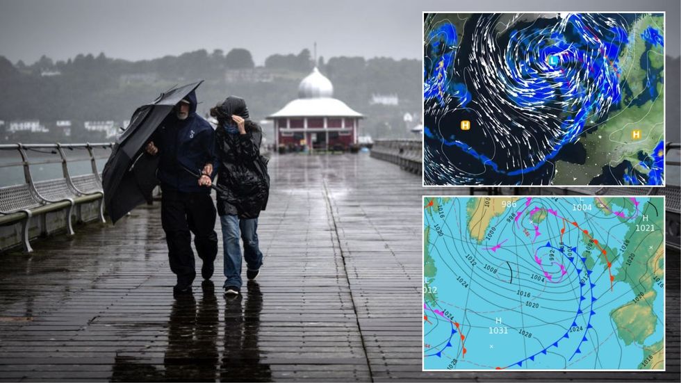
A double-tailed cold front about to scour Britain will usher Polar winds and plummeting temperatures for the start of summer
|Getty/ Met Office
Jim Dale, meteorologist for British Weather Services, said: “It is going to turn cooler towards the end of spring with temperatures falling from the 20Cs into the mid- to high teens.
“This will be a noticeable change, especially in the rain where it is going to feel cooler, and even out of the rain, people are going to feel the difference.
“The fall in temperatures will be the result of modified Polar air coming through, so it will be back to the coats, and time to put away the t-shirts.”
A stubborn "blocking high" pressure pattern responsible for the dry spring will this week finally give out.
Rain-bearing low pressure from the west will bring unsettled conditions through the rest of the month.
LATEST DEVELOPMENTS:
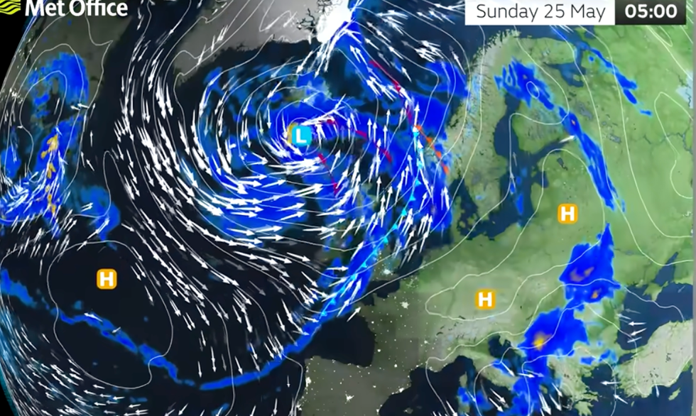
Rain-bearing low pressure from the west will bring unsettled conditions through the rest of the month
|Met Office
Heavy downpours threaten floods from water run-off in parts of the country where the ground has dried out.
Dale said: “Heavier rain is likely by the weekend, and this will cause some problems with flooding where the ground has dried over the past couple of months.
“Here, rain will run off rather than soak in, and that is where you see issues developing.
“The heaviest showers will be to the west of the country where more than an inch could fall.”
It spells bad news for those hoping to head out for the Bank Holiday and start of half term next week.
While not a "complete washout", Monday is looking cool and wet with heavy downpours in parts, according to the Met Office.
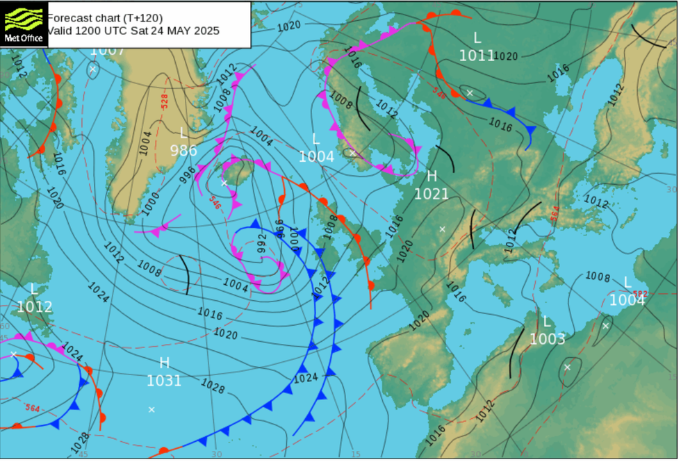
Heavy downpours threaten floods from water run-off in parts of the country where the ground has dried out
|Met Office
Meteorologist Alex Burkill said: “Low pressure eventually does start to head to the UK, and towards the end of the week, we are going to see that low pressure pretty close to the UK.
“On Saturday and overnight into Sunday, most places will see some wet and some blustery weather pushing its way in, with eastern and southeastern parts seeing that rain arrive a little bit later, and the south and west will see heavier rain and some stronger, blustery winds.
“We don’t have any warnings out at the moment, and while the weather doesn’t look especially severe, there could be tends up, there could be gazebos and other temporary outdoor structures and travel because of the Bank Holiday weekend.”
Jason Nicholls, lead international forecaster for AccuWeather, said: “There is a front coming through, and this will spread rain which could be thundery towards the end of the week and this pattern will continue over the weekend.
“There will be a continued risk of isolated thunder.”