


A bolting 200mph jet stream that is about to trigger a major ‘shift in the weather’ will plough Britain with a barrage of tropical wind and rain.
The UK will be bulldozed by the remains of two tropical cyclones, kicking off October with an eruption of storms.
The calm run up to the weekend with temperatures hitting 21C will give way to torrential downpours and gales.
Winds will stir after mid-week as weathermen closely eye the Atlantic for the arrival of ex-Hurricane Humberto and Tropical Storm Imelda.
TRENDING
Stories
Videos
Your Say
Met Office meteorologist Alex Deakin said: “We are going to see a big shift in the weather as we go through this week as things turn wetter and potentially very windy.
“On Thursday, in the hazy sunshine we could get up into the high 20Cs, 21C which is 70F.
"But the winds will be picking up everywhere, and it will not just be windy because the rain is starting to build up.
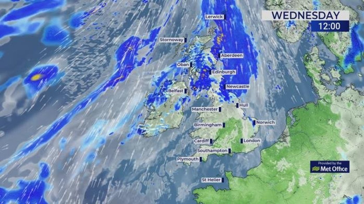
“In the northwest of Scotland, the rainfall totals are really building up, and we could see up to 250mm of rain in some locations, and that could cause some flooding issues.”
LATEST DEVELOPMENTS:
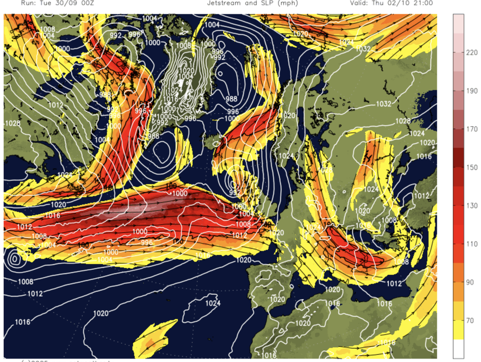
A 200mph jet stream is expected to hit Britain
|NETWEATHER
The stormy onset will be driven by the jet stream as it fires into action and heads towards Britain.
As it shifts south, it will yank areas of low pressure, spinning them up and hurling them towards the UK.
Deakin said: “On Saturday there is a dramatic change, and the jet stream has shifted right in across the UK.
“In the tropics, there are two tropical cyclones, Hurricane Humberto and another weather system potentially becoming a hurricane as it moves northwards.
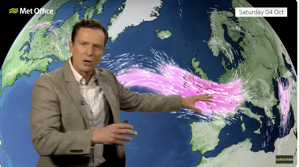
Alex Deakin warns the jet stream will speed up
|MET OFFICE
“They are going to interact with each other, and that is always a flag for meteorologists.
“They move north, and Humberto will undergo extra tropical transition and potentially develop into an area of low pressure, and it is this low that gets picked up by the jet stream and tracks towards the UK.
“It will bring with it some potentially wet and windy conditions.”
Britain’s calm start to autumn has been the result of high pressure building clear cloudless skies over the country.
As the jet stream changes direction, low pressure will jolt the high, opening the doors to storms.
While no storm names have been issued for the weekend, as the weather starts to stir, Amy could be waiting in the wings.
Jim Dale, meteorologist for British Weather Services and co-author of ‘Surviving Extreme Weather’, said: “This is going to be one that we will watch as the Atlantic starts to wake up.
“We are overdue the first storm of autumn, and as the weather turns more unsettled, we could see the first during October.
“The rest of the week will see high pressure bring more settled weather, but there is a potential change at the weekend.”