


Britain will become a nation divided by flooding and drought with half of the country facing torrential downpours while the other half continues to parch.
Almost a month’s rain will drench Scotland this week while cloudless skies push temperatures in the south to 20C.
The heaviest downpours will set in mid-week as the jet stream stretches to steer low-pressure in from the Atlantic.
The cyclonic deluge will arrive powered by strong winds as stormy weather targets the north.
TRENDING
Stories
Videos
Your Say
Met Office meteorologist Tom Morgan said: “As we go through the middle part of the week, the jet stream will straighten out and that will help to develop areas of low pressure.
“There is quite an unsettled flavour to the weather across the north of the UK, with outbreaks of rain at times, and it will be rather windy across many parts of Scotland and Northern Ireland, and there will be a lot of rain to come.
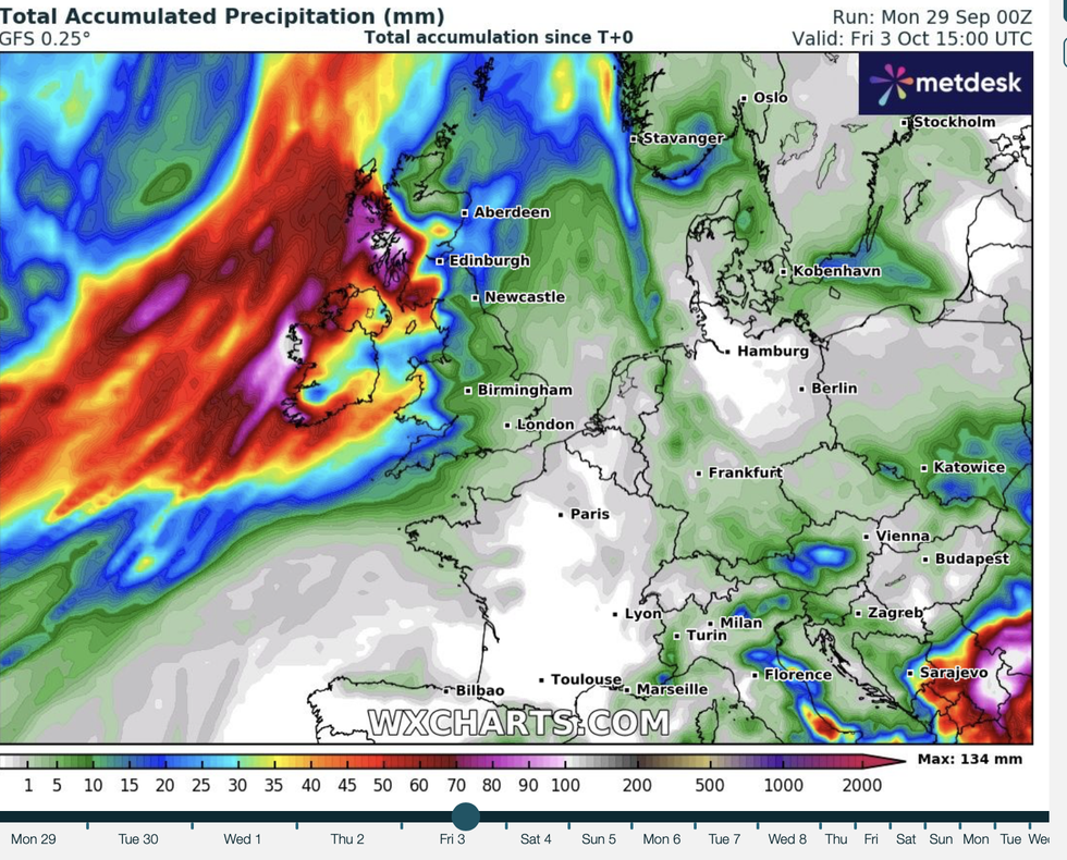
“Potentially the wettest spots of western Scotland could see well over 100mm of rain by the end of Thursday, but for the rest of England and Wales, there is very little in the way of rain during the week ahead.”
It will follow another calm start to the week as high pressure wedges firm, driving clear skies.
LATEST DEVELOPMENTS: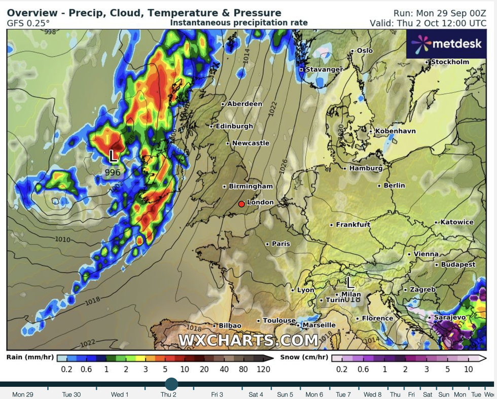
A band of heavy rain will smash into the west coast of Britain
|WX CHARTS
After a chilly start, temperatures will nudge the high teens in Scotland while the south hits 20C.
Morgan said: “Generally the rain will be light and intermittent, and Tuesday will be a warm day with highs up to 20C in the southeast of England, parts of northeast Scotland will see temperatures in the high teens.
“I wouldn’t be surprised to see a few isolated mist and fog patches as we get to Tuesday morning, with temperatures in the countryside falling into single figures with the odd patch of frost around.”
As thermometers head upwards, bookies have taken the axe to the odds on an October scorcher.
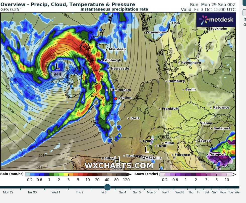
WX Charts map shows intense low pressure bringing huge bands of rain to the north
|WX CHARTS
Coral’s John Hill said: “With temperatures of 20C forecast for next week and sunshine set to remain in the early stages of autumn, we have cut the odds on next month being the hottest October on record in the UK.”
Intense rainfall over northern regions through mid-week could spark localised flooding and disruption.
Up to four inches in a few hours will drench parts of Scotland while southern Britain sees little to no rainfall.
Months of dry weather in the region has prompted experts to warn of the risk of a winter drought.
Up to four inches of rain will fall in just a few hours over Scotland
|WX CHARTS
Jim Dale, meteorologist for British Weather Services and co-author of ‘Surviving Extreme Weather’, said: “In parts of the country, we have now seen unusually dry weather since spring, and this is going to continue through the next fortnight.
“Southern Britain has had well below average rainfall through the past few months, and this is going to leave reservoirs and water tables lower than they would ordinarily be at this time of year.
“This is going to bring the risk of a winter drought, and with no change on the horizon, this could have implications going into next year.”