


Britain’s freakish mini spring heatwave could be one of many over the coming weeks amid forecasts for an unusually warm run up to summer.
Latest government long-range outlooks predict an almost double normal chance of higher-than-average temperatures, and even heatwaves, into June.
As the near-record April warm spell gives way to rain, gales and below-average temperatures, the next tropical blast may not be far off.
The Met Office’s three-month outlook states warmer weather is around 1.8 times more likely thanks to global weather drivers, including changes in stratospheric winds, rainfall patterns in the tropics, and the end of a La-Nina cooling of the eastern Pacific.
TRENDING
Stories
Videos
Your Say
A spokesman said: “There is an increased chance of warm conditions and some indications of a greater-than-normal chance of heatwaves in early summer.
“The risk of impacts from rainfall are similar to normal, however, there is a higher-than-normal chance of April being a drier month.”
But sun-loving Britons may have to hold out for the next warm spell, with the rest of April looking cooler.
The Met Office outlook states: “There is an increased likelihood of northerly and easterly winds in April, which increases the chance of some colder spells.
More surprisingly good weather is on the way for Britons
|PA
“While the likelihood of wintry hazards is small and mainly restricted to the north, the risk of impacts from late-season frosts is more widespread.
“Later in the period, an increased chance of warm conditions implies a greater-than-normal chance of heatwaves in early summer.”
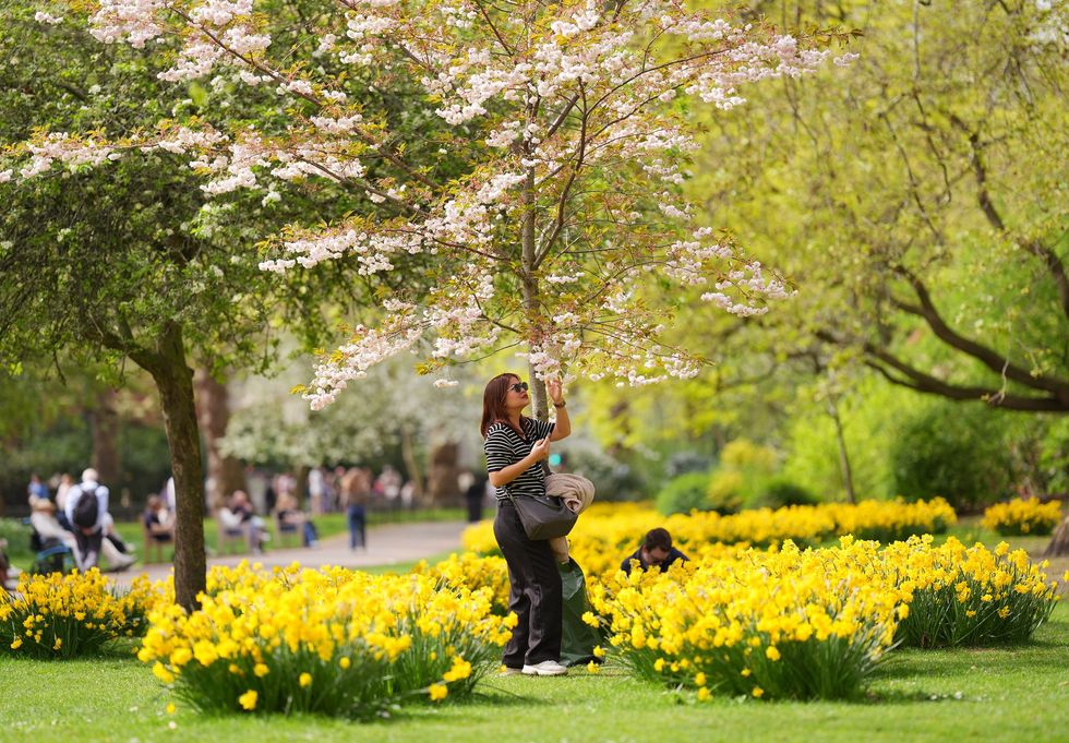
The sizzling prediction comes after Britain baked in one of the warmest April spells on record.
Temperatures in Kew Gardens, London, hit 26.6C on Wednesday, more than 10C higher than average for the time of year.
LATEST DEVELOPMENTS
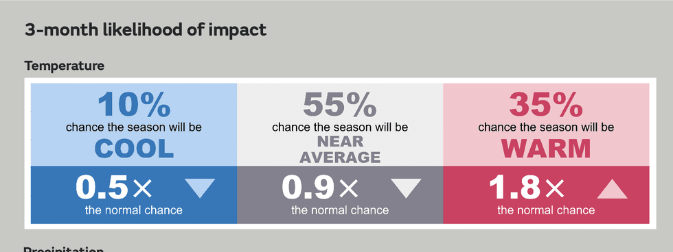
Met Office predicts greater than average chance of warmer weather
|MET OFFICE
Change is afoot this weekend, however, as cooler winds sweep bands of rain in from the Atlantic.
Met Office meteorologist Honor Criswick said: “A change is on its way to something a bit cooler and more unsettled.
“On Friday, there will be lots of dry bright weather but a cooler feel, and then the first area of low pressure will start to push its way north-eastwards.
“Later Friday, as this system pushes its way north-eastwards, there will be a risk of gales and possibly some very isolated severe gales around Northern Ireland and Western Scotland, but most of the winds are going to be around coastal areas.”
Once again, the driver for Britain’s erratic weather is the jet stream, which has split into two on its path over the Atlantic.
The rapidly flowing band of air high in the atmosphere is often the force behind stark changes in weather and strengthening storms.
A feisty low-pressure system will power up at the start of next week as it sandwiches between two high-speed ‘streaks’ of the jet.
Ms Criswick said: “The next area of low pressure, which sits between two jet streaks of the jet stream, pushes into the second jet streak early next week and develops quite a deep area of low pressure towards the southwest of the country.
“As we head into Tuesday, there are some heavy showers pushing into the south, with sunshine and showers elsewhere.
“Over the weekend, it is likely that northwestern parts of the country will see a wet and windy spell, and elsewhere there will be plenty of showers around.”
Jim Dale, meteorologist for British Weather Services, and co-author of ‘Surviving Extreme Weather’, said: “Then, there is a chance that high pressure will return bringing more settled weather.”