


A fresh Arctic-Atlantic clash will plummet temperatures into minus figures as parts of Britain brace for heavy snow.
Scotland and the north are on alert for a weekend winter blast while the south battles wind and rain from the west.
Stormy weather will continue to plough in from the Atlantic in the wake of Storm Chandra, bringing strong winds and rain turning to snow.
Meanwhile, northerly winds will hit the north triggering heavy wintry showers and the risk of settling snow.
Met Office meteorologist Alex Burkill said: “There is more unsettled weather to come as we go through the week.
“On Friday, there is more unsettled weather coming, we have low pressure to the southwest of the UK, so some strong gusty winds and more wet weather to come.
“This will push across more central areas and with colder air across northern parts, we could see sleet and snow across higher ground.”
Storm Chandra will hover to the west of Britain through the next 24 hours, paving path for further low-pressure storm systems.
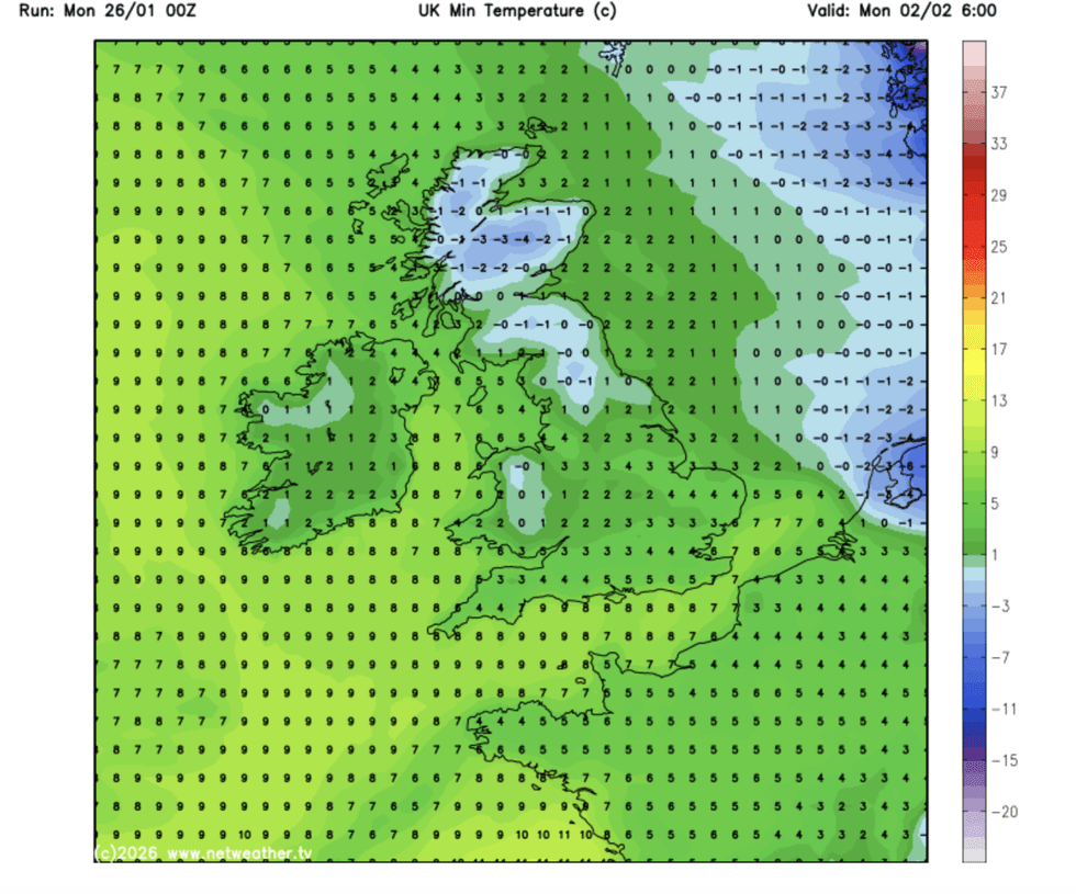
Scotland and the north of England will suffer the worst of the cold
|NETWEATHER
Today is expected to bring a 24-hour gap of calm respite before the spin cycle resumes.
Temperatures across southern regions will nudge double figures, although Arctic winds further north will keep winter locked in.
Burkill said: “Through into Thursday, Chandra is still there to the west of us, and there is a front coming in and some slightly colder air coming in across northern parts on Thursday, so the chance of seeing some wintriness with some sleet or snow increases.
“Even though temperatures for some towards the southwest getting into double figures, where we have strong gusty winds, it is going to feel pretty cold indeed.
LATEST DEVELOPMENTS
Northerly winds will hit the north triggering heavy wintry showers and the risk of settling snow
|NETWEATHER
“Temperatures are near normal to the south and the winds lighter, but across northern parts the colder air is digging in a little bit more.”
The snow risk will mount over higher ground of the north, although showers may settle to lower levels.
A UK Health Security Cold Weather Alert is in force across northeastern counties until the end of the week.
While the overall theme for the rest of the month is wet and windy with average temperatures, the cold could be about to return.
Jim Dale, meteorologist for British Weather Services and co-author of ‘Surviving Extreme Weather’, said: “For the next week, we are looking at the same pattern of unsettled weather with a more Atlantic regime bringing low pressure in from the west.
“There is no major cold snap coming in the immediate future, but that could change as we go through next month.
“Meanwhile, the greatest risk is going to be from the continuing rainfall across regions that are already at tipping point.”
A Met Office spokesperson added: “Looking beyond midweek, conditions will remain unsettled.
"Weather systems will continue to move in from the Atlantic bringing further spells of rain, especially across southern and western areas, continuing to bring the risk of some localised flooding.
“Hill snow will remain a possibility across northern upland areas whenever precipitation interacts with colder air.”