


A historic freeze crippling America could be about to steamroll Storm Chandra into Britain laden with torrential rain and snow.
Wales, Scotland and western counties are braced for turbulence from tomorrow as a powerful cyclonic system barrels in from the Atlantic.
High-ground snow and heavy rain swept in on the jet stream will be fuelled by plummeting temperatures over the US.
Warm and cold airmasses battling on the other side of the Atlantic will power the jet sending it UK-bound angry with storms.
TRENDING
Stories
Videos
Your Say
Met Office meteorologist Annie Shuttleworth said: “Very cold Arctic air is moving into the USA and with winter snow warnings for a major snow event.
“This cold air across the US fires up our jet stream, and that amplifies our jet stream and this will develop low pressure systems out in the Atlantic.
“Into Tuesday, we could see a fairly noticeable area of low pressure across the UK, and this would bring the risk of seeing some snow, but also more heavy rain and the chance of some quite strong winds across southwestern areas.”
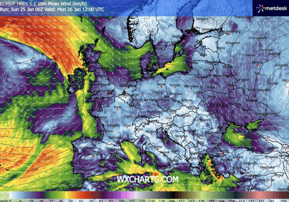
Storm Chandra is set to batter Britain this week
|WXCHARTS
The name Chandra came after Amy and Bram, and more recently Storms Goretti and Ingrid, named by the French and Portuguese meteorological services.
Jim Dale, meteorologist for British Weather Services and co-author of ‘Surviving Extreme Weather’, said: “There will be some periods of strong winds and very heavy rain with this system, which has some venom on it, and because of the aggregated effect of this coming into regions already hit by severe weather, it earned named-storm status.
“Some parts of this region are at the tipping point of severe disruption and damage, so anything coming on top will have a high impact.”
LATEST DEVELOPMENTS
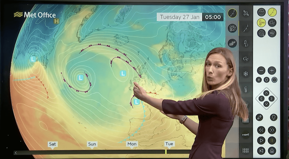
Annie Shuttleworth describes stormy conditions on Tuesday
|MET OFFICE
Once again, Wales, western England and the Southwest are in the firing line for the heaviest rain and strongest winds, he warned.
He said: “Western regions are going to see the most rain and there could be localised flooding and hazardous driving conditions.
“While we are expecting rain across the country, here is where we are going to see the heaviest downpours and the most disruption.”
The stormy forecast comes as experts once again roll back on predictions of widespread snow.
While temperatures this week will fall, the threat of the east is again being held back by the Atlantic.
Shuttleworth said: “Although it is set to turn colder across the UK, the signal for snow is somewhat limited.
“We continue to see westerly winds, so the colder air from the east never really gets in situ across the UK, and so although there is an increasing risk of snow in the UK, it is only going to be across high levels, and that is because the air is not going to be cold enough.
“The most likely scenario is for a fairly deep area of low pressure to drive up from the southwest bringing spells of wet and windy weather across more central areas of the UK.”
Britain’s weather is frequently affected by events in America, particularly when cold weather hits the north.
This meets milder air to the south, ploughing energy into the jet stream and sending it over the Atlantic to the UK.
This storm in the US is being dubbed as "historic" with more than half of the country under weather alerts.
Temperatures dipping below -20C have triggered torrents of snow and the threat of deadly ice storms from New Mexico to the Midwest and mid-Atlantic states.