


A mighty clash between the Atlantic and the East driven by a US mega-freeze threatens Britain with torrential rain, flooding and "significant snow".
Raging jet-stream winds, turbocharged by plunging temperatures over North America, will fling a barrage of cyclonic weather patterns at the UK.
Storms hurtling into the path of a bitter easterly clawing in from the Baltic will plunge Britain’s weather into a week of winter chaos.
Eastern regions face nosediving temperatures this weekend, while elsewhere comes under fire from rain and the risk of snow.
Met Office meteorologist Aidan McGivern said: “Into the end of the weekend we have easterly winds making inroads into the west, but we have the jet stream and Atlantic lows gearing up to come in, and this is the first clash of the Atlantic lows with the cold air from the east.
“As a band of heavy rain turns up on Monday, it bumps into the cold air and may turn to snow, but where depends on the exact orientation of the low.
“There could be some significant snow in places, at least before we see the rain set in.”
Tussling weather patterns, however, are confusing forecasting models at odds over where and when snow will arrive.
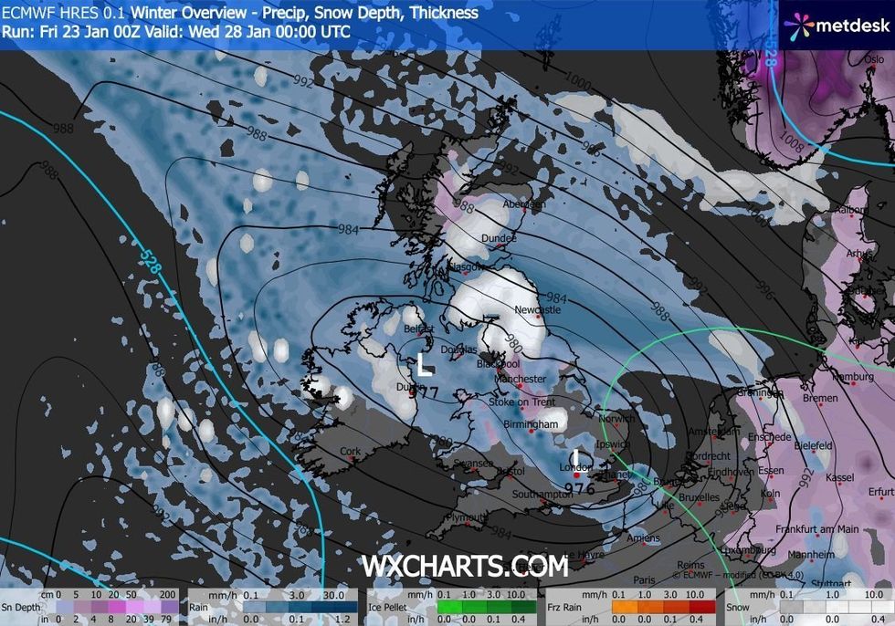
WXCHARTS is forecasting snow and rain over the coming days
|WXCHARTS
A weaker westerly jet stream would offer less resistance to the easterly cold, bringing a greater chance of a cold snap.
Stronger jet winds, though, would push stormy lows in from the Atlantic, hitting Britain with wetter, windier weather, McGivern explained.
Behind the battle is a big freeze hitting Canada and the US, fuelling the jet stream on its journey eastwards.
Mr McGivern said: “An important factor is the depth of cold air over north America with very cold air moving across Canada and into parts of the USA.
LATEST DEVELOPMENTS
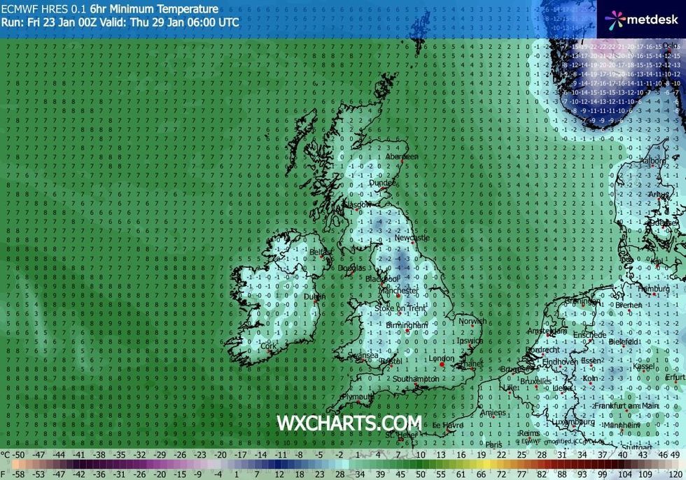
Temperatures will likely dip below freezing
|WXCHARTS
“When we get these cold outbreaks across North America, that fuels a powerful jet stream making its way across the Atlantic.
“We have a powerful jet stream and deep areas of low pressure coming in from the Atlantic coming up against cold, dry weather to the northeast, and that means that It is going to be complicated.”
The most likely outcome for the weekend and beyond, he said, is a mix of wet weather from the west with colder easterlies triggering snow somewhere between.
“Those two scenarios really dominate proceedings through next week,” he added.
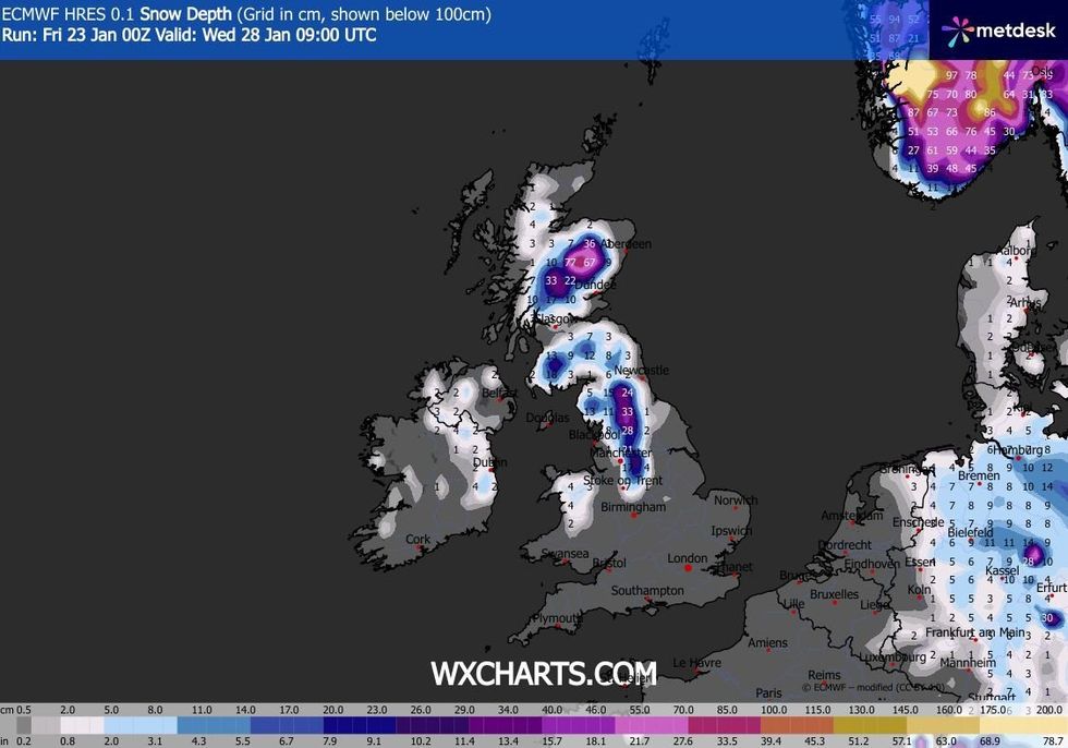
WXCHARTS is also forecasting deep snow across the North of England and Scotland
|WXCHARTS
In the firing line for the heaviest rain through the next 24 hours is eastern Scotland facing up to four inches of rain.
Torrential downpours have drenched the region this week with no end in sight through the start of the weekend.
Met Office warnings remain in force today for travel disruption, fast-flowing flood water and power cuts.
A spokesman said: “Rain will fall increasingly as snow over high ground, especially on Thursday and into Friday, adding to the uncertainty as to how quickly rivers may respond downstream.”
Temperatures after the weekend could sink to -10C where easterly winds take a direct path.
If the cold winds win out, Britain could be facing a chilly end to the month and start to February.
Jim Dale, meteorologist for British Weather Services and co-author of ‘Surviving Extreme Weather’, said: “Next week we start to see the lower temperatures with a greater risk of snow, particularly in prone regions like the Highlands of Scotland and the Grampians.
“Temperatures could sink as low as minus 10C overnight, and while we are not talking about a Beast from the East, it is definitely an easterly pattern and feeling colder than recently.”