


Britain’s start to summer has once again been thrown into doubt as the weather falls to the mercy of a shapeshifting pressure dome.
As temperatures ahead of the weekend rocket, experts warn the next U-turn is probably around the corner.
Behind the chaos is a fidgety dome of high pressure, teasing the country with an ever-changing weather picture.
Sunshine and blue skies this week risk falling foul later this month of more rain and unseasonable northerly winds.
Met Office’s Alex Deakin describes high pressure dominating the weather
|MET OFFICE
Jim Dale, meteorologist for British Weather Services, said: “Towards the end of the month, the outlook for the weather is, again, very uncertain, but there are signs of another change to something unsettled.
“This could mean a breakdown from the current weather, which this week could bring the highest temperature of the year so far.
“This would be the result of high-pressure giving way to low pressure which would come in from the Atlantic, meaning that currently we are in a position of having to just watch the space to see what happens.”
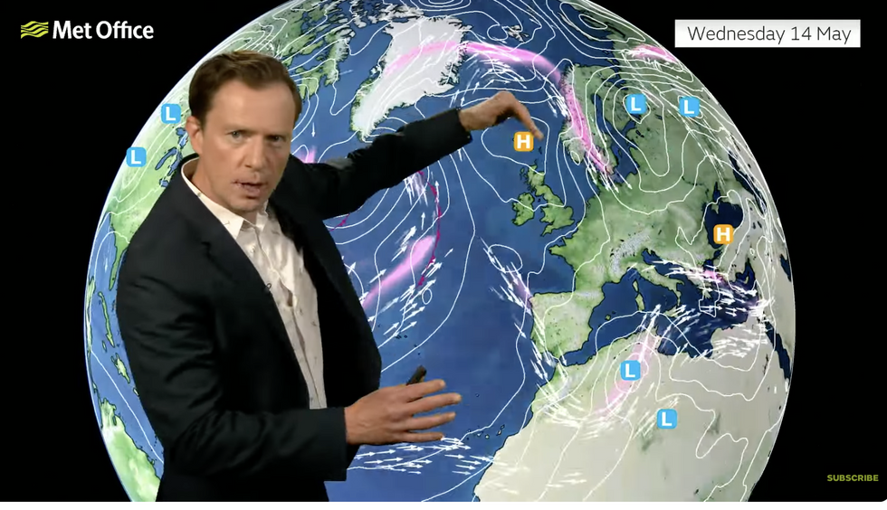
Britain’s weather will also come under the influence of the jet stream, which has split into two branches straddling the UK.
Dominating high pressure this week will see temperatures rise, although parts of the country may get a northerly chill.
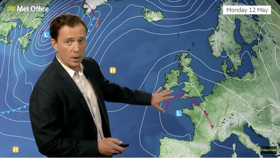
Alex Deakin pointing to high pressure north of Britain
|MET OFFICE
Met Office meteorologist Alex Deakin said: “There is one arc of the jet stream way up to the north and another arm way down to the south.
“This isn’t going to shift the weather pattern too much, but gradually under the influence of the upper ridge, this high pressure at the surface will push away that low pressure and this high will dominate our weather for most of this week.
“But with the high pressure sitting to the north and the west of the UK, the breeze will be coming down from the north, and this will at times make things pretty fresh and at times, fairly cloudy.”
Coastal regions this week will stay cooler in the mid-teens while further inland the mercury could nudge the 20Cs, he said.
Eastern regions will feel the bite of a chilly breeze sweeping the sea surface still cool after winter, he added.
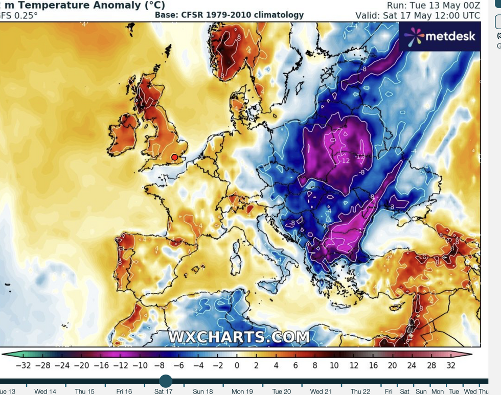
WX Charts map shows temperatures set to rise within days
|WX charts
Britain’s weather over the past fortnight has juggled a freakish hot spell at the start of the month, thunderstorms and overnight frosts in the north.
Fine, warm weather at this time of year is driven by high pressure, although its position will decide the peak of the temperatures.
High pressure this month has been shifting around the country, switching wind directions and fluctuating temperatures.
Met Office meteorologist Alex Burkill said three outcomes could decide the final resting place of this week’s high.
He said: “If we look at the three most likely setups, the high pressure is a bit further north, and bringing in an east, southeasterly or southerly flow across the country.
“The second most likely has the high a little bit further towards the west and Iceland, the further the high is away towards the northeast, the greater the chance of something trying to come in from the west.”
Jason Nicholls, lead international forecaster for AccuWeather, added: “High pressure will promote sunshine and warm weather across much of Britain through the remainder of this week.”